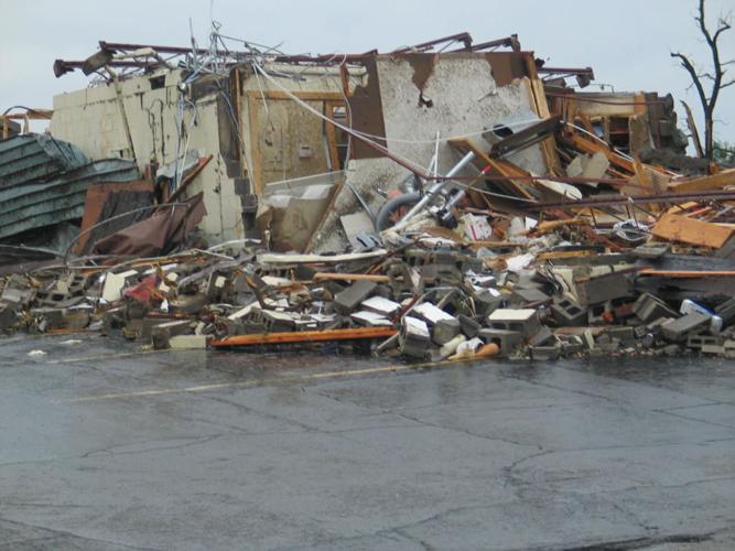
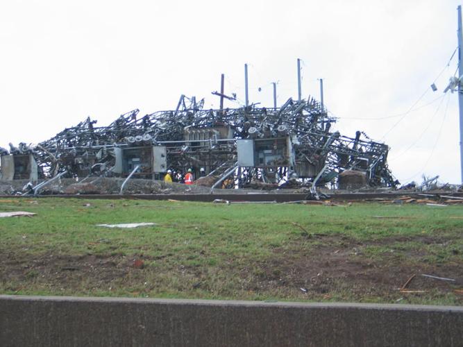
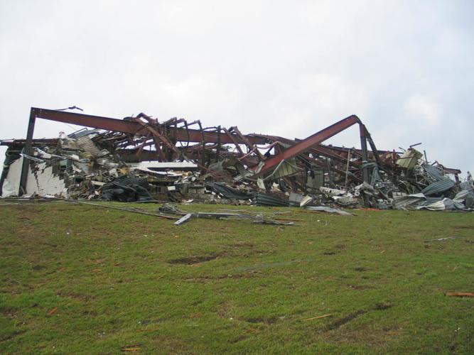
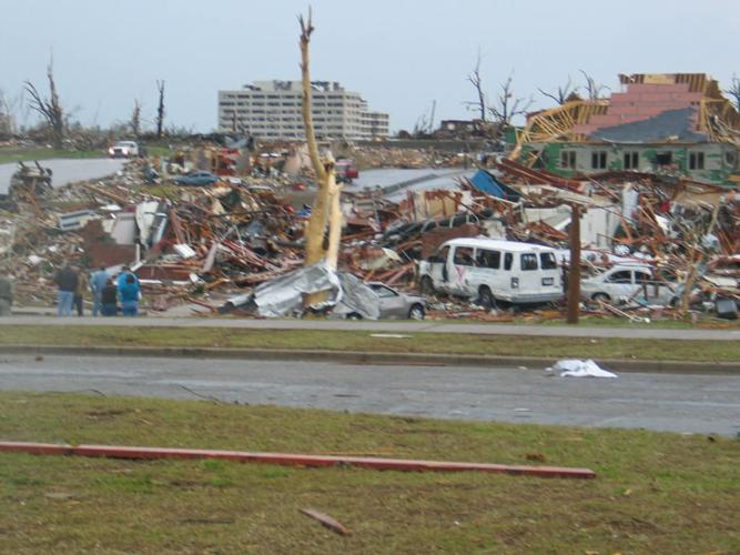
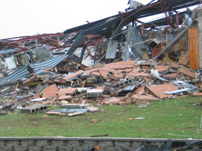
Ten years ago today, on May 22, 2011, the deadliest tornado in the modern warning era was ravaging Joplin, Missouri. Between 158-163 (sources differ) people died as a result of the storm and more than 1000 were injured. The storm caused $2.2 Billion Dollars in damage making it the costliest tornado disaster on record at the time.

Image from NWS
On a hot and humid Sunday afternoon, a supercell thunderstorm tracked from extreme southeast Kansas into far southwest Missouri (NWS Springfield, County Warning Area). This storm produced an EF-5 (greater than 200 mph) tornado over Joplin, MO. This storm along with others generated additional tornadoes, wind damage and flash flooding across far southwest Missouri.

Image from NWS
The Joplin tornado is the deadliest since modern record keeping began in 1950 and is ranked 7th among the deadliest tornadoes in U.S. history. 2011 was the fourth deadliest tornado year in U.S. history. The storm exploded as it collided with another weaker storm to the south and the unfortunate result was a deadly and destructive tornado. Let me take you back through the storm.

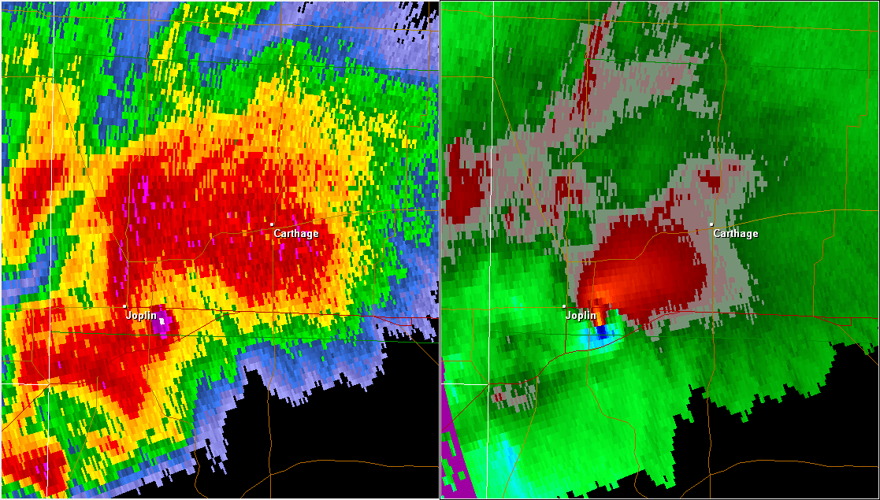
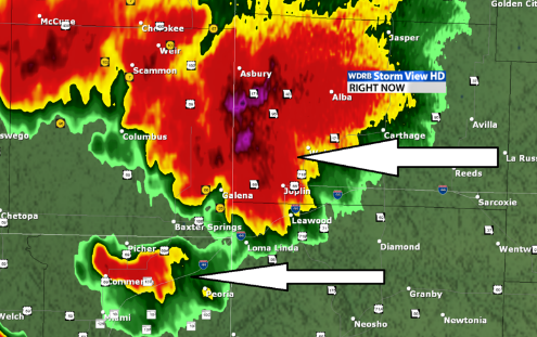
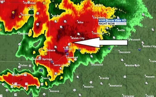
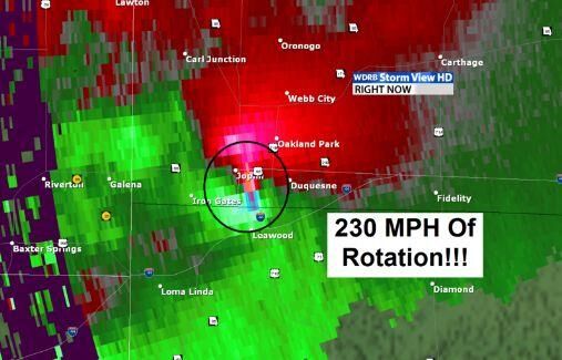
Radar Analysis May 21, 2011 Joplin, MO Tornado
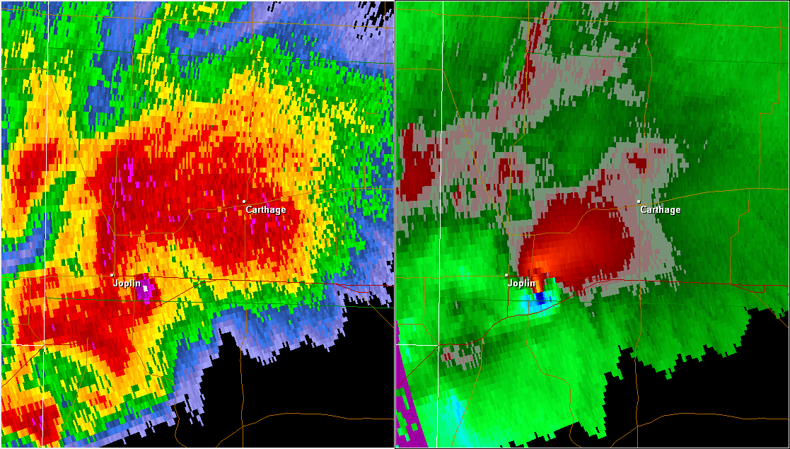
A very interesting thing happened the day the tragic Joplin tornado occurred. It is called a storm merger. Two distinct storms appeared on radar west of Joplin in the afternoon on May 22, 2011. At this point the Joplin tornado had not formed and there were two distinct areas of rotation.
The rotation increased from around 60 mph to well over 200 mph on radar RAPIDLY.
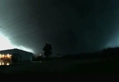
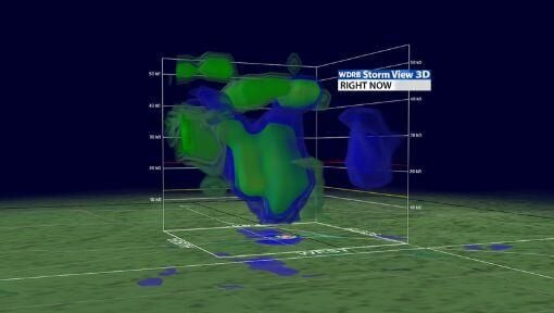
As the tornado moved through Joplin, StormView HD captured these amazing images of the tornado tube extending upward to 35,000 feet!
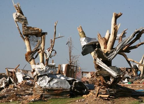
These trees were left standing on the east side of Joplin High and collected debris from the heavily damaged school. This picture below is from John Daves - U.S. Amry Corps of Engineers, Kansas City District.
There hadn't been more than 100 fatalities from a single storm since 1953, and most people thought because of advancement in storm prediction, radar technology and the modern warning system, that a tornado catastrophe of this magnitude was not possible.

Image from NWS
The high death toll has been attributed to a combination of factors including the incredible strength of the storm, the path of the storm through a highly populated area, the lack of adequate shelter, and people not acting quickly enough. Social scientist believe that complacency played a part in the disaster. Despite good lead times of 20 to 30 minutes of warning before the storm arrived, in many cases people failed to seek shelter or at least adequate shelter until it was too late.

Image from NWS
Unfortunately, the vast majority (82%) of homes in Joplin were built without basements and/or storm shelters so by the time most people sought shelter, they resorted to interior closets or bathrooms which simply was not enough protection against an EF5 tornado.


