


Temperatures during the work week are pretty nice! We'll be back into the low 70s more than likely for Wednesday and remain around normal for the rest of the work week in the 60s.
Things are about to change, though! A pair of cold fronts this weekend will shake up our temperatures and usher in the coldest air we've seen so far this season! It will obviously get a lot colder further into winter, but the coldest air since last winter is set to arrive!
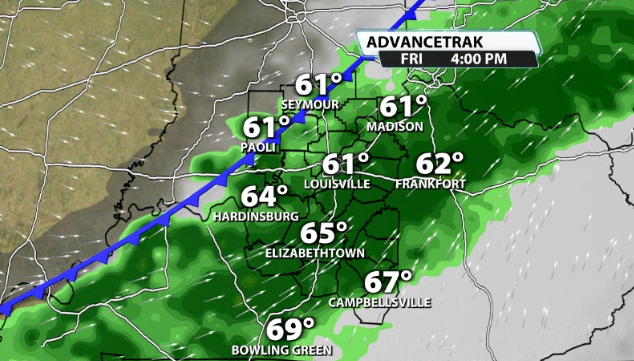
A cold front will swing through on Friday that will bring in showers and storms back to our area once again. It has a low-end severe potential with it, but it doesn't look overly concerning. This will bring in a good amount of rain and will pass quickly by Saturday morning.
By Saturday night, another cold front is set to roll on by. Data doesn't show as much rain with this one, but it will likely have a much bigger impact with temperatures.
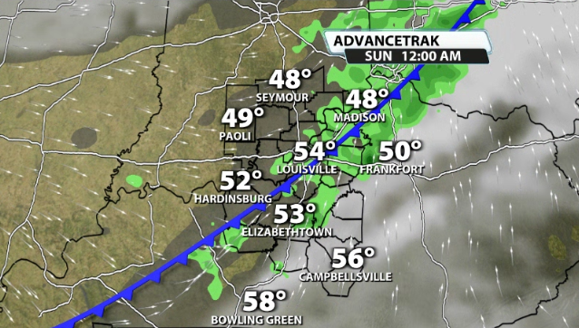
Temperatures behind this front and low by Sunday will send temperatures falling into the 40s by the afternoon and will always pick up the winds to make it feel colder as well. Next thing you know, by Monday morning the majority of us are waking up to temperatures in the 20s!!
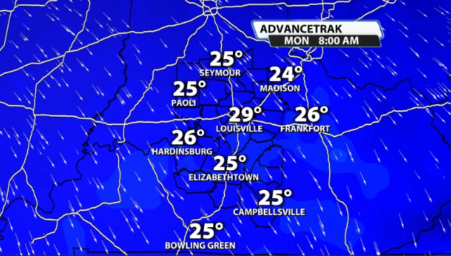
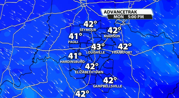
Monday will likely be a raw, cold, and breezy type of day that will hold temperatures way below normal. High temperatures will likely struggle to even get out of the low 40s by Monday afternoon! We could even see some snow flakes flying around on Sunday night/Monday morning!
CIPS analog data show basically over a 100% chance for colder than normal temperatures to be in our area over the next 6-8 Days! Those numbers basically are maxed out and all-but a guarantee!


