There are now two tropical storms headed toward the Gulf of Mexico: Laura and Marco. The way these two storms interact with each other will dictate whether or not we feel the tropical impacts here in Kentuckiana, so let's evaluate both storms.
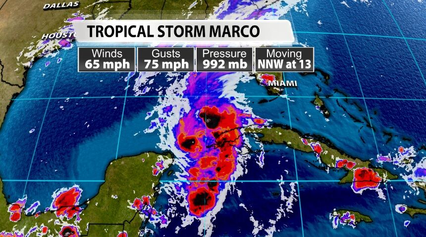
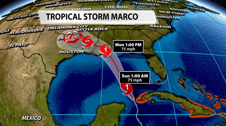
We start with Marco because a Hurricane Watch has been issued for parts of the Mississippi and Louisiana coast lines ahead of Tropical Storm Marco. This is the storm that will make landfall first.
During the day Saturday, the computer forecast models used to predict motion and intensity started taking Tropical Storm Marco a bit farther east. There are a few reasons for that: drier air west of the storm, a ridge building farther east, and how Marco will (or won't) be influenced by Laura.
Laura is making landfall in Puerto Rico Saturday afternoon and will impact the Dominican Republic Saturday night and Cuba Sunday morning. The changes to the model forecast tracks today are due in large part to this land interaction, and it's a crucial part of the Laura forecast which then influences the Marco forecast (is your head spinning yet? Stick with me...)
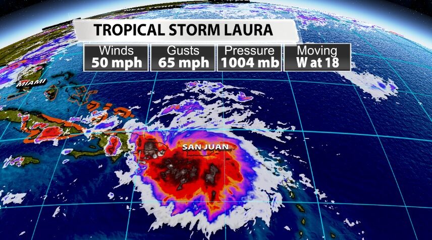
Tropical storms feed on warm ocean water; it's like gasoline to them. When a tropical storm moves over an island, especially a larger island like the three mentioned above, the land cuts off that supply of gasoline. The land also provides friction, especially when the land has mountains like these islands do. Laura's current track over the islands and the topography it's about to traverse will slow Laura down and halt the growth of the storm.

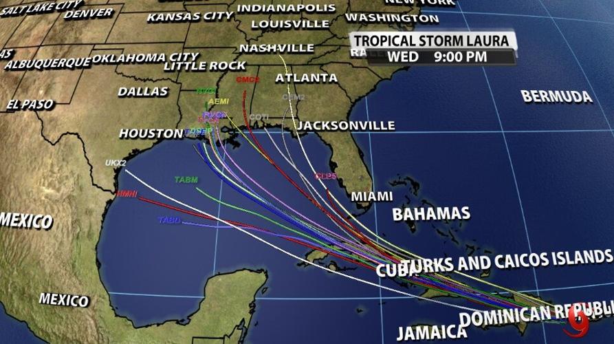
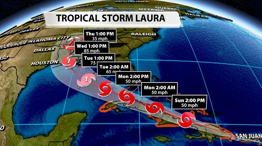
After impacting Cuba, Laura is expected to emerge into the southern Gulf of Mexico and quickly pick up steam. Water temperatures are in the upper 80s and low 90s, so there's a lot of fuel for Laura once it gets out into the ocean again. At that point it should be able to strengthen into a hurricane before making landfall in the continental United States. Unfortunately at this point the forecast track for Laura landfall is less than 100 miles away from the forecast landfall point of Marco about two days later. Those exact points will change in the coming days, and the spaghetti plots above still shows possible landfall for Laura anywhere between south Texas and the Florida panhandle.
You may have seen headlines recently about these two storms basically combining to form a super hurricane, but that's now how this works. If they get close enough to each other (within about 900 miles, roughly the size of the Gulf) one will start to kind of rotate around the other. This is called the fujuwhara effect and is another one of those things you might see in headlines on social media in the comings days. That can lead to one of the storms weakening, but Marco and Laura may not even get close enough to interact that way.
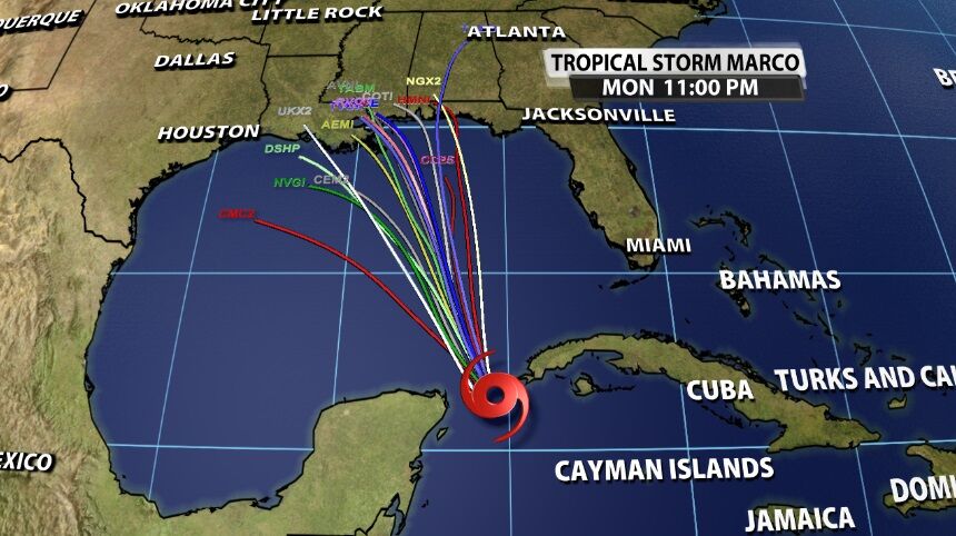
Here's another headline you'll see: there have never been two hurricanes in the Gulf of Mexico at the same time. That's true! But I'm not sure two hurricanes in the Gulf at the same time is a slam dunk here. Yes, both Marco and Laura are forecast to become hurricanes before making landfall on the continent. However, Marco is forecast to make landfall Monday afternoon, and Laura is not expected to strengthen to a hurricane until Tuesday afternoon.
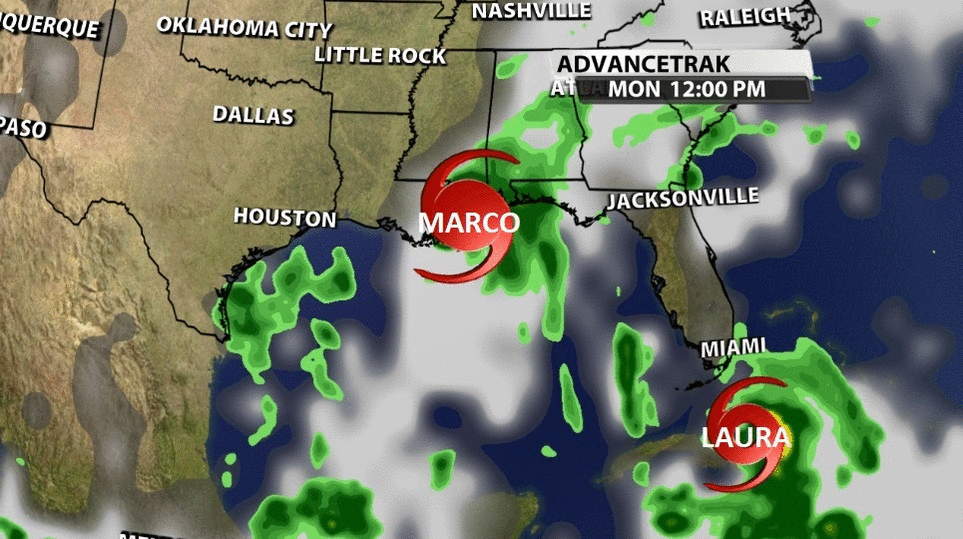
Bottom line: landfall between Marco and Laura is separated by two days and not much geography (at this point). Since they are now farther apart it doesn't look like they will have as much interaction with each other as was initially expected. Marco will weaken quickly as it curves west into drier air in Texas. Laura is the one we need to watch for impacts to Kentuckiana.
