
Our quieter weather pattern the last few days won't be lasting much longer. We've got a few days worth of rain & storm chances heading into our area later this week. If you've got outdoor or travel plans, listen up!
Thursday
We'll first start to see impacts on Thursday night. After some of the day is dry and windy, we climb our temperatures up into the low-mid 60s. Most rain holds off until after sunset.
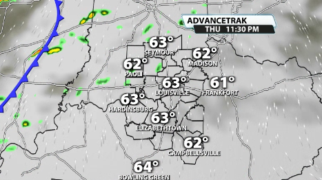
Rain turns into storms overnight and they remain pretty widespread all night long.
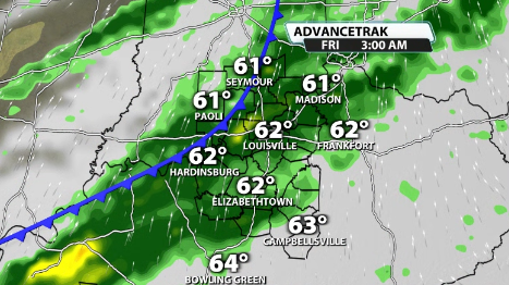
Friday
Some rain and storms are still left over for daybreak come the Friday morning commute, but should come to an end and leave part of Friday dry, although still breezy and mild with temperatures in the mid-upper 60s.
Another wave of showers and storms along a second low pressure swinging by will impact us on Friday night into early Saturday. This once again comes with some strong wind gusts and heavy rain (especially for our southern KY counties).
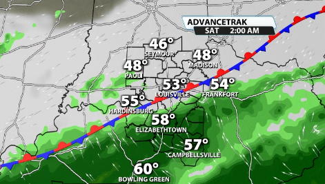
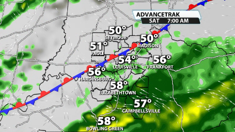
Saturday
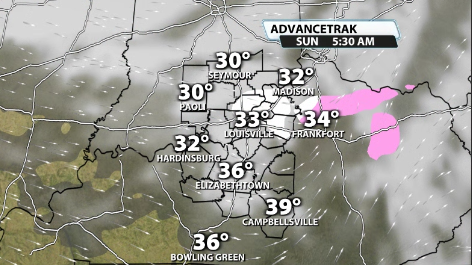
By Saturday morning, gusty showers and perhaps a few storms are left over, but don't last all day. They should be leaving our area by mid-afternoon. That doesn't mean impacts are done though. Winds are still whipping around through the afternoon as the cold front pushes through and temperatures drop from the low 60s on Saturday afternoon to the upper 20s and low 30s on Sunday.
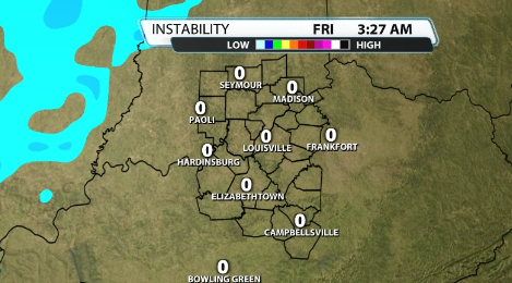
Severe Risk?
Yesterday, the SPC had a sliver of our southern communities in a Slight risk for severe storms. This has since quickly been pulled south and out of our area entirely.
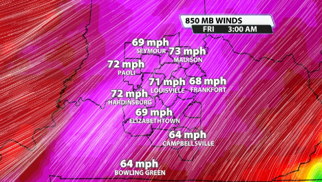
Still, some storms packing a punch aren't impossible. Remember, when talking strong to severe storms, you need sufficient wind energy (~>40mph at the 850mb level), and enough storm energy (or CAPE) to keep storms rolling. Not only that, but you need them to align at the same time to get severe weather.
Wind energy
As you can probably guess from me mentioning strong wind gusts, there is plenty of wind energy with this system. Winds at the 850mb level peak late Thursday night into very early Friday morning. You can see values about a mile above the ground at 70mph or stronger. That is obviously plenty of wind energy.
CAPE
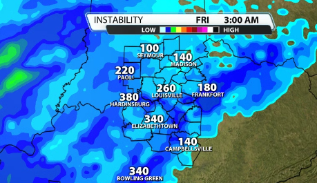
Remember though, we need the CAPE to match up with the sufficient wind energy. When we look at this same timeframe when winds are at their peak, the amount of CAPE available differs depending on what model you look at. The more aggressive model, the Euro, shows a couple to a few hundred, but not all at the surface...
...while the GFS shows basically nothing at the surface....
So what it looks like is plenty of wind energy and potentially some elevated CAPE being available. You need surface CAPE for severe storms. With that being said, elevated CAPE can still cause some strong wind gusts and a couple strong storms, but doesn't really support organized severe weather as a whole.
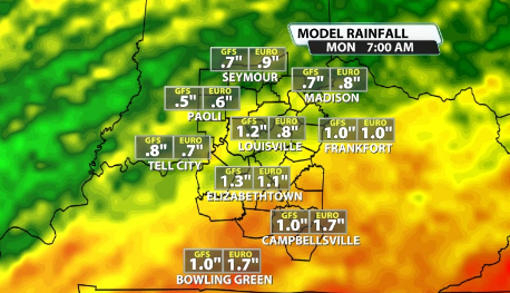
Rain Totals
Most data is in agreement that our southern counties in KY and specifically toward Southeast KY gets the most rain. For our area in particular, 1-1.5" looks like a decent probability for most locations, especially south of the river.
