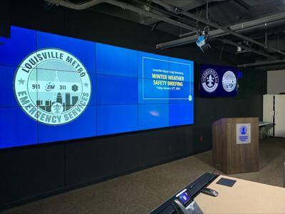
LOUISVILLE, Ky. (WDRB) -- Louisville Mayor Craig Greenberg and city leaders are urging residents to be cautious over the next week due to incoming weather conditions.
According to the National Weather Service, "damaging wind gusts" greater than 50 miles per hour are likely Friday and early Saturday.
"It is only going to get colder and colder over the coming days," Mayor Craig Greenberg said. "This is a very serious matter, because a winter storm is moving across our entire country, and Louisville will likely be impacted in ways beyond just traditional cold wet."
There's also a chance of snow Sunday night and early next week while extreme cold temperatures will follow due to an arctic cold front coming through the region. The NWS is concerned about snow Monday night into Tuesday as snow will make the temperatures colder.
"Please wear several layers of clothing to protect yourself," said John Gordon with NWS Louisville. "This is coming. This is not propaganda. The real snow is coming. Jack Frost has changed his name to Jack Freeze."
As of Friday afternoon, the worst-case scenario for snow is about 1 inch. Air temperatures will range from single digits to teens from Monday through Wednesday and wind chills that will sometimes get below zero.
The Metro Snow Team will report in Sunday afternoon, and if there's no rain before snowfall, they'll apply brine to snow routes.
"I want to stress how prepared we are," Metro Works Director Jennifer Caummisar-Kern said. "We have been getting ready for months."
They'll work 12-hour intervals to make sure roadways remain in safe driving conditions. To track the Snow Team's progress, click here.
"We want everyone in Louisville to be able to get to work, doctor's appointments, to grocery stores, to do what they need to do as safely as possible," Greenberg said. "It is going to be dangerously cold. So, everyone should limit their times outdoors and take this weather seriously."
Greenberg said LG&E crews remain on standby and are monitoring the high winds
Greenberg said LG&E crews remain on standby and are monitoring the high winds.
Friday afternoon, some experienced outages as wind started to pick up across the metro area.
Including Drew Tarr, who lost power for about an hour at his business, Street and Strip Performance in Okolona.
"We were just in the middle of a our normal work day," Tarr said. "The power blinked once and out it was."
Chris Whelan, spokesperson for LG&E, said the company is essentially prepared for two different storms.
Air temperatures will range from single digits to teens from Monday through Wednesday and wind chills that will sometimes get below zero.
"We're planning for the wind, and then we're turning around and planning and making sure all of our systems are up and running for the cold as well," Whelan said.
LG&E said it's called in extra crews to ensure outages can be resolved, before temperatures start to dip.
"We'll be working through the night and throughout the weekend to make sure that we keep the power up and going," Whelan said.
There are eight locations throughout Louisville that'll be serving as Warming Centers for those needing to get out of the cold. To find your nearest location, click here.
"If you do not need to be out, please stay home if you can," Caummisar-Kern said.
If you're on the road, emergency services says you need to have jumper cables, reflective material, and a full tank of gas.
At home, make sure you have flashlights on hand, extra food and all your prescriptions.
“Don’t wait until today if your power goes out. Don’t wait until Sunday, Monday when the snow comes. Don’t wait until the week when the temperatures drop. Make sure you and your family know what to do," Jody Meiman, with Louisville Metro Emergency Services, said.
Related Stories:
- JCPS lays out contingency plan for next week's winter weather in Louisville
- Louisville students prepare to learn from home, if needed, as JCPS opts for NTI over snow days
- Louisville nonprofit delivers 3,500 pounds of hygiene products, gloves for homeless ahead of frigid weather
- Kentucky Humane Society offers tips to protect your pets as temperatures drop
- 5 tips to help winterize your home as cold weather heads toward Louisville area
- 'It's brutal' | Colder weather makes fighting fires in Louisville more challenging
Copyright 2024 WDRB media. All Rights Reserved.


