
In Louisville, statistics show our first Fall frost normally occurs on October 20th, but we are likely to get that early this year as skies clear out tonight and temperatures plummet. This means if you have anything that is sensitive to a frost or freeze, you should be covering that before 2 am tonight. We will likely have a repeat again tomorrow night.
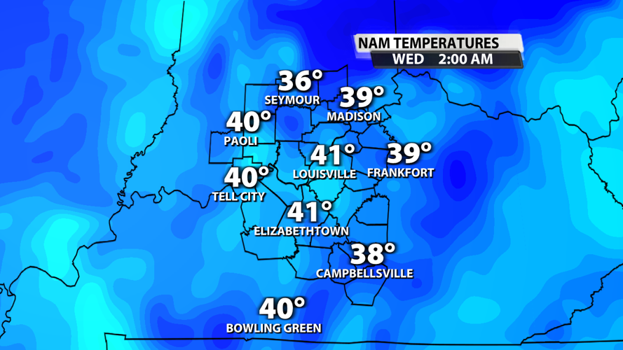
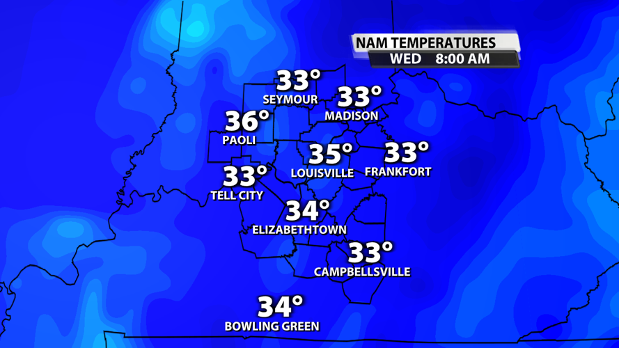
As skies clear overnight and winds lighten this will allow the atmosphere to cool quickly. You can see on the top right the time the data is valid for and notice how cold it gets my 7-8 am.


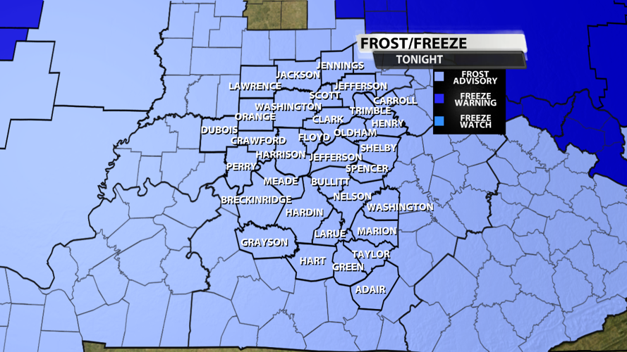
By definition, frost occurs at 36F. A freeze is defined as hitting 32F. Finally, a hard freeze occurs when we drop below 32F for 4 hours or it 28F. So tonight is a widespread frost with some isolated locations attaining criteria for a freeze. For this reason, the NWS has issued a Frost Advisory for our area tonight.

...FROST ADVISORY IN EFFECT FROM 2 AM EDT /1 AM CDT/ TO 9 AM EDT /8
AM CDT/ WEDNESDAY...

* WHAT...Temperatures in the low-to-mid 30s will result in frost
  formation.

* WHERE...Portions of south central Indiana and east central, north
  central, northwest, and south central Kentucky.

* WHEN...From 2 AM EDT /1 AM CDT/ to 9 AM EDT /8 AM CDT/ Wednesday.

* IMPACTS...Frost could harm sensitive outdoor vegetation. Sensitive
  outdoor plants may be killed if left uncovered.

PRECAUTIONARY/PREPAREDNESS ACTIONS...
If you have anything outside sensitive to a frost or freeze, make sure it is covered tonight.


