
A quick moving storm system will affect our area on Saturday evening and night. As of right now, we do not have any advisories for the storm system, but it is looking increasingly likely that a Winter Weather Advisory will be needed starting late afternoon or evening across a chunk of our area.
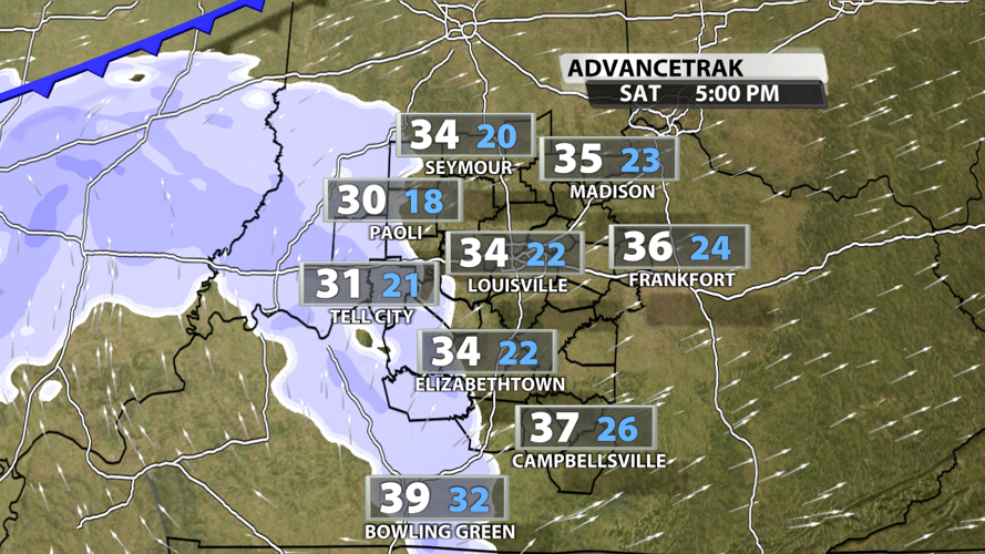
The quick hitting storm that will bring the light snow to the area moves into our western counties mid to late afternoon. Notice Advancetrak pushes the light snow into areas like Jasper, IN to around Tell City, IN by around 3 - 4 pm.

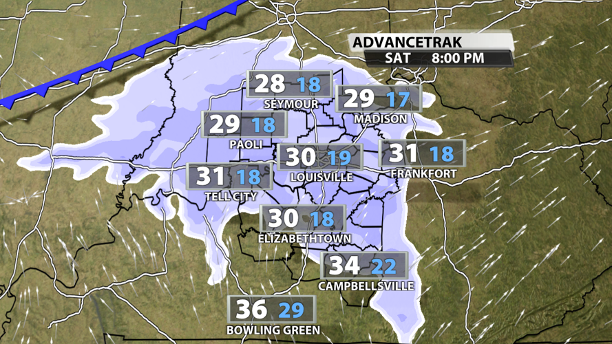
The data moves the light snow into Louisville somewhere between 5 pm and 7 pm. Notice the temperatures (white) are near freezing meaning this can stick much easier than the last time we had some wintry precipitation.

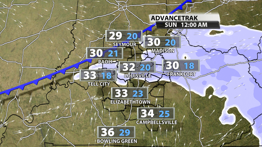
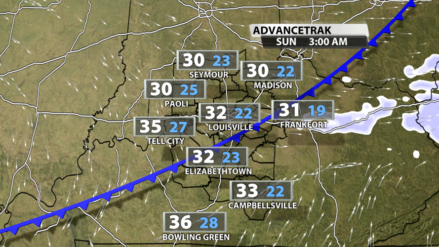
This is not a long duration snow scenario because this is a "clipper" type system. By nature, these are moisture starved and move quite quickly. The data moves the snow out by the 3 am timeframe on Sunday.


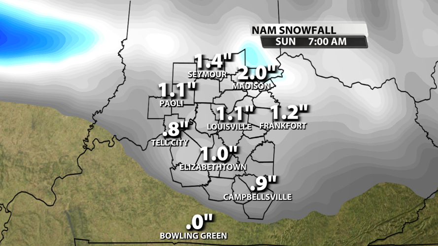
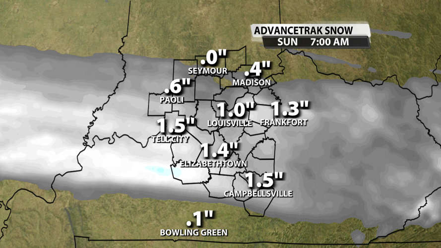
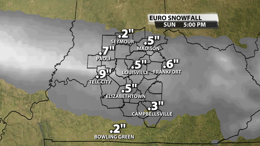
The next obvious question is can any of this can accumulate? I am going to show you a few different computer models here to show you accumulation potential. What you will notice is that virtually all the models show this light snow and none of the models show a monster. Many will see an inch of snow with some getting potentially closer to two inches of snow.


The bottom line is this is not a huge snow, but it absolutely can cause some slick roads and impacts late on Saturday. Considering the timing in the evening on Saturday, I think a Winter Weather Advisory is justified for parts of our area including the metro. Light accumulations on grassy surfaces is easier, but some travel impacts should be expected. I will be showing my full snow map on WDRB News at 10 and 11 pm tonight.


