
I know it's not what you really want to hear after receiving another 3" of snow in Louisville yesterday, but we aren't done with the arctic temperatures in our area just yet.
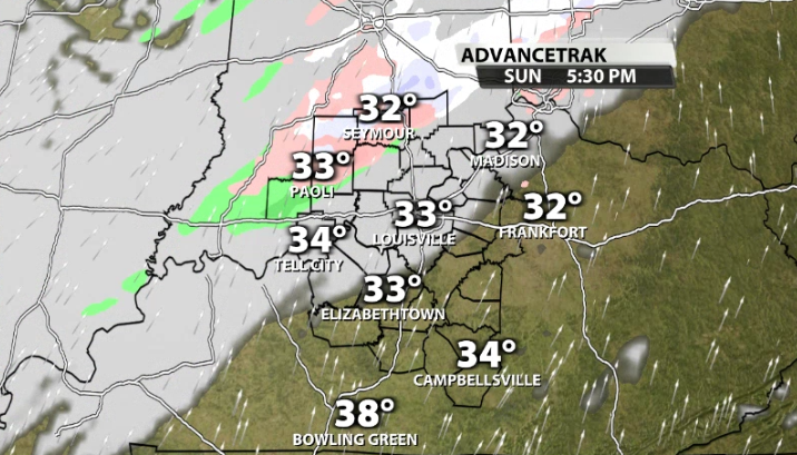
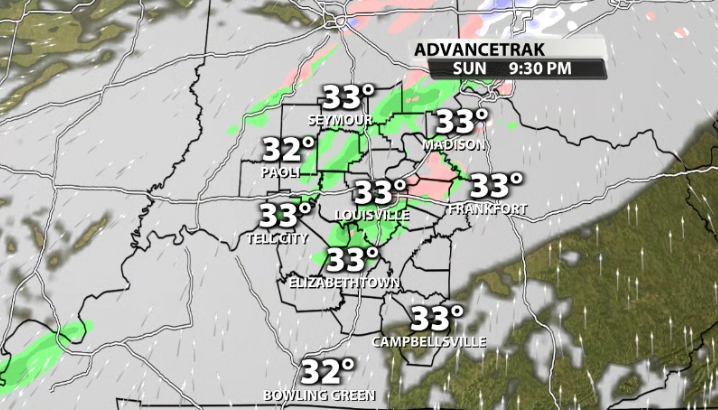
Another arctic front is heading toward our area Sunday night and through Monday. This will bring in a chance for some mixed showers Sunday night and transitioning to a few snow showers Monday morning. Most of that look pretty light and shouldn't cause too many issues.
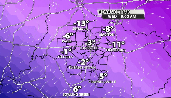
What is more impactful is the cold air that follows that front. By Tuesday morning, data shows most of our area starting to clear the clouds and calm the winds down. With snow already on the ground and with those two factors rolling in, it allows for radiational cooling to happen easier. Single digit temperatures for lows on Tuesday morning are looking likely for most of us.
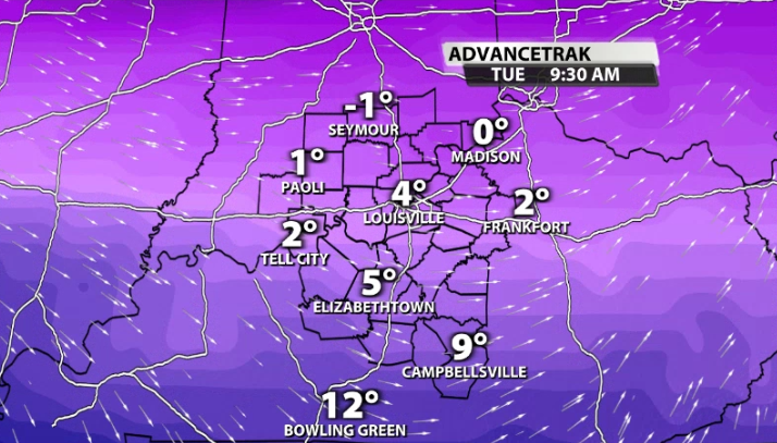
Since we only climb into the mid 20s on Tuesday afternoon, the temperature swing with more potentially clear skies and calm winds heading into Wednesday morning could be larger. Data has supported sub-zero air temperatures for much of our area on Wednesday morning. The only exception could be the urban heat island of Louisville.
We are probably going to see a couple more of the "Cold Weather Advisories" in our area like we did a couple of days ago. Be sure to trickle water from your faucets and open those cabinets for exposed pipes.


