

After more Flash Flooding on Saturday, we will have to watch for another chance for some scattered downpours this afternoon.
That pesky low pressure isn't in a hurry to get out of our hair today. It will slowly sag its way down near the Kentucky parkways and closer to the KY/TN border for this afternoon. Since the low is still close to our area, it will still spark scattered downpours and storms for part of the day.
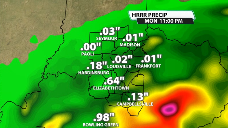
The further south you go in our area today, the more like you'll run into more impactful, heavy rain that could cause some local flash flooding. Why our southern communities? Since the low is further south, the closer you get to the low the closer you are to the hub of where the moisture is.
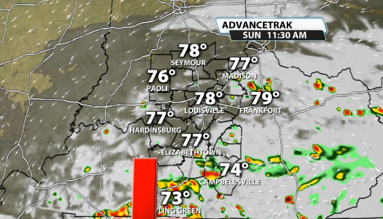
We could see some of these start to flourish more as early as mid-late morning. As we get into the afternoon, we'll see more begin to thrive with heat of the day.
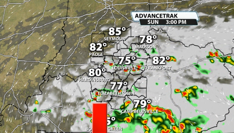
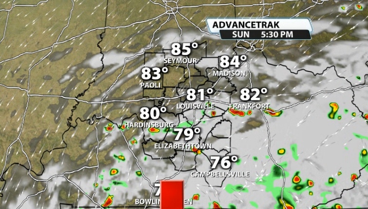
Just because our southern counties have the best chance of seeing the more impactful rainfall, doesn't mean that Louisville is in the clear. Data shows a few scattered heavy downpours at times, especially mid-late afternoon, say around 2-6PM.
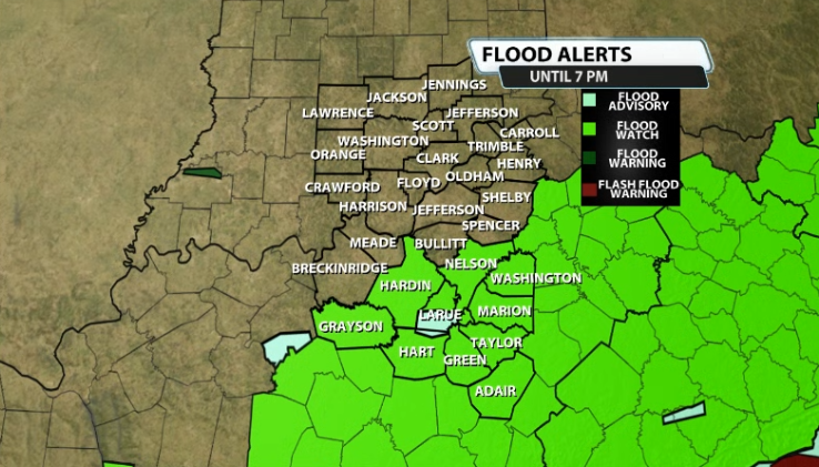
The Flood Watch that expired in Louisville and southern Indiana this morning has been extended through 7PM this evening. Everywhere from Hardin and Nelson county and south is included in this due to the threat for some more flash flooding this afternoon and evening.
You can see rain totals are all over the place, but the highest rain totals should remain in our Kentucky counties for the rest of the day today.
If you come across a flooded roadway, remember the phrase "TURN AROUND, DON'T DROWN".


