

Today and Wednesday have the potential to be the hottest days of the year and bring some near record heat to the area. High pressure building over our area is helping to keep us dry and clear the past couple of days and will continue through the next 48 hours.
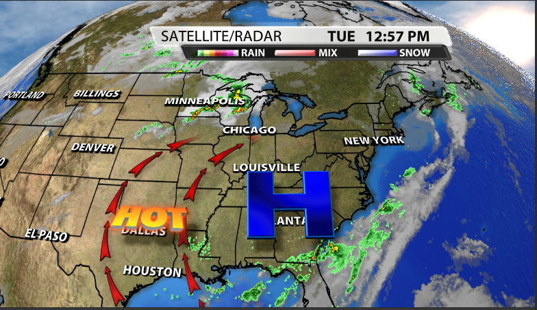
This is helping to bring in more moisture from the South and Southwest combined with heat that is going to be coming close to breaking some3 high temperature records today and tomorrow.
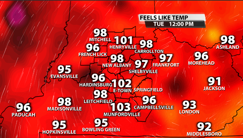
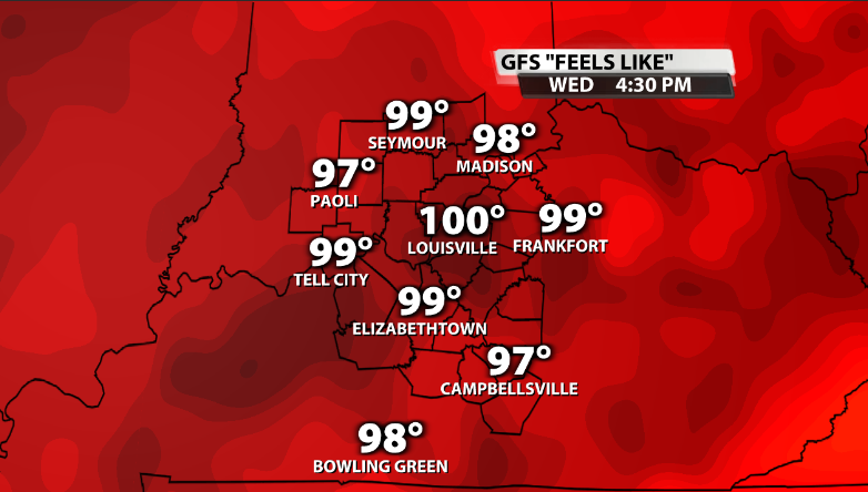
Heat index values today are already soaring into the triple digits and will remain there this afternoon. Expect heat indicies to be between 100-105 across many communities in the area.
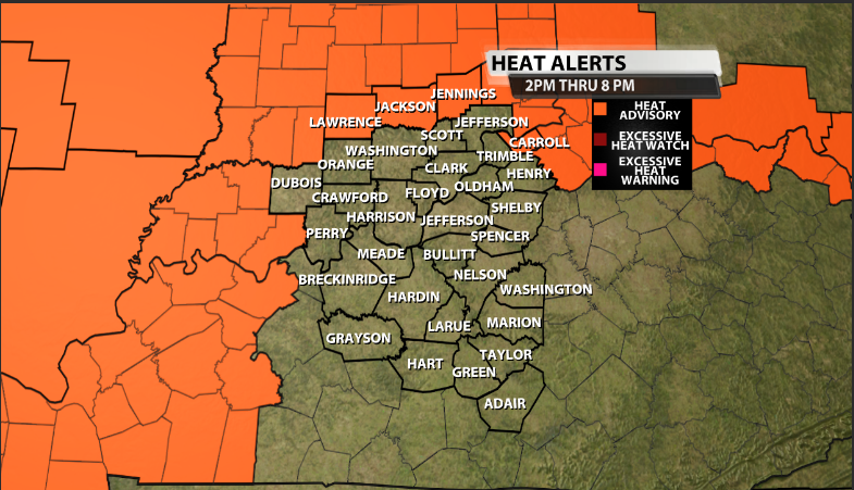
Because of this, a few of our Northern counties in our viewing area are under a Heat Advisory through this evening. We could likely see more advisories added on Wednesday.
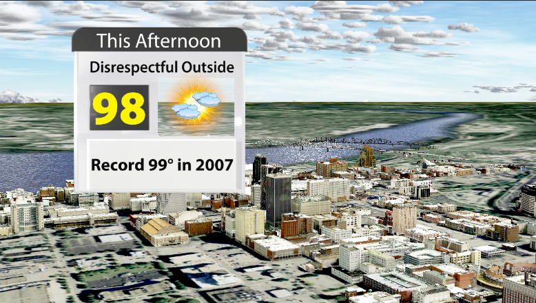
The record high temperature for today is 99 set back in 2007, which you may remember. We're going to be coming very close to either tying or breaking that record today with a forecasted high of 98 degrees.
It is not going to feel good out today with dew points once again in the low to mid 70s across the area.
Any relief?
The short answer-no, at least not yet. Even though we are gradually getting close to September, temperatures are not looking very fall-like heading into the future. Wednesday could potentially be even hotter today, and come close to the record of 100 set back in 1948. As of now, the forecasted high is around 99. Keep in mind, this is not the feels-like temperature, this is the actual air temperature forecast.
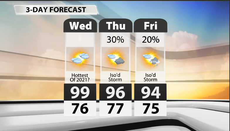
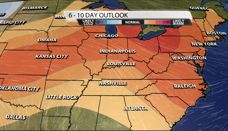
You'll notice rain chances creep their way back into the forecast heading toward the end of the work week, but the chance still remains fairly low. If you're looking for that all-day rain type of forecast, this is not the week for that to occur. The heat looks to be sticking around for a while, as the Climate Prediction Center's 6-10 day outlook still has a decent probability of our area seeing above average temperatures.
The best chance of rain over the next 7 days is looking to be Monday ahead of a "cold" front slowly making it's way toward our area. Stay safe and cool out there!


