
Data used for the U.S. Drought Monitor is cut off at 8 AM ET every Tuesday. The maps, which are based on an analysis of that data, are then updated and released every Thursday at 8:30 AM ET. They identify areas of drought and labels them using four classifications of severity. D1 is the least intense level of drought while D4 the most intense. Now that we've established how this works, let's move on to what we know and don't know.
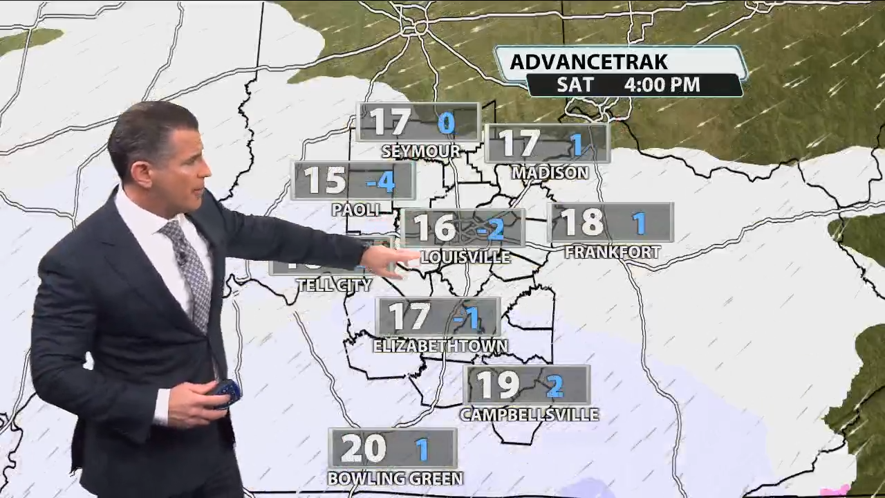
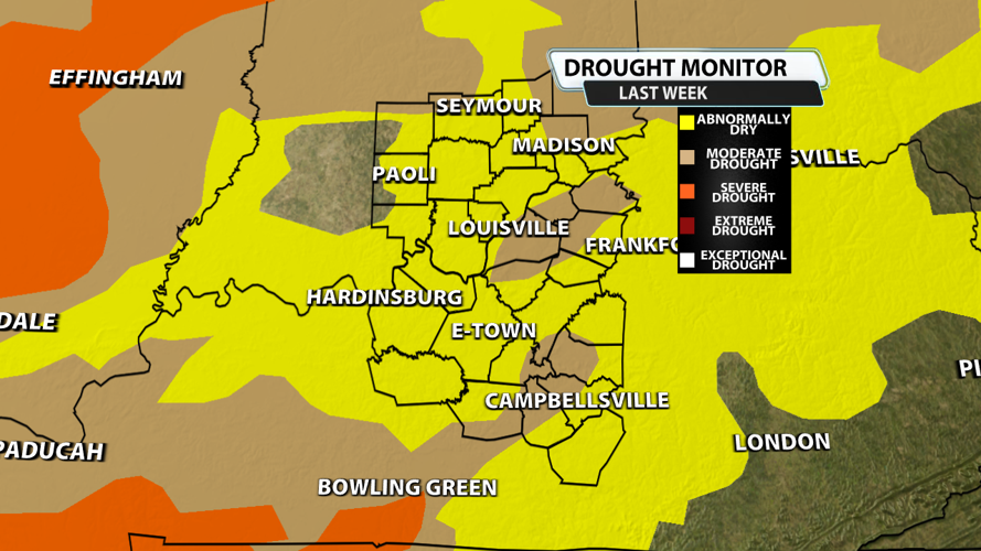
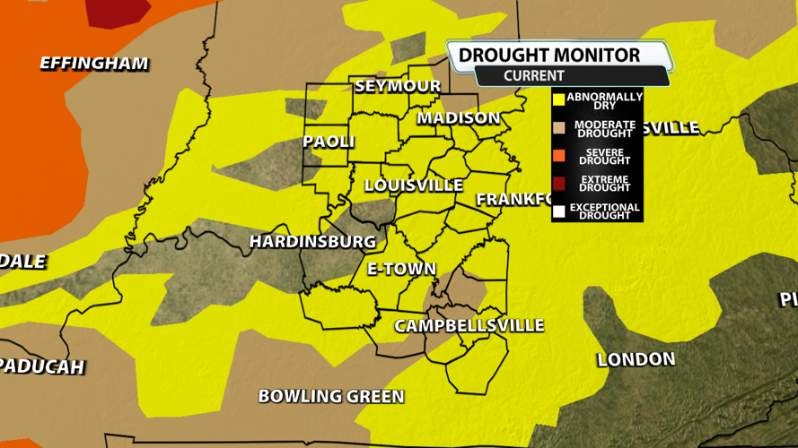
Do you remember what was happening Tuesday morning? It was still pouring down rain so I looked back at the observations and calculated 3.64" of rain fell after 8 AM. After chatting with the NWS in Louisville, it's a bit unclear how much of that rain was taken into account in this week's assesment. Regardless, we've made improvements. The first image shows moderate drought in Louisville last week and severe drought around Bowling Green. When you look at the second image or current drought status, the severe drought has been removed from Kentucky and Louisville is back to abnormally dry. Areas north of Madison in Indiana could use more rain. Moderate drought is also holding on in Loretto, Raywick, Saloma and Summersville of Kentucky. Unfortunately, if you're looking for rain we can't muster up more than a sprinkle over the next 7 days.