Article by NOAA
On September 5, 2025 by AOML Communications to HIFP-Hurricane Forecast Improvement Project, Hurricane Research, Modeling and Prediction
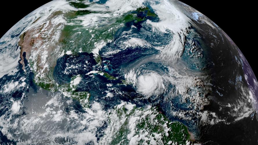
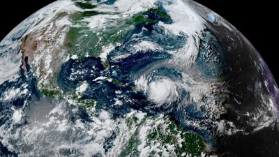
Hurricane Erin was one of the largest storms recorded in the Atlantic basin, with only around 5% of storms matching or exceeding its size. Both operational and experimental NOAA forecast models for Erin proved incredibly accurate, especially for Erin’s track early in the forecast period.
NOAA’s flagship hurricane forecast model, the Hurricane Analysis and Forecast System (
HAFS), has demonstrated clear advances over other regional and global models for hurricanes. HAFS is a next-generation model that holistically captures the environmental conditions during storm development and provides forecasts with reliable guidance on hurricane track and intensity.
As part of the Hurricane Forecast Improvement Program (HFIP), NOAA’s Atlantic Oceanographic & Meteorological Laboratory (AOML) advances hurricane prediction through real-time testing, model upgrades, and research-to-operations transitions of HAFS in close coordination with NOAA’s National Weather Service – Environmental Modeling Center.
This year, scientists at AOML and the Cooperative Institute for Marine & Atmospheric Studies are running three experimental HAFS configurations: one with ocean data assimilation (HFXO), one with upgraded physics (HFXB), and the innovative HAFS Multi-Storm model (HFXM).
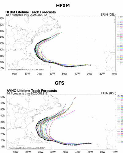
During Hurricane Erin, the experimental versions of HAFS provided improved track forecast, early storm genesis prediction, and one of the first successful simulations of the storm’s extreme rapid intensification – a challenging aspect of hurricane forecasting. HFXB and HFXM are the only regional models that run out to seven days. This would provide NHC forecasters and other collaborators with extended guidance that could be compared with global models like the Global Forecast System (GFS), in the future. In fact, for Erin both HFXB and HFXM were more accurate than the GFS model in showing the storm passing between Bermuda and the United States (Figure 1). These experimental models reproduced the track forecasts and Erin’s inner structure over the seven day period.
(Figure 1) All Hurricane Erin track forecasts from 8/12/25 to 8/22/25 from HFXM (HAFS Experimental Multi-storm Model) and GFS (Global Forecasting System). The black line is the “Best Track” observed track from NHC. Note that the experimental versions of HAFS were closer to the observed track in the West Atlantic than the operational GFS.
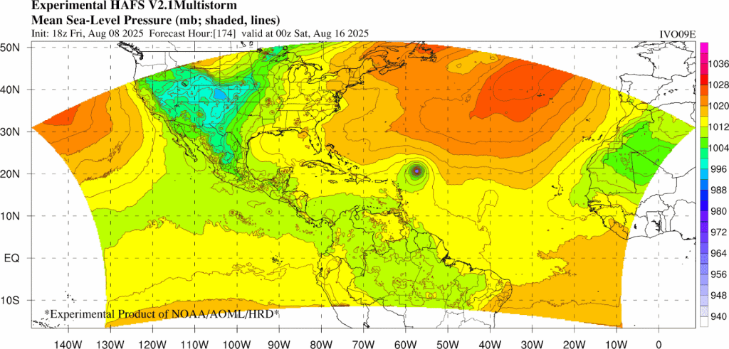
A total of 45 HAFS forecasts were conducted for each configuration of the model, starting from before its rapid intensification as it threatened the U.S. Virgin Islands. These forecasts showed Erin as a strong hurricane northeast of the Caribbean even before it formed (Figure 2), which is another feature of the model’s multistorm configuration running out to seven days. All the experimental runs were made available to the hurricane community in near-real time.
(Figure 2) A full seven days before Hurricane Erin formed, while it was still just a tropical wave off Africa, the model already showed its intensification into a strong hurricane and a track passing just northeast of the Caribbean.
Erin’s rate of intensification to a category 5 hurricane was one of the fastest on record in the Atlantic. While these forecasts were able to reproduce the complex inner-core features of the storm in striking detail, a model with an even higher resolution (less than 1 km horizontal resolution) is needed to fully capture the rapid intensification processes within the storm’s tiny eye, a feature that scientists at AOML are working on.
AOML scientists continue to be involved in forecasting and the improvement of hurricane modeling. During the first Atlantic hurricane of the season, HAFS demonstrated clear advances over other regional and global models. AOML will continue to conduct these real-time experiments as the Atlantic hurricane season approaches peak activity over the next few weeks.
Reach meteorologist Matthew Wine at mwine@wdrb.com, on Twitter or on Facebook. Copyright 2025. WDRB Media. All rights reserved.


