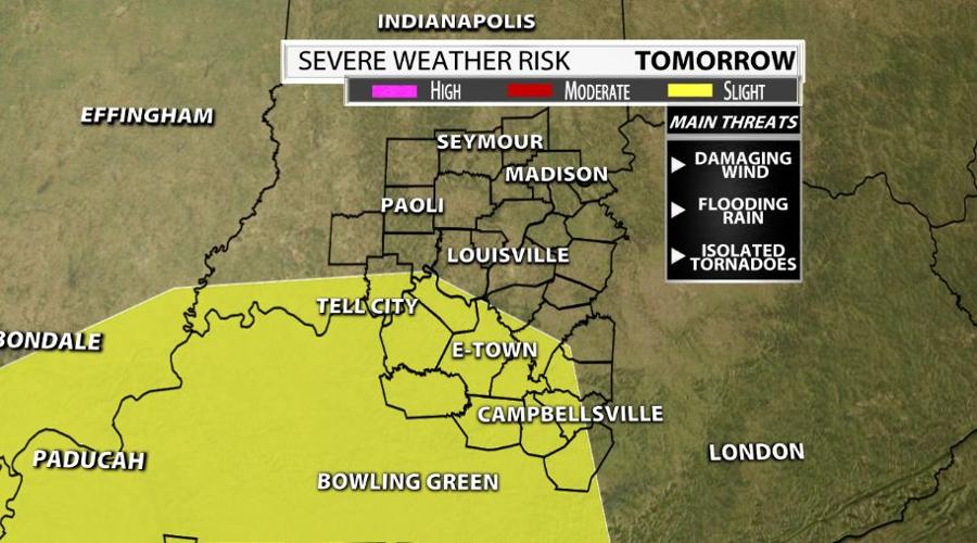

The next 24 hours look active with the potential for severe storms. The Storm Prediction Center backed off on the risk when compared to yesterday, but regardless I feel we all need to watch out for strong storms, some just more than others. Damaging winds, flooding rains and isolated tornadoes are the three main threats...

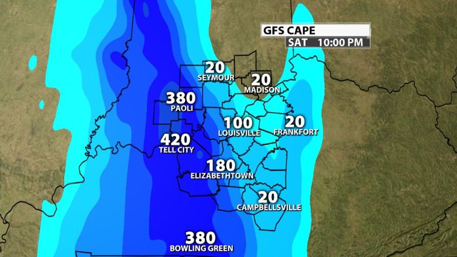
Tomorrow starts off with rain, some which could be heavy at times. There isn't much time between the morning round and the ones that race through during the afternoon so storm fuel will be limited. Check out the GFS computer models offering up meager amounts of CAPE or Convective Available Potential Energy...

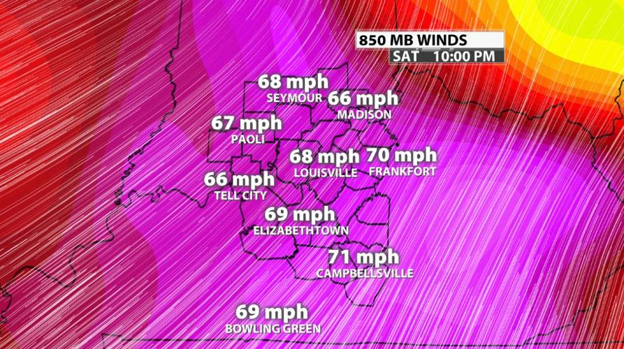
Wind energy in not in short supply! Don't let this graphic disturb you because the winds are 1 mile above the ground, but we have a powerful low-level jet cranking out 70 mph winds. A portion of this may get transported down to the ground inside storms which is why damaging winds are the primary concern on Saturday...

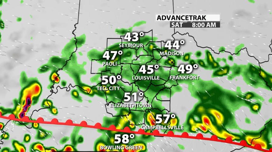
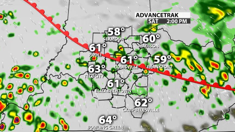
A warm front brings us a decent, but not great rain chance during the morning and early afternoon. Any storms that begin to develop during this time frame remain below severe limits. I've included a look at future radar between 8 AM and 2 PM to give you a rough idea of what to expect. The longer it rains, the less intense storms could be later in the day...


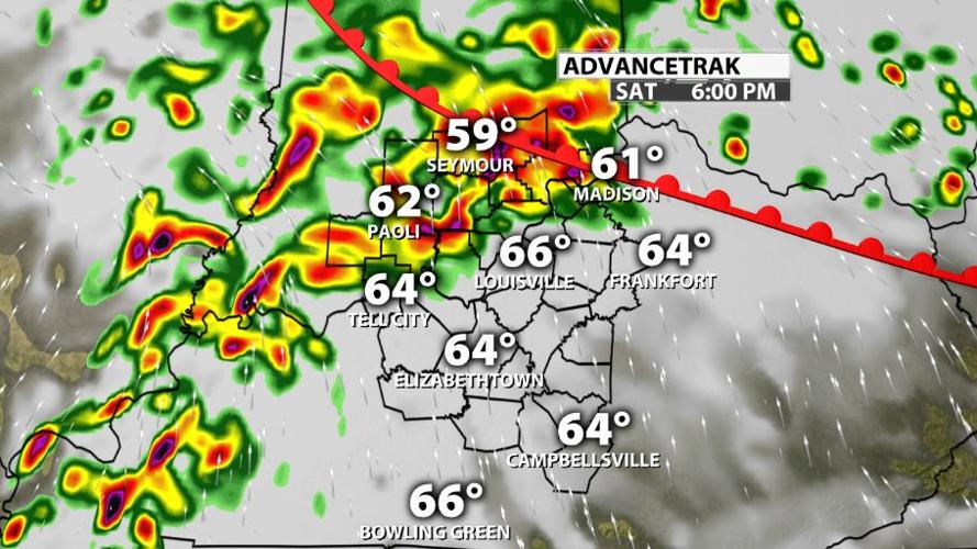
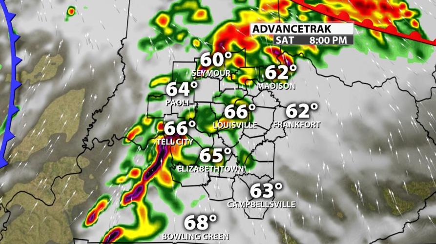
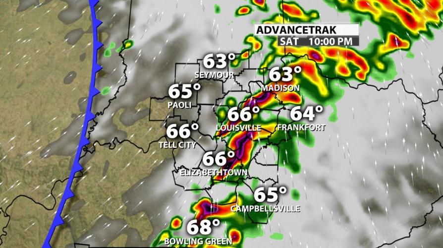
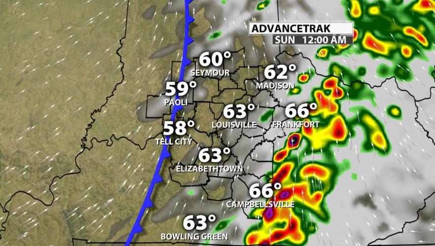
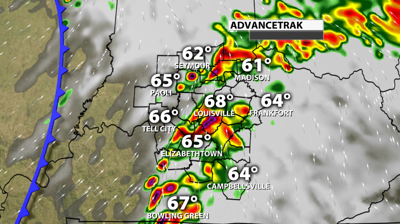
Now let's chat about the cold front. A couple waves of storms are possible ahead of it from 4 PM through midnight. I would say 7 PM - 9 PM is when they would be strongest and closest to Louisville. If you have any plans on Saturday, these would be the storms you want to avoid. Aside from the wind threat, flash flooding could materialize in minutes and we can't rule out a few tornado warnings as well. Take a look as the remaining future radar images below...


While this isn't a major event, it does look like a handful of warnings are possible tomorrow afternoon/evening with the best opportunity west of I-65. Does this mean everyone will see severe weather? Absolutely not! As always, it ends up being localized in nature, but you certainly don't want to get caught off guard. Marc and I will be looking at the latest info for WDRB News at 10 & 11! Katie and Hannah have you covered this weekend.


