
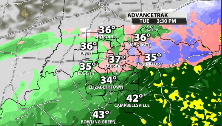
Expect snow to start falling in our area very early Tuesday morning. Likely between 4-6 a.m. in Louisville. This should begin as all snow, with cold rain being more likely toward our southern Kentucky counties.
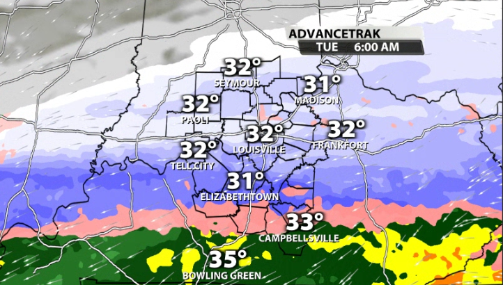
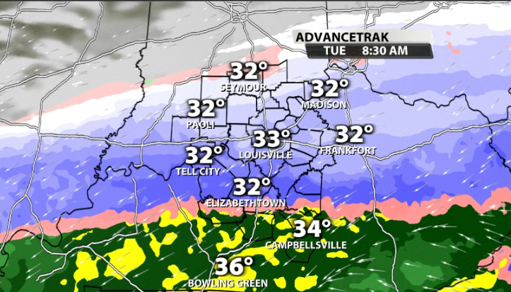
As we progress into the morning rush, this is where the snow that is falling will likely have its greatest impact due to a lot of people being on the road. By around 8 a.m., data still has Louisville in an all snow scenario, with the "freezing line", or where we switch from snow to cold rain, still down near the parkways.
From here the question is how long can Louisville remain in an "all snow" scenario. The cold rain line will begin to make its way further to the north and come closer to the metro by late morning. From here, it all comes down to how cold/warm we are at the surface and aloft. Most data has Louisville as all snow through most of the afternoon, but there is a potential that some warm air at the surface and/or aloft could infiltrate that.
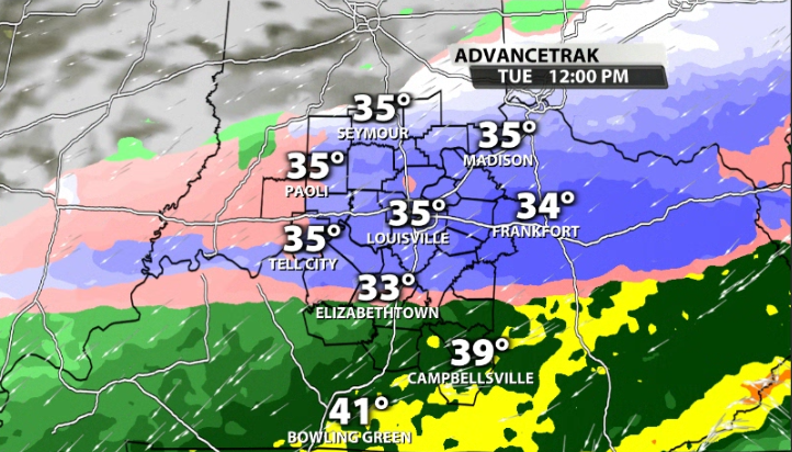
You will also notice a small sleet band in between the cold rain and snow. Just north of wherever that sleet band ends up will likely be where our heaviest snowfall totals will be. We should start to mix in with cold rain in the Louisville area by late afternoon at the latest.
With rain falling on the back side of this system and it not being incredibly cold, that will help to melt some of the snow that has fallen quickly. So when the entire system is gone, you may end up seeing less than what actually fell.
It's also important to note that these will likely be the fat and thick snowflakes that stick to everything since we don't have a lot of arctic air in place like we did for the previous winter storm in our area. This means any snow that falls will likely be a wet and heavy snow.
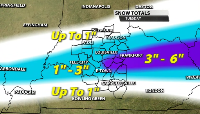
This system still has a lot of ground to make up, so there will be some tweaks to totals. Any minor shift north or south by just a few dozen miles can change the entire forecast. For now, snow up to 1" looks possible from areas in the white, like Seymour and North Vernon. The light blue stands for 1"-3" of snow which includes areas like Tell City, Scottsburg, and Upton. Finally, the purple shading stands for the heavier swath that is a potential in our area for 3"-6" of snow. This includes areas like South Louisville, Taylorsville, and Bardstown.
It's important to check in on TV with the WDRB Weather Team through the evening as snow totals are shifted based on the latest data and trends. We will also be covering the snowfall in studio and in the field on WDRB mornings tomorrow.


