


The storm system to the west has just started to form its main line of showers and storms in eastern OK and KS, but it will do that later this evening. We're stuck in the warm sector with temperatures soaring through the 70s and dew points climbing toward 60° this afternoon. But things take a turn later tonight.
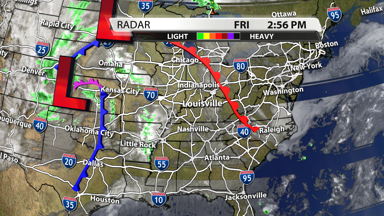
Satellite & Radar graphic made in WDRB's WSI graphics system
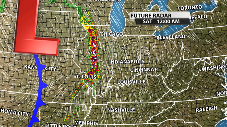
A line of storms will form in the Southern Plains and into the Ohio River Valley / Midwest Region around midnight. Storms should gradually start to weaken as they cross the Illinois/Indiana border.

AdvanceTrak graphic made in WDRB's WSI graphics system
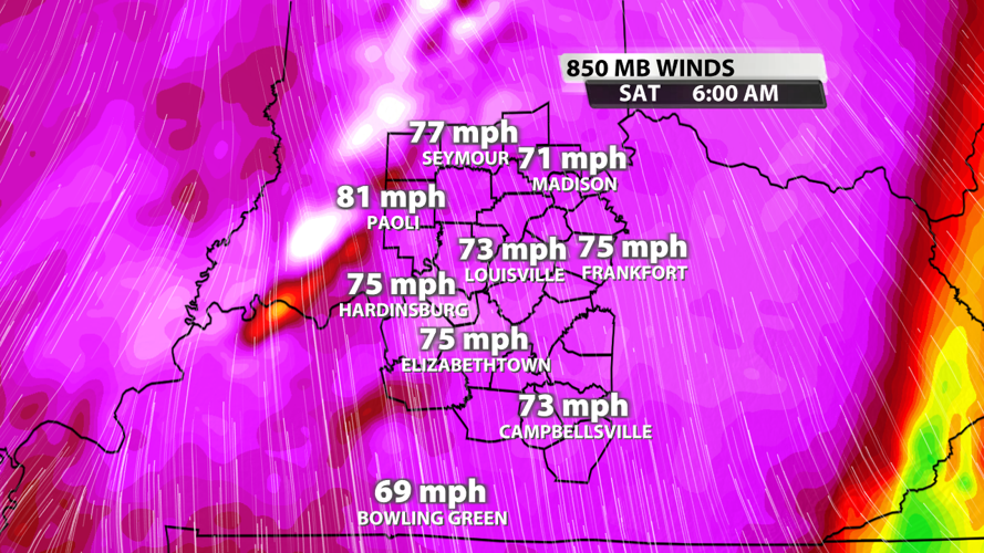
The reason storms are expected to weaken is that they will likely be running well-ahead of the cold front and ahead of the best surface energy. The low level jet will be absolutely screaming, so damaging winds around 60 mph is the most likely scenario late tonight and early Saturday morning. Some hail will be possible, and a few instances of rotation could lead to a tornado warning or two for a possible brief, spin-up tornado.

Low level jet wind speeds graphic made in WDRB's WSI graphics system
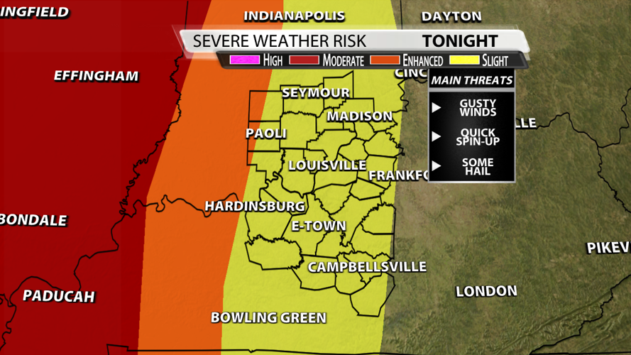
The Storm Prediction Center does still have us in s Slight Risk for severe weather tonight, and that's a good call in case storms do manage to hold together as they enter our region. However, they will likely rapidly fall apart as they approach the I-65 corridor.

SPC Day 1 Risk graphic made in WDRB's WSI graphics system
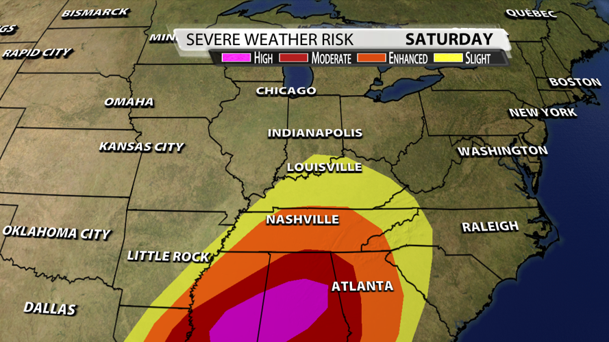
Tomorrow will have better moisture and a little energy, but the wind shear will die down quite a bit. Therefore, we're expecting more gusty winds, some hail, and widespread moderate to heavy rain from morning to evening (with periods of dry time) that could lead to isolated flooding issues. Tornado appear much less likely, but the threat isn't entirely zero Saturday afternoon. There is a High Risk for violent tornadoes, damaging winds, and large hail to across the Southeast.

SPC Day 2 Risk graphic made in WDRB's WSI graphics system
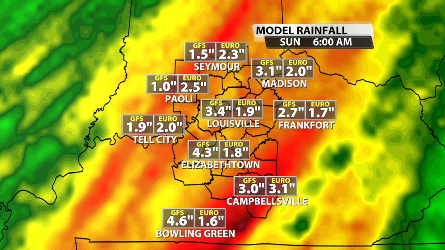
Rainfall totals are still expect to be widespread 1-3" with some spots topping out closer to 4". Most of the widespread heavier rain will fall Saturday afternoon and evening.

Rainfall comparison graphic made in WDRB's WSI graphics system


