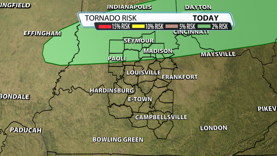


The chance for severe weather on Sunday is still in play. Storms should start off as supercells with a hail threat being the primary concern, and then there should be a transition to a damaging wind threat as individual cells start to cluster together. The tornado threat is low, but it isn't zero.

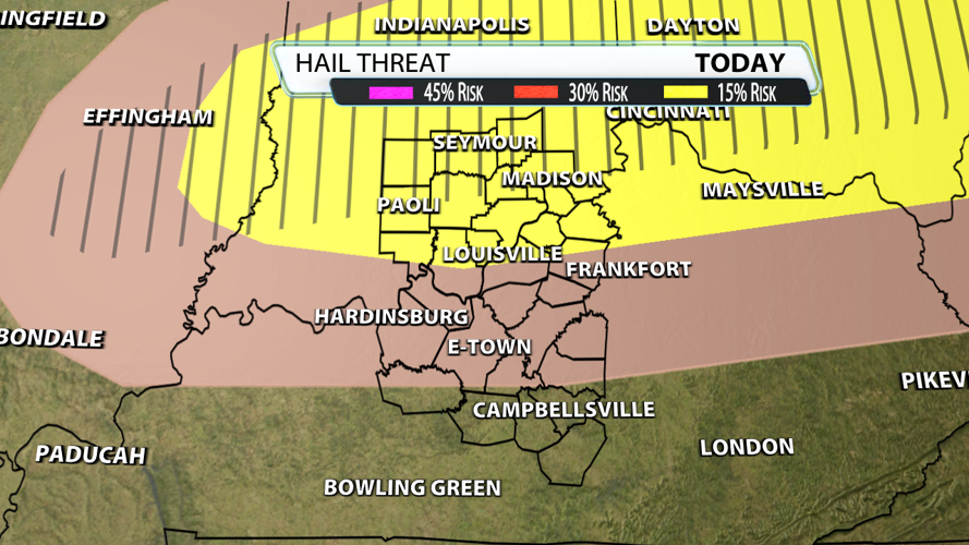
The hail threat with supercells is higher than with a line of storms. That's one of the big differences between this setup and what we experience last Sunday night. Any of the storms could produce some hail tonight, but the strongest storms could produce hail of 1.5" - 2.5" in diameter. In general, the yellow shaded region has the highest chance for seeing hail, specifically hail of severe criteria of 1" or larger. The hatched region signifies the areas where hail could be over 1.5" in diameter.

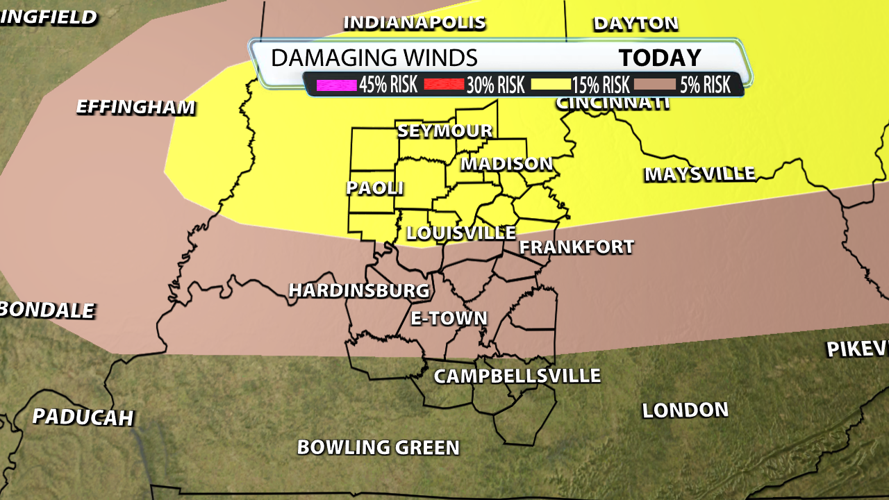
The damaging wind threat is quite a bit lower than what we experienced last weekend. Just like the hail threat, storms along and north of I-64 have a better chance of producing severe criteria winds around 60 mph.

Tornadoes are definitely not a primary threat, but they are possible. The is very little shift in the directional profile of the winds as you go up in the atmosphere, so there won't be much rotation within the storms. There is some speed shear, but it isn't nearly as intense as what we experienced last week. In fact, winds at 850mb (about 1 mile off the ground) will be roughly 50-60% of the the speed of last week's wind speeds.

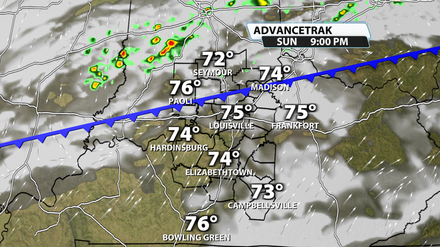
Storms should start forming after sunset in central Indiana. They will slowly move south throughout the night. As they do, the atmosphere's energy levels will be dropping due to the lack of sunshine helping sustain the energy from earlier in the day. This results in an overall weakening trend in the storms' intensity levels the farther south they move.

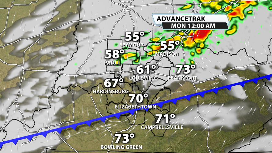
Storms could reach the Louisville area or the I-64 corridor around midnight or 1 AM. This is when the storms are expected to weaken some.

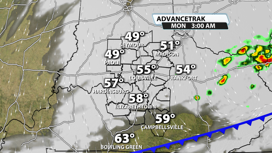
By 3 or 4 AM, storm coverage will probably be decreasing significantly, and the severe chances will be minimal. Monday morning should start bone dry and cooler with 30s and 40s on the board.

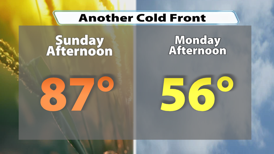
Sunday's near-record warmth will be diminished quickly as the cold front moves across the region. Afternoon highs on Monday will probably be in the middle 50s, so a 30 degrees drop from one day to the next is likely. Temperatures Tuesday will dip into the 30s in many locations. At least we aren't talking about snow on the backside of this severe weather system!


