
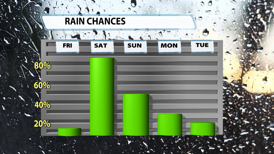


You probably don't want to hear this, but showers and storms return to the region over the next 48 hours. Friday's rain chance is exclusively during the later evening to overnight hours and brings no threat of severe weather. Saturday's forecast tells a much different story. Let's talk about what the latest model data is showing us.

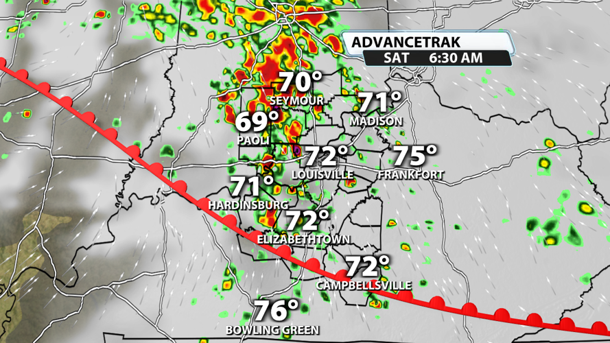
A line of storms will be present Saturday morning as a warm front passes across the Ohio River. We'll watch for severe potential here, but it isn't our primary concern. Instead, this will bring in more moisture to help fuel storms later in the day. Considering this first round of rain is fairly early in the morning, there should be ample time for the atmosphere to reenergize before the second round of storms particularly if the clouds break and the sun comes out in the early afternoon.

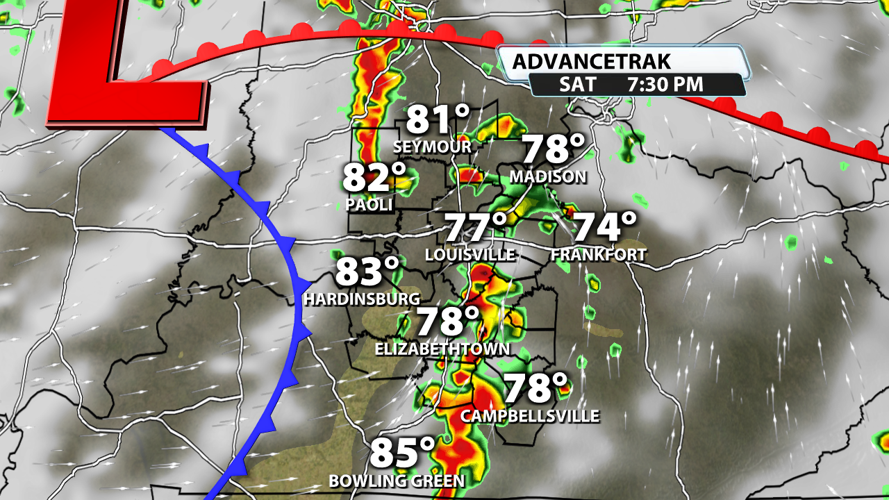
Storms should reform in the evening hours, and they could tap into some energy at the surface and winds aloft that are marginally conducive to severe weather potential. The wind profile isn't particularly favorable for widespread severe weather, but it could be just enough to pop off a few instances of damaging winds or a weaker tornado.

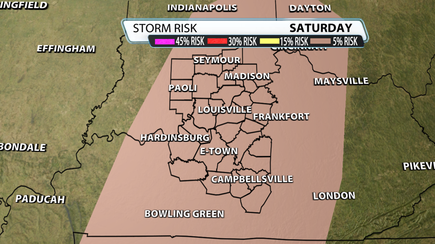
The aforementioned severe weather ingredients are why the Storm Prediction Center has place all of our counties under a marginal risk for severe weather. A few damaging wind gusts, some hail, and a tornado can't be ruled out with this setup. Overall, the threat should stay low unless winds higher in the atmosphere pick up and the energy levels near the surface increase with some extra sunshine.

Rain chances will stay moderate on Sunday, but the severe weather potential will have subsided. Showers could linger into the first half of next week, but expect conditions to be significantly drier.


