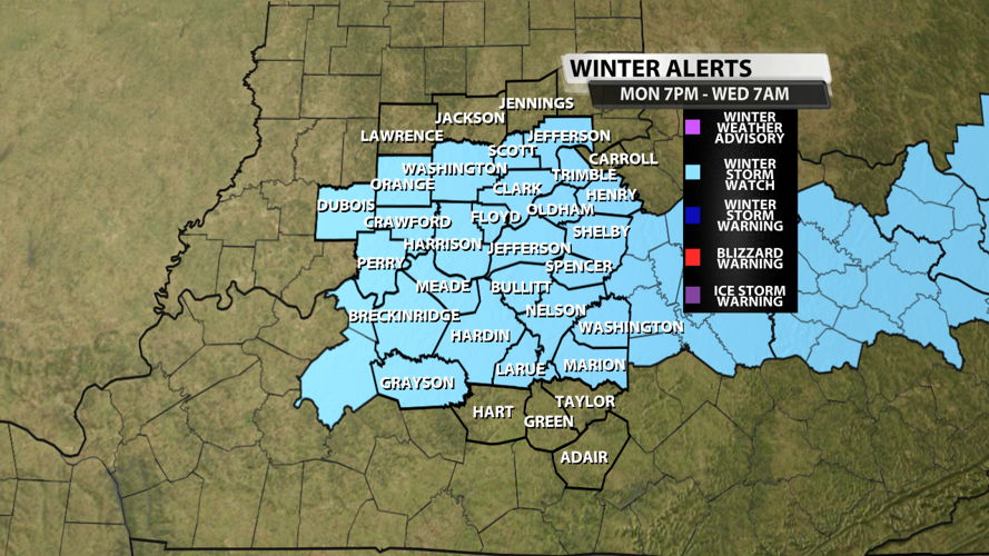

...WINTER STORM WATCH IN EFFECT FROM MONDAY EVENING THROUGH
WEDNESDAY MORNING...

* WHAT...A wintry mix of snow, sleet, and freezing rain is expected
  across the watch area.  Significant amounts of snow with
  accumulations greater than 4 inches are possible in the watch area.

* WHERE...Portions of south central Indiana and east central, north
  central, northwest, and south central Kentucky.

* WHEN...From Monday evening through Wednesday morning.

* IMPACTS...Roads, and especially bridges and overpasses, will
  likely become slick and hazardous.  Travel across the region late
  Monday night and Tuesday will be difficult.

Winter Alerts made in WDRB's WSI graphics system
An impactful winter system is very likely for the first half of this upcoming work week. The National Weather Service in Louisville has already issued a Winter Storm Watch for many of our Kentuckiana counties from 7 PM EST Monday to 7 AM Wednesday.

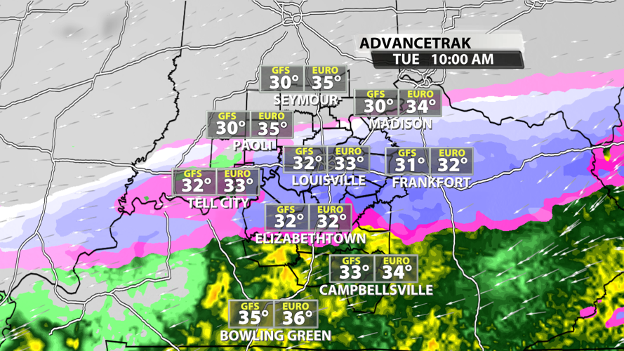
AdvanceTrak from WDRB's WSI graphics system
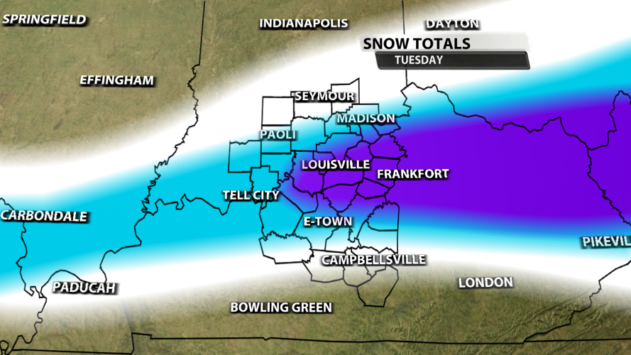
Accumulating snowfall will cause road conditions to deteriorate on Tuesday morning, and impacts should last through Wednesday morning in many places. However, temperatures will be at or just above freezing across most of the region Tuesday and Wednesday, so the snow could melt faster than normal even if we get decent accumulations.

Snowfall map made in WDRB's WSI graphics system
Snowfall totals will increase sharply from south-central KY to the I-64 corridor, and they will gradually decrease from I-64 through the southern third of Indiana. Our southern communities will warm up just a touch throughout the day, resulting in more moderate rain rather than heavy snow in areas south of the Western Kentucky and Bluegrass Parkways. The map above designates lower snowfall totals in the white, moderate snowfall in the blue, and heavier snow in the purple. Snow accumulation expectations and will change over the next 24 hours, with the most likely scenario being increased totals especially on either side of the I-64 corridor specifically east of I-65.


