The National Weather Service in Louisville has issued a Winter Weather Advisory from 6 AM through 1 PM Sunday for several of our WDRB counties.
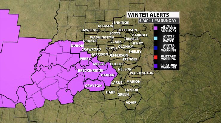
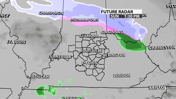
The chance for wintry mix starts around daybreak. It moves in from the west and southwest which is why our western counties are included in the Advisory.
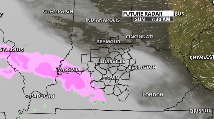
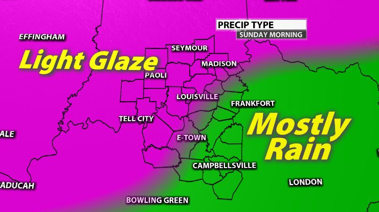
This mix will be mostly sleet or freezing rain, so icy roads will be possible through late morning and early afternoon.
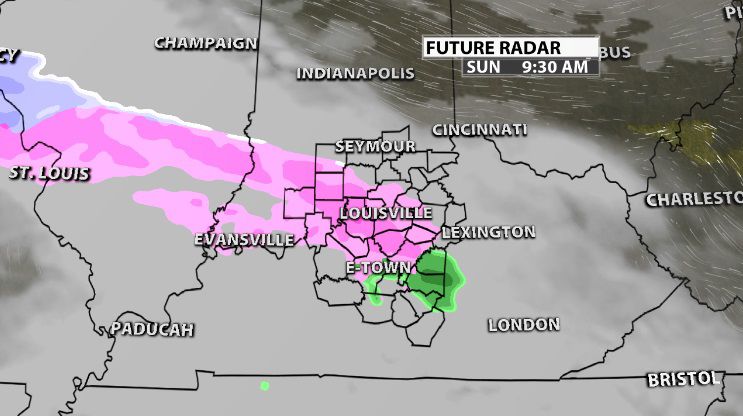
By afternoon temperatures climb enough to transition us to rain, and this first wave of moisture moves out. More rain, some heavy, follows Sunday night.
Ice or snow accumulation will be fairly minimal, so instead of amounts, below you will see what precipitation type is most likely for your area. The spots where a light glaze is possible could develop slick spots on untreated surfaces.
Below is the text issued by the NWS with the Advisory:
...WINTER WEATHER ADVISORY IN EFFECT FROM 6 AM EST /5 AM CST/ TO
1 PM EST /NOON CST/ SUNDAY...

* WHAT...MIXED PRECIPITATION EXPECTED. A COMBINATION OF A FEW
  TENTHS OF AN INCH OF SNOW AND/OR A FEW HUNDREDTHS OF AN INCH OF
  ICE.

* WHERE...PORTIONS OF INDIANA AND NORTH CENTRAL AND NORTHWEST .

* WHEN...FROM 6 AM EST /5 AM CST/ TO 1 PM EST /NOON CST/ SUNDAY.

* ADDITIONAL DETAILS...PLAN ON SLIPPERY ROAD CONDITIONS.

PRECAUTIONARY/PREPAREDNESS ACTIONS...

A WINTER WEATHER ADVISORY MEANS PERIODS OF SNOW OR FREEZING RAIN WILL
CAUSE PRIMARILY TRAVEL DIFFICULTIES. EXPECT SLICK ROADS, AND USE
CAUTION WHILE DRIVING.
