


Rainfall totals from Friday, Saturday, and Sunday ended up being 1" - 2" across much of Kentuckiana as anticipated. The rain we got last night finally brought Louisville's 2024 rainfall total up and over the average rainfall for this point in the year. December's rainfall total of 3.75" is just barely below the 3.88" we would normally have at this point in the month, so last night's 1.1" of rain really helped get us back up to par.

Rainfall total graphic made in WDRB's WSI weather graphics system
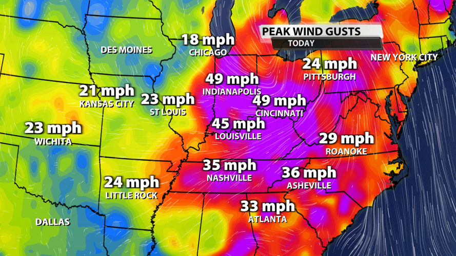
Rain wasn't the only big story with this system. The 35 - 50 mph wind gusts really made for a bad hair day and even caused hundreds of power outages across our counties in Indiana and Kentucky. Much of the Midwest and Ohio River Valley had peak wind gusts above 40 mph. Winds are calming down this evening, so the Wind Advisory we had in place expired at 7 PM EST as scheduled.

Peak wind gusts graphic made in WDRB's WSI weather graphics system
Over the next few days, you can expect a big change in the weather. Monday will be warm with a little sunshine coming through some fairly dense cloud cover. Temperatures should top out in the middle 50s with a 10-20% chance for a few light sprinkles. Winds will be a lot less breezy as gusts stay below 20 mph.
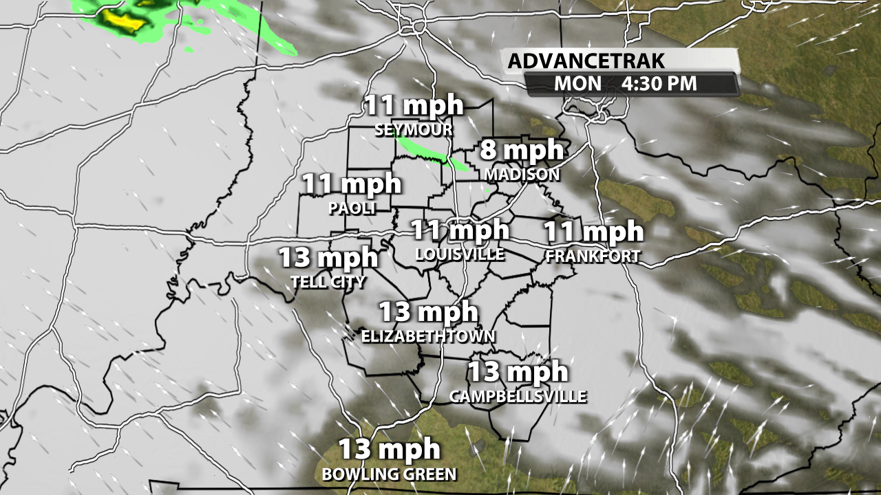
AdvanceTrak graphic made in WDRB's WSI weather graphics system
Monday night and Tuesday bring us another chance for rain. This next round of showers will be lighter than what we just had, so expect totals to be between .1" and .5" in most spots. Temperatures will fall throughout the day with 50s becoming 40s and eventually 30s just after the clock strikes 12 and we start a new year on Wednesday.

AdvanceTrak graphic made in WDRB's WSI weather graphics system
Wednesday afternoon will be in the 30s and low 40s with a few flurries possible at some point on Wednesday.

AdvanceTrak graphic made in WDRB's WSI weather graphics system
Wednesday's cooler temperatures are expected to hang around for a long time. We don't know the specifics just yet, but the Climate Prediction Center has already given us an 80% chance for blow normal temperatures in the 8-14 day outlook. Not only will we have colder air, but an impactful winter weather setup is expected across the Plains and into the Midwest next Sunday. There's a lot of time between now and then, so we can't speculate what will come of it. But a southern track would absolutely mean impacts for Kentuckiana. More details to come in the days ahead!

CPC temperature outlook made in WDRB's WSI weather graphics system


