

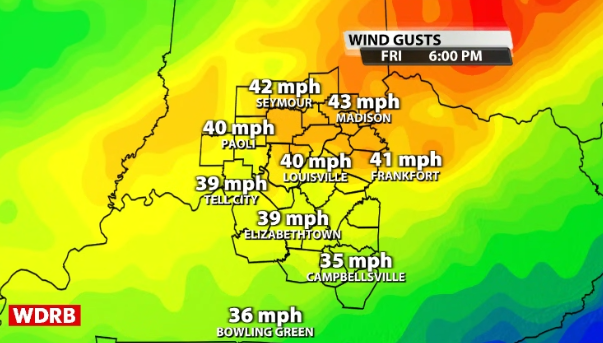
Keep a tight grip on your steering wheel Friday! The morning looks quiet, then winds will huff and puff from the southwest during the afternoon with gusts up to 45 mph. There currently isn't a Wind Advisory posted for our area yet, but don't be shocked when one comes out since I do believe we will meet criteria.
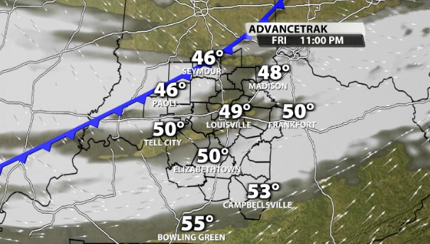
On a postitive note, that does mean Friday feels mild with high temperatures in the upper 60's. A couple locations may sneak into the 70's for a second time this week. A silent cold front brings us clouds Friday night, no rain, along with a shot of much colder air for the weekend.
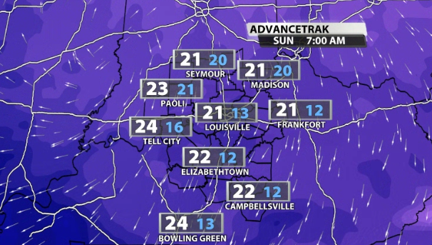
That means a 45 degree temperature drop from Friday afternoon to Sunday morning as lows fall down to 20 degrees. When you factor in the breeze, wind chill values get knocked into the teens. That will sting a little bit and should serve as a reminder that winter isn't over yet.
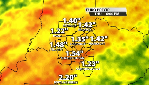
Then we turn our attention to a very powerful low pressue that arrives Tuesday into Wednesday. Heavy rain and strong to severe storms will be on the table once again. While rivers have been able to recover from the insane rain we saw during the middle of this month, another 1-2" may cause some floding issues. In my opinion, the chance for a couple waves of potentially nasty storms will be the bigger concern. The WDRB Weather Team has your back every step if the way.


