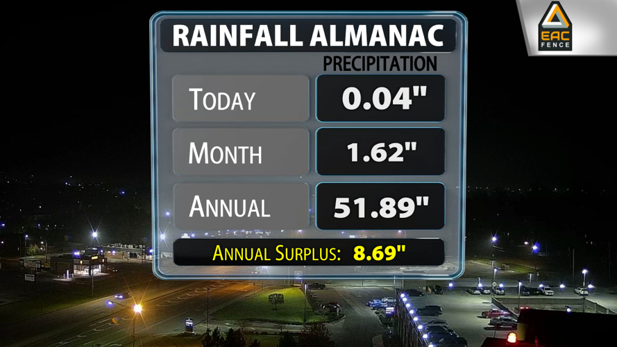


The weather recently has been quite bleak considering we had almost four straight days without any sizable breaks in the cloud cover and a fairly persistent mist with some heavier downpours mixed in as well. Louisville is actually .79" below what we would expect in terms of rainfall at this point in November, but there will be more opportunities to pick up additional rainfall.

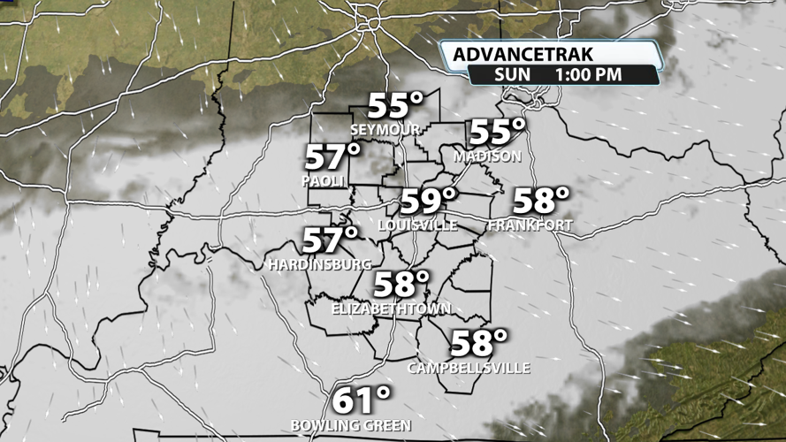
Today brought us some sunshine, but tomorrow will give us even more! Sunday will have a mix of sun and clouds with temperatures in the upper 50s and potentially low 60s in our warm spots. There won't be lot of wind to mix the air, but any amount of sunshine will bump up our temperatures fairly quickly.

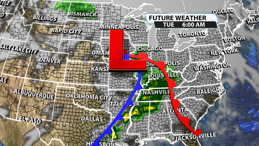
Our next rainmaker arrives Monday night and hangs around for the first part of Tuesday. Rain chances are high, and rainfall totals will probably be anywhere from .25" to 1" across Kentuckiana. The better chance for heavier rainfall will be in our southern communities.

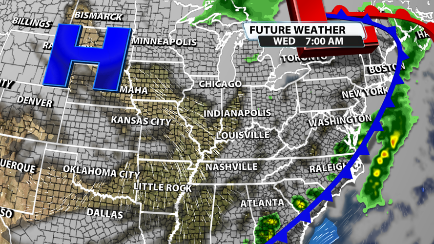
The rain will be out of our region by Wednesday morning, and high pressure will settle in behind the system. This will drop rain chances to zero for Wednesday and Thanksgiving Day, so no weather worries on the roads when heading to your holiday destination anywhere in our area.

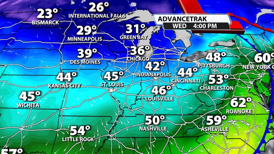
Temperatures will drop a good bit Tuesday to Wednesday with 60s quickly ending up as 40s from one afternoon to the next. Temperatures will drop even farther by Thanksgiving Day with morning lows expected to be close to freezing area-wide!


