


LOUISVILLE, Ky. (WDRB) -- Meade County was hit by a second EF-1 tornado during Sunday's storms, according to the latest survey from the National Weather Service.
The second EF-1 tornado with wind speeds of 90 mph touched down in the town of Flaherty, Kentucky, according to the survey.
Mike Kochasik with the National Weather Service said a fifth tornado was confirmed in Breckinridge County. The track was just north of Harned and there were 90 mph winds.
WDRB Chief Meteorologist Marc Weinberg posted an update on his Facebook page Tuesday afternoon.
The second tornado continued into Hardin County, ending in Radcliff, according to the NWS.
IMAGES | Powerful storms damage property, topple trees in Kentucky and Indiana

Pictured: this image dated March 31, 2025, shows an overturned tree that fell on a vehicle in a driveway of a home on Mitchell Hill Road in Fairdale after powerful storms moved through the area on March 30, 2025. (WDRB/Jeff Gordon)

Pictured: this image dated March 31, 2025, shows an overturned tree that fell on a vehicle in a driveway of a home on Mitchell Hill Road in Fairdale after powerful storms moved through the area on March 30, 2025. (WDRB/Jeff Gordon)
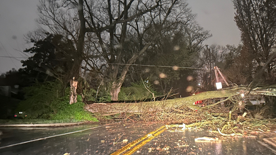
Pictured: this image from a WDRB viewer shows a tree blocking Cannons Lane near Lexington Road in Louisville, Ky., after storms moved through the area on March 30, 2025. (Sara Moses)

Pictured: this image dated March 31, 2025, shows damage ; left behind at RRB Auto Sales on W. Manslick Road in Louisville, Ky., after powerful storms moved through the area in the evening hours of March 30, 2025. (WDRB image)
A tree down in the Irish Hill neighborhood from the storm. Image courtesy of Tamberlyn Brown. Mar. 31, 2025
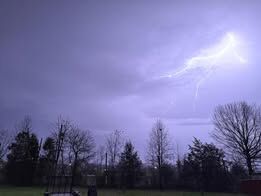
Lightning near Shepherdsville. Mar. 31, 2025

Pictured: a downed tree in a yard in the Indian Falls neighborhood off of Cooper Chapel Road in Okolona. (WDRB viewer Andi Shelton via Facebook)
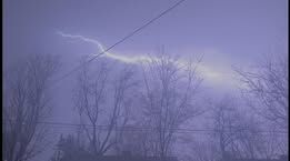
Lightning picture courtesy of Candice Lynn. Mar. 31, 2025
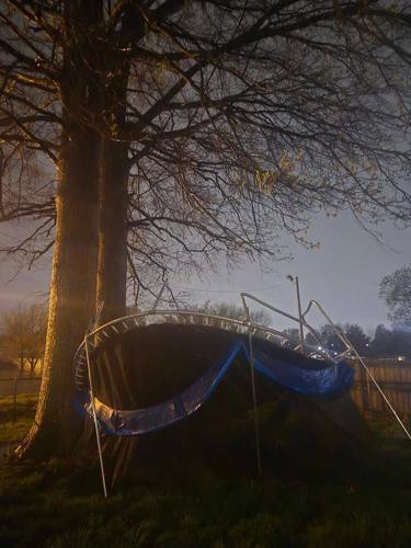
A trampoline blown over from high winds in Okolona. Image courtesy of Tabitha Stamper. Mar. 31, 2025
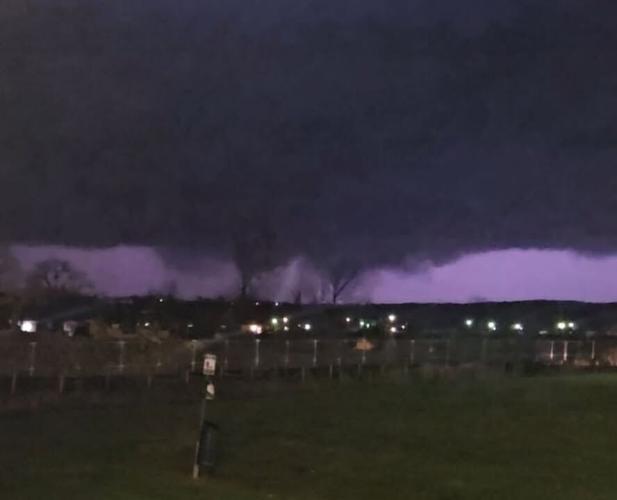
An ominous look at the sky in Shepherdsville during the storms. Image courtesy of Kelsey Moore. Mar. 31, 2025

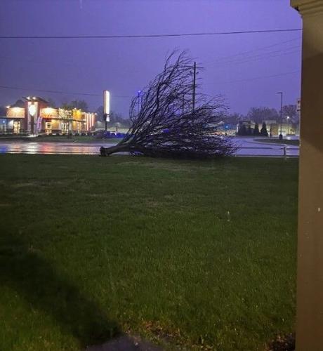
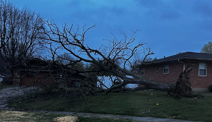
A tree snapped in half from the storm in Madison, IN. Image courtesy of Amy Lewis Chase. Mar. 31, 2025
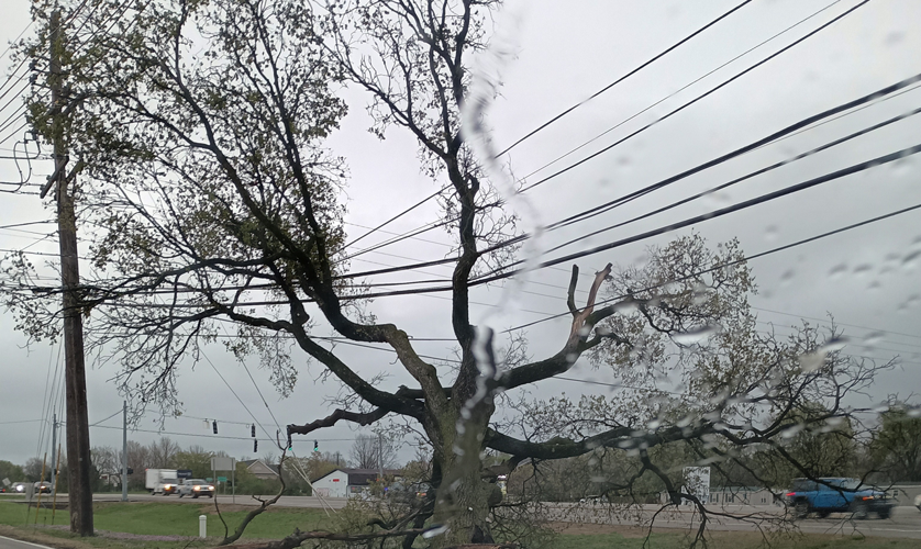
Pictured: this image from a WDRB viewer dated March 31, 2025, shows tree limbs tangled in utility wires morning in front of a KFC in Hillview, Ky., after storms moved through the area on March 30, 2025. (Stephanie Montgomery)
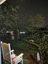
Pictured: this image dated March 31, 2025, shows a tree down in the yard of a home in Louisville's Cloverleaf neighborhood after powerful storms moved through the area on March 31, 2025. (Kallie J. Arnold via Facebook)
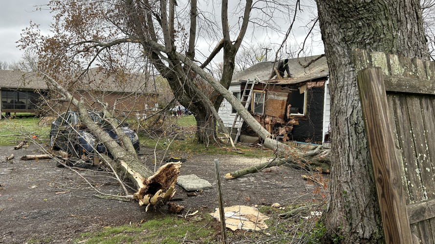
Pictured: this image dated March 31, 2025, shows crews in Fairdale on Chieftain Drive and Mitchell Hill Road assessing damage left behind by powerful storms that moved through the area on March 30, 2025. (WDRB/Katrina Nickell)
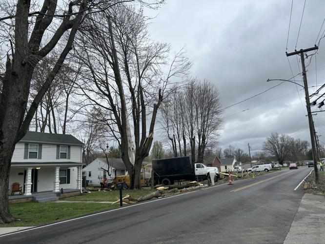
Pictured: this image dated March 31, 2025, shows crews in Fairdale on Chieftain Drive and Mitchell Hill Road assessing damage left behind by powerful storms that moved through the area on March 30, 2025. (WDRB/Katrina Nickell)
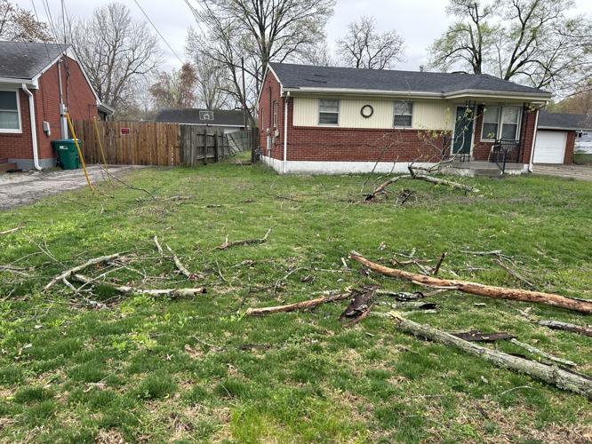
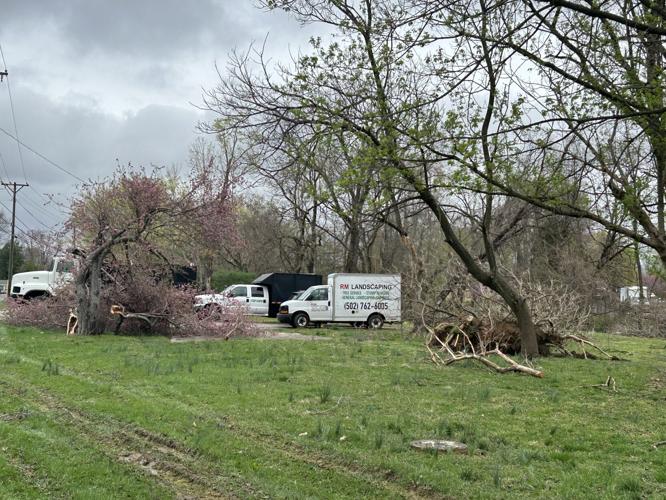
Pictured: this image dated March 31, 2025, shows trees down in a yard on Morgan Avenue near Mount Holly Road in Fairdale; after powerful storms moved through the area on March 30, 2025. (WDRB/Katrina Nickell)

Pictured: this image dated March 31, 2025, shows storm damage on Chieftain Drive and Mitchell Hill Road left behind by powerful storms that moved through the area on March 30, 2025. (WDRB/Katrina Nickell)
That brings the total tornado count from Sunday night’s storms to four in our area. That number could grow as NWS continues to conduct surveys.
More severe weather is in the forecast through the end of the week, and officials are urging people to take precautions. For real-time weather alerts, sign up for emergency notifications by texting "LensAlert" to 67283.
Download WDRB Apps
A great way to stay weather aware is to download the WDRB Weather app, which provides current and up-to-date weather notifications and alerts when severe weather comes through. Opt-in for push alerts to make sure you receive severe weather alerts as they happen. To download the app on the Apple App Store, click here. To download for Android on Google Play, click here.
For the latest forecasts and conditions from WDRB's weather team, click here.
Related Coverage:
- Spencer County officials explain why sirens didn't activate during initial tornado warning
- Louisville officials urge residents to prepare for storms, life-threatening floods in the forecast
- EF-1 tornadoes confirmed in Jefferson, Bullitt and Spencer counties from Sunday night storms
Copyright 2025 WDRB Media. All rights reserved.


