After the last few days have brought lots of sunshine and high temperatures near 80, this cold front is bringing a noticeable drop in temperature. It's not the only one in the next week either.
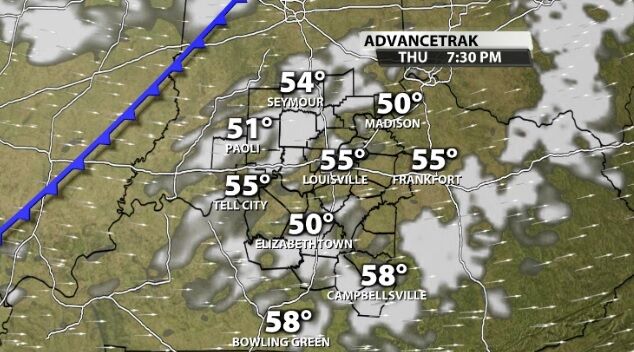
Earlier today the cold front pushed rounds of rain and storms to parts of our area. It will actually move through our communities Thursday and drop temperatures farther by Friday. High temperatures will be back in the 60s like we enjoyed last weekend. It's not just this cold front, though. Another front will roll through our area this weekend bringing even cooler air to us next week.
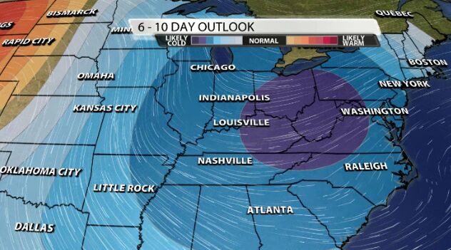
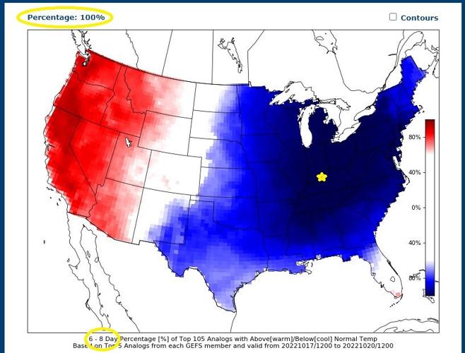
The Climate Prediction Center shows a strong probability of temperatures below average in our area next week, but the analogs show that could be a slam dunk! I've circled the important pieces in the image below which show 6-8 days from now a 100% probability of "colder than average" temperatures in Louisville. For perspective, average high temperatures this time of year are in the low 70s with average low temperatures in the low 50s.

You can click here to see the 7-day forecast showing how strong that next cool down will feel.


