
Given its spot on the calendar, the Easter holiday can bring many different kinds of weather to the Ohio Valley. Here we look back at the extremes and what to expect Sunday.
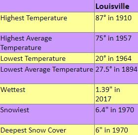
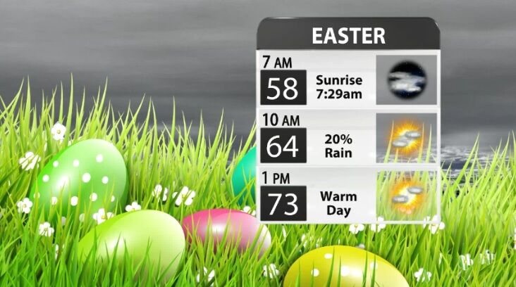
The chart above and the data in it are from NWS Louisville. Easter in Louisville has been as warm as 87º and as cold as 20º. There's been as much as six inches of snow on the ground, which happened in 1970. The wettest Easter on record happened only seven years ago. Many of you likely remember the downpours from 2017. We are not forecasting any of those extremes for Easter 2024. Temperatures will range from the upper 50s into the 70s, and while we do expect hit or miss storms early in the morning and again late in the evening, large sections of the day and parts of our area will be dry.
Tune in to WDRB News at 10 for an updated look at when we expect storms in our area and an hour-by-hour temperature forecast.


