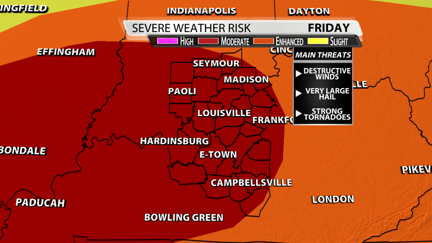
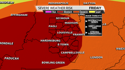

The Storm Prediction Center has just about all of our area under a "moderate risk" for severe weather on Friday. What does that mean?
By definition, it means widespread severe storms are likely that will be long-lived and intense. I know a lot of people suffer from storm anxiety.
Plan, don't panic.
If you have multiple ways to get warnings, keep phones charged in case power goes out, and have a sturdy structure to take shelter, then hopefully that control can make the storms a little less scary.

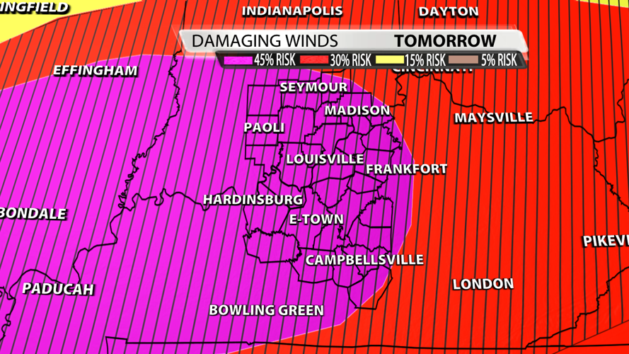
My goal is to illustrate the likelihood of each threat starting with wind. The Storm Prediction Center has a 45% probability of damaging thunderstorm winds or wind gusts of 58 mph or higher within 25 miles of a point. Notice the hatched area which means there's a 10% or greater probability of wind gusts 75 mph or greater within 25 miles of a point. Those are hurricane-force winds that could take down trees that are now full of leaves.

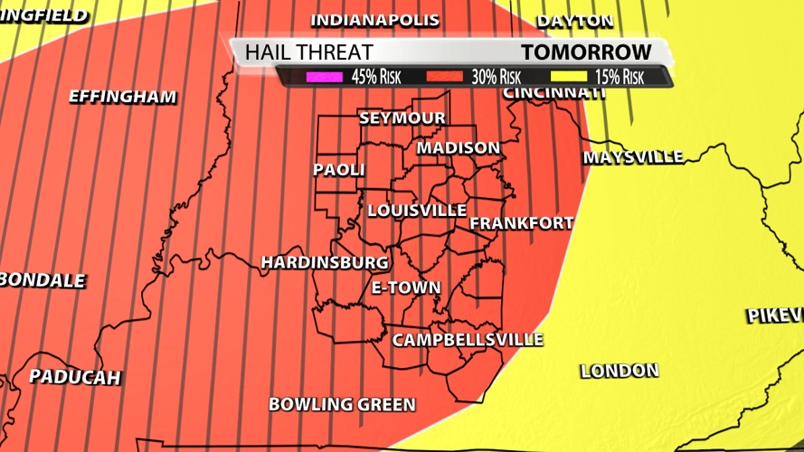
Moving on to hail, we have a 30% probability of one inch diameter hail or larger within 25 miles of a point. Don't forget about the hatched area that represents a 10% or greater probability of two inch diameter hail or larger within 25 miles of a point. Golf ball-sized hail is 1.75" in diameter so it could be larger that that, maybe even growing to 2.75" which are baseballs.

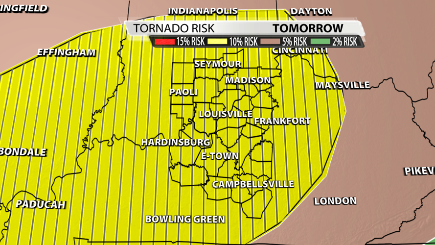
Finally, the probability of a tornado within 25 miles of a point is at 10%. The hatched area delineates a 10% or greater probability of EF2 - EF5 tornadoes within 25 miles of a point. Tornadoes are classified as weak, strong, and violent. Strong tornadoes begin at EF2 with winds at a bare minimum of 111 mph. I always want you to prepare for the worst and hope for the best. Watch us on TV or WDRB+ for an updated timeline on when storms strike your location. As always, please trust the WDRB Weather Team to keep you and your family safe.