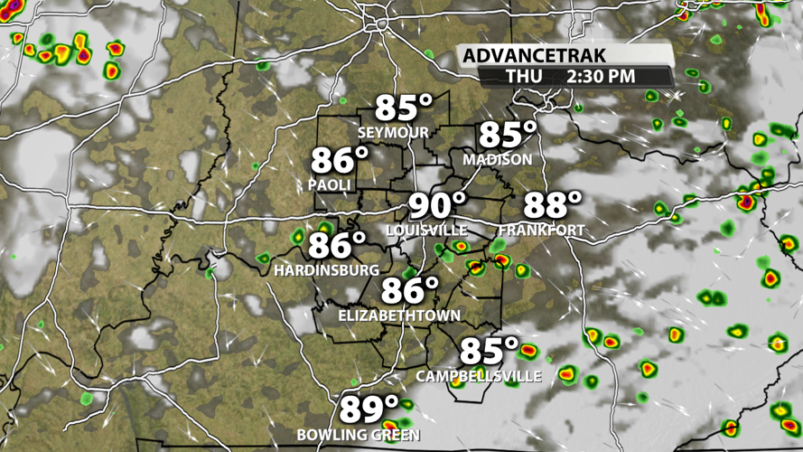

Today was a bit on the cool side compared to what we've had recently! The widespread, dense cloud cover made a huge difference and kept our highs in the low to middle 80s across much of the region. But this was truly a one off situation as temperatures climb again starting tomorrow.

Thursday will have partly sunny skies with a 20-30% chance for showers and storms. While downpours are possible, the sunshine will take our highs into the upper 80s and low 90s.

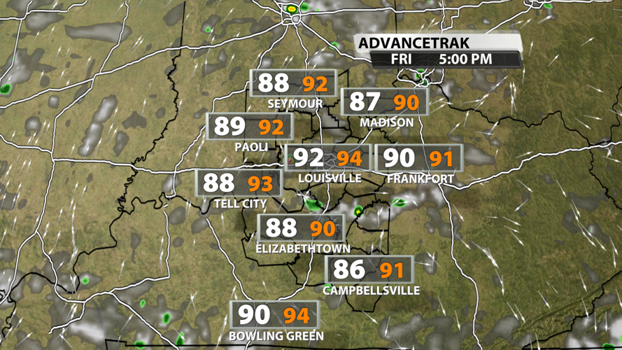
Friday will be a couple degrees warmer in most spots compared to Thursday, but it won't feel crazy humid. That's because dewpoints will be in the middle 60s. Feels-like temperatures will be pretty close to the actual temperature for most of the day.

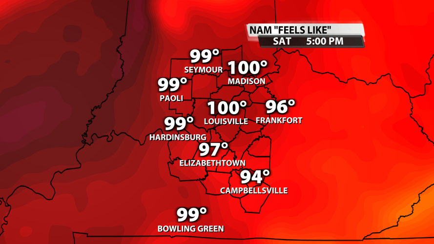
Saturday's rain chances are primarily during the evening hours, but the bigger story will be feels-like temperatures around 100 degrees much of the afternoon as dew points return to the low and middle 70s and actual air temperatures top out in the middle 90s.

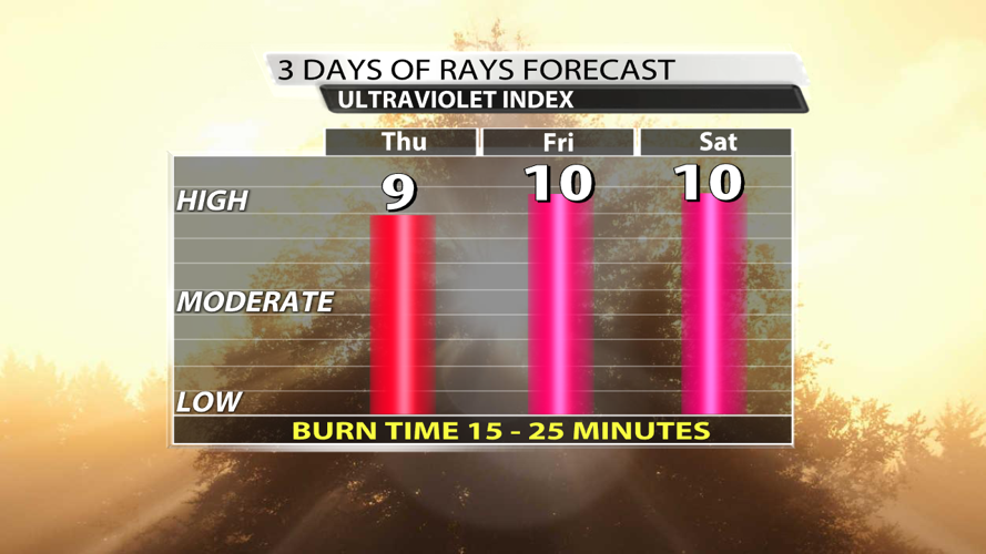
For those trying to spend time outdoors during the late morning and early afternoon hours, don't forget the sun protection! With less rain and extra sunshine, the UV index will be back up to the 9-10 range. That means a burn time of 15-25 minutes is possible.


