

Happy Summer! Meteorological Summer starts today which only has to do with record-keeping. June, July, and August are considered "summer" so we can keep clean records, but technically our seasons are determined by astronomy. The summer solstice happens on June 21 this year, and we will talk more about that as it gets closer.
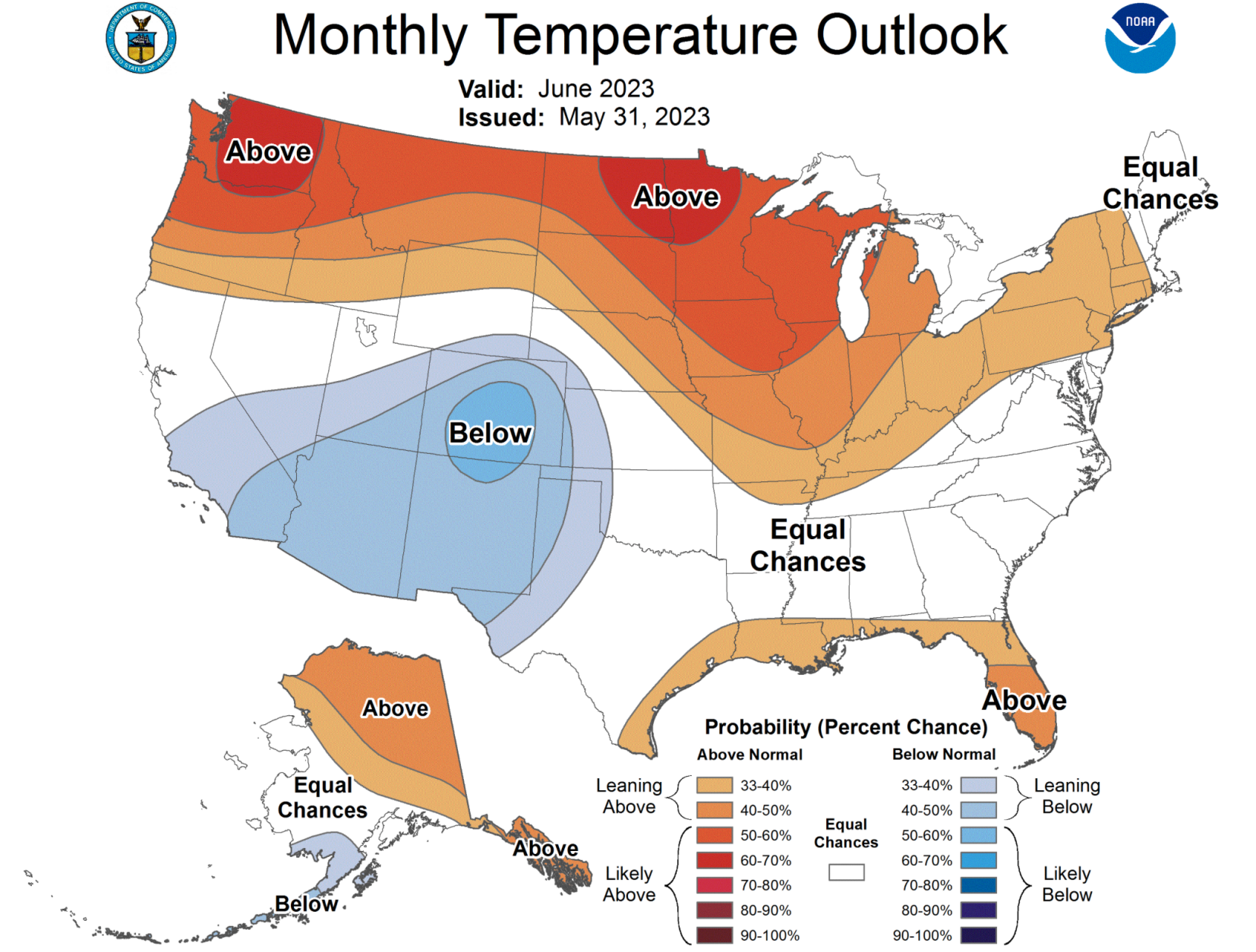
Today our focus is on what kind of weather to expect through the month of June. The Climate Prediction Center releases these monthly outlooks which are based on probabilities of temperatures and precipitation being above or below normal. So first, we need to establish what is normal during the month of June. According to the National Weather Service in Louisville, the normal maximum temperature in June is 85.7°, the normal minimum temperature is 67.2°, and the normal average temperature is 76.4°. Normal rainfall for the month is 4.27"; all of those numbers are based on climatological normals from the last 30 years (1991-2020).

Now we can look at what these maps are trying to tell us. The CPC gives a 33%-40% chance of above normal temperatures for the month. Remember, this doesn't mean the high temperature every day will be "warmer than normal" but that when we look back on the entire month of June, they expect it to be near or slightly above those normal values we broke down above. At this point there are equal chances of rainfall ending up either above or below normal for our area, but the shading for slightly below normal is closer to us than the one for slightly above normal. That would mean we should expect rainfall to be near normal by the end of the month, but it looks like we are going to start with a prolonged dry stretch. To end the month near normal, that would mean increased rainfall later in the month to make up the difference.


