
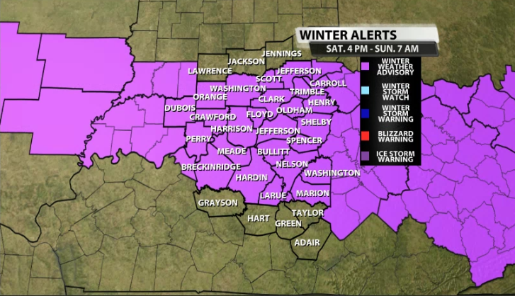
In case you haven't noticed...it's cold! With arctic air in our area for the weekend it makes it a little easier to get snow showers in our region if we can bring enough moisture in. Well, a quick hitting storm system will arrive later this afternoon/evening and overnight tonight that brings in a decent chance of snow showers to our area. Due to potential slick roads, we have a Winter Weather Advisory that goes into effect at 4PM and lasts through 7AM.
We still have some dry air in our area, so as snow showers start to push their way in, moisture has to win over that dry air first, which shouldn't take too long, but could prevent some accumulations to start.
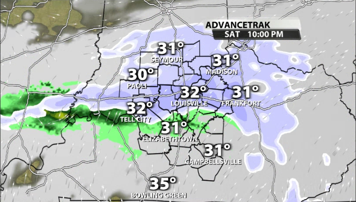
Light snow showers start approaching our western communities around 3PM-5PM.
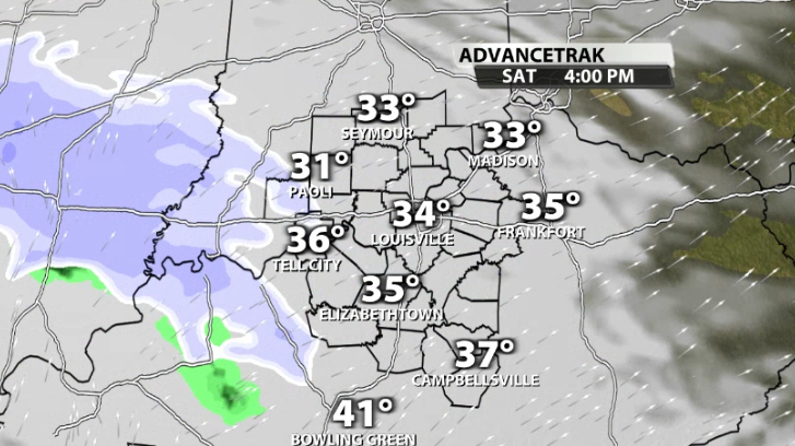
They start rolling into Louisville around 4PM - 7PM. Accumulations will not start immediately due to the dry air that will briefly dominate as previously mentioned.
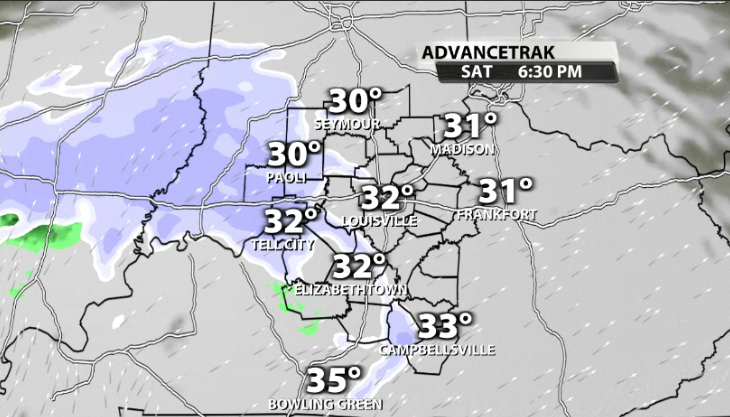
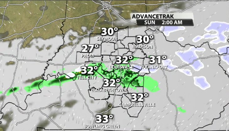
Accumulations should start in Louisville around 8PM - 10PM. Since this storm system is what we call a "clipper", it doesn't last very long across our area. Most data has snow showers pushes through late tonight and out of our area (for the most part) by around 3AM - 4AM.
Of course what everyone wants to know is how much snow are we talking about? As we did in the blog on Friday, first let me show you what different models are showing for potential totals around our area.
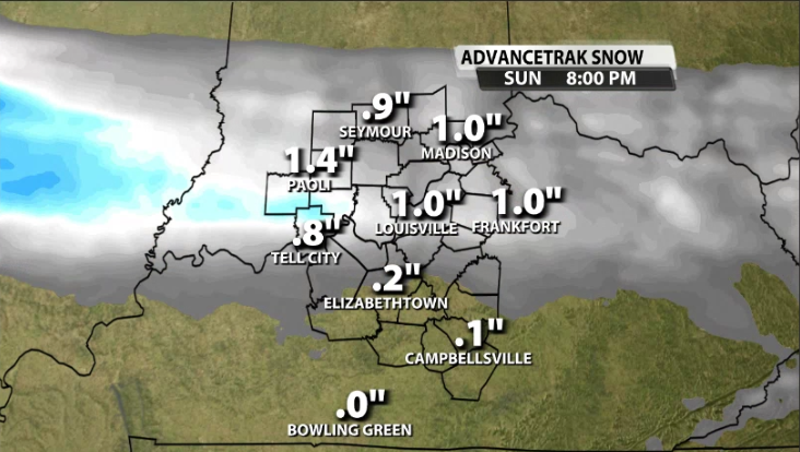
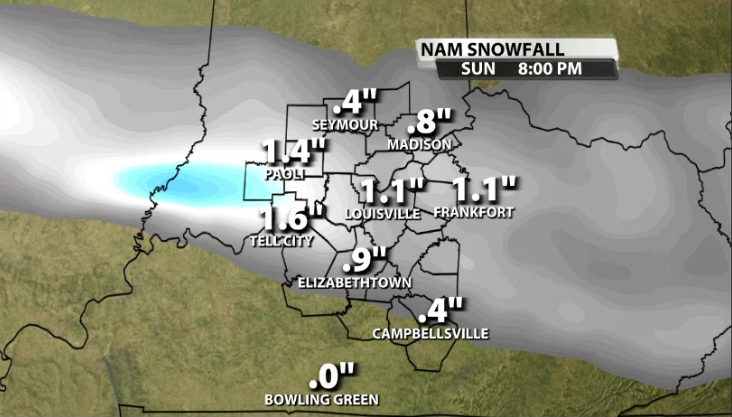
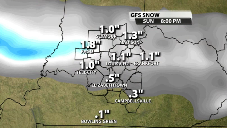
What you'll notice is that most data has a sliver of higher potential snow totals along the river and north/south by around two counties. Where this heavier snow band ends up tonight will dictate who gets the most. So, let's look at what we have for tonight.
The white shading in the image below represents where 0"-1" of snow could fall. This includes areas like Seymour, North Vernon, Madison, etc. You'll notice the dark blue shading that rolls through areas like Louisville, Corydon, Leavenworth, Shelbyville, and Sellersburg. This represents where 1-2" of snow are most likely. In that blue shading there could be isolated spots up to 3".
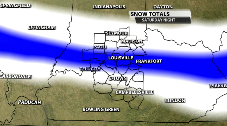
It's important to remind yourself to not just focus on the higher number where you are located but focus more on the range that is possible. We will continue to watch for snow totals trends heading into this evening and will have new totals on WDRB News at 10pm.


