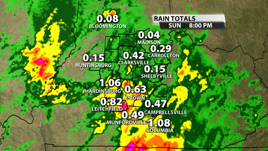


Everybody got some rain today, but some got a whole lot more than others. The highest rainfall totals were south of I-64 in Kentucky. Hardinsburg got over an inch of rain while the eastern half of Grayson County picked up 2-3" around lunchtime.

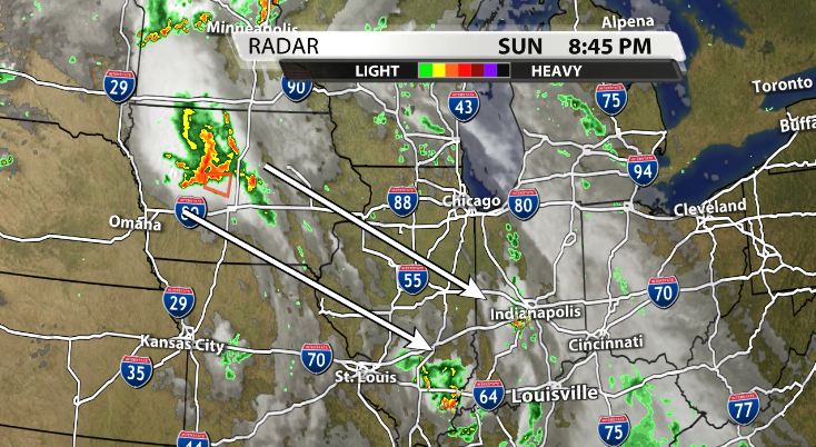
We still have a 30-50% chance for scattered showers and storms over the next couple of hours, but rain chances will subside tonight before picking back up tomorrow. Our next round of storms may come from a group of storms that formed in Iowa earlier this evening. Timing isn't perfect, but it *could* arrive in our area before noon *if* it makes it this far. There is uncertainty here, but models have been consistent with showing a batch of storms forming in Iowa and attempting to crawl down to the Ohio River as a dissipating MCS. Southern Indiana is the most likely place for this possible MCS to end up falling apart. There could still be heavy rain and very gusty winds within this storm complex if it holds together this far south.
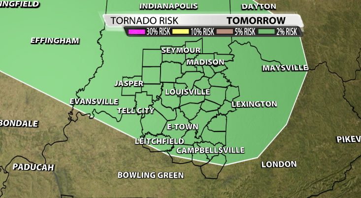
Another MCS may form over Central Illinois and Central Indiana later in the day Monday. This may bring even more widespread heavy rain and the possibility of additional severe weather. Considering this storm complex hasn't formed yet, there is a whole lot more uncertainty about its timing of arrival and potential impacts for Kentuckiana; however, the Storm Prediction Center has placed us under a Marginal Risk (level 1 of 5) for damaging winds and tornadoes as seen below.
With multiple rounds of storms bringing heavy rain to our area on top of what we have already seen today, there is another Slight Risk (level 2 of 4) for flooding across much of Kentuckiana. Make sure to tune in to WDRB for the latest updates on flooding and severe weather threats tomorrow morning and throughout the day.


