

Whew! What a morning around our area. A couple tornado warnings for our Northwestern communities, wind and hail damage, and more heavy rain! We aren't done just yet! More storms are set to arrive as we head through the afternoon, so let's dive into what to expect.
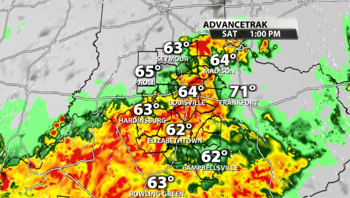
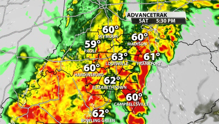
While mid morning is dry across most of our area, it doesn't last long. More storms are already on their way out of the south. They should start to arrive in our southern communities around 11AM-1PM, and reach Louisville by 12PM-1PM.
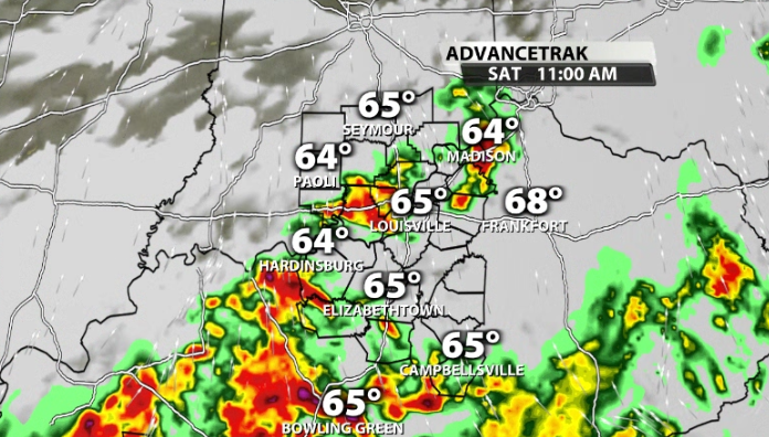
Some of these storms could still pack a punch and even be severe in some cases. You'll notice that we still have some instability in our area for these storms, but not a ton. It should be just enough to provide enough juice for a few strong storms to develop.
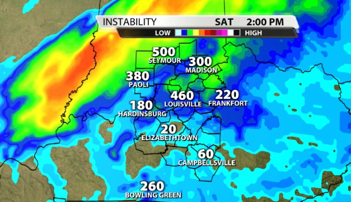
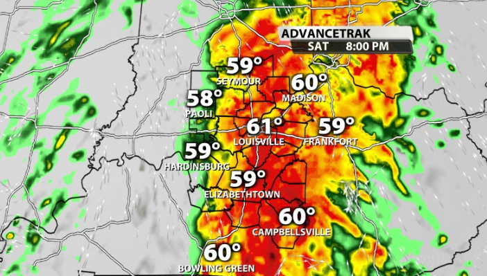
As rain turns widespread, it will cool the atmosphere and almost act as a shield that keeps most severe weather to the southern portion of our area.
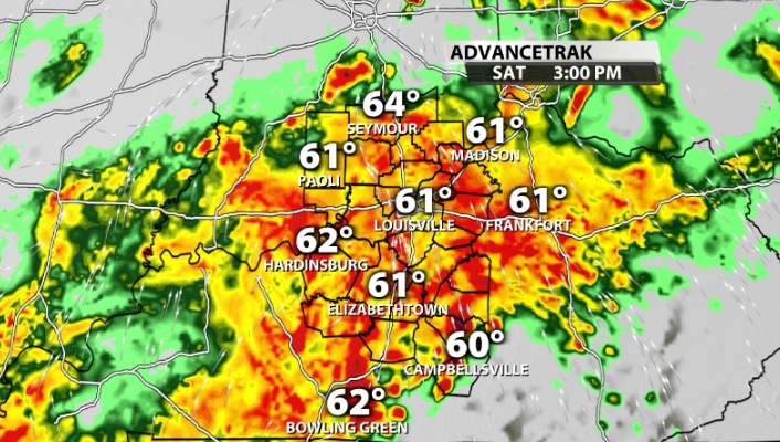
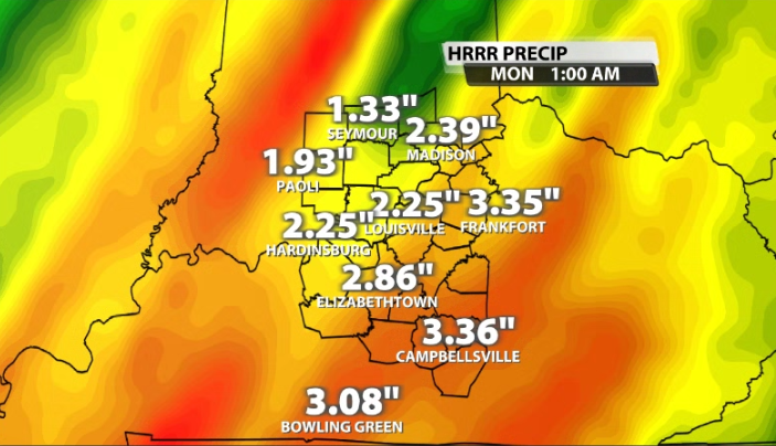
Rain and storms will remain widespread through our area through the entire afternoon and into tonight as well. A lot of this rain will probably be pretty heavy, and could drop an additional 2-3" of rain on top of what we saw this morning.
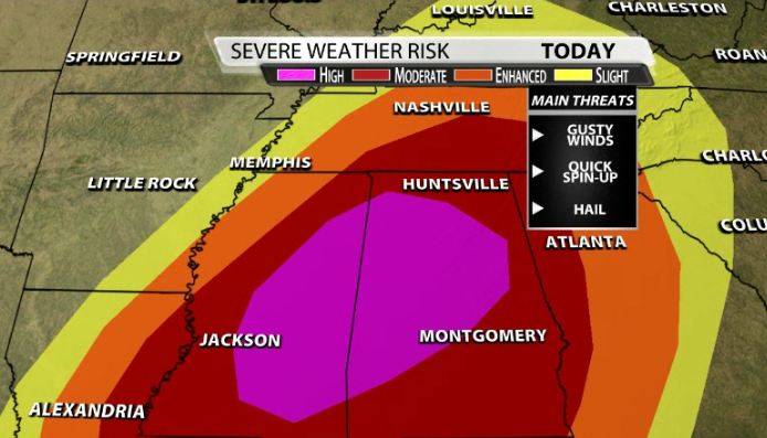
The SPC currently has a "Slight" (2/5) risk for severe storms for most of our area this afternoon and evening. The main threats would be strong, damaging wind gusts, followed by hail, and the low, but non-zero threat for spin-up tornadoes.
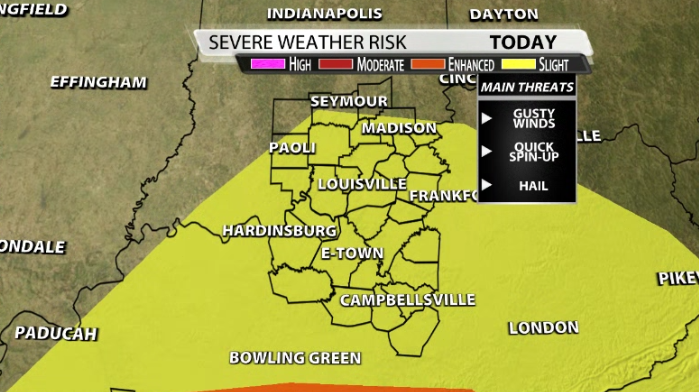
Luckily, we are avoiding the real tornado outbreak today that looks imminent for the Deep South. They are included in a rare high (5/5) risk for severe weather today.


