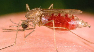

From the U.S. Department of Defense to Ministries of Health in sub-Saharan Africa, communities around the world are relying on NASA research and satellite data to better face the threat of mosquitoes and the diseases they can carry. NASA’s fleet of Earth-observing satellites provides a unique vantage point on the habitats that mosquitoes prefer – and where the geographic expansion of these mosquito habitats may increase the risk of disease exposure.

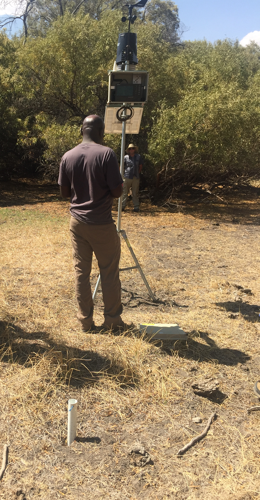
Assaf Anyamba taking GPS coordinates of a weather station installed in a dry dambo, a common mosquito habitat, at the Quaggafontein study site in Free State Province, South Africa in 2016. Credits: NASA/Assaf Anyamba
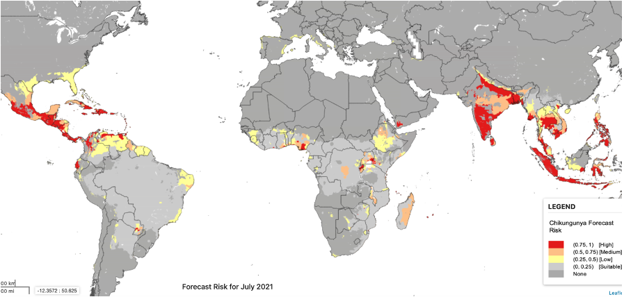
That is why the NASA team designed CHIKRisk App to be a publicly accessible mapping platform to monitor the chikungunya virus’ spread and provide climate-based risk maps for its occurrence up to three months in advance. CHIKRisk incorporates Earth observations like land surface temperature derived from the MODIS instrument on board NASA’s Terra satellite, humidity and soil moisture data from NASA’s Global Land Data Assimilation System (LDAS), and human population density data from NASA’s Socioeconomic Data and Applications Center and mosquito vector data from Walter Reed Biosystematics Unit (WRBU).
Understanding where the risk is greatest is crucial to reducing exposure and protecting public health. That is why the Department of Defense’s Global Emerging Infections Surveillance Section - Armed Forces Health Surveillance Branch, the World Health Organization, and the Pan American Health Organization now use a NASA-supported app called CHIKRisk to protect their own personnel, inform travel recommendations, and issue alerts related to the chikungunya virus.
Making Moves Against Malaria
But CHIKRisk is not the only example of Applied Sciences work to tracks mosquitoes – and the diseases they carry – from space. John Beck, a research scientist with the University of Alabama in Huntsville, is leading a Health and Air Quality team collaborating with the Centers for Disease Control and Prevention (CDC) to enhance malaria control decision-making in sub-Saharan Africa with NASA Earth observations.
Malaria is a fever-inducing illness caused by the Plasmodium parasite, transmitted by Anopheles mosquitoes. According to the World Health Organization, there were 229 million malaria cases and 409,000 deaths in 2019. To address global challenges like malaria, more than 60 countries, the CDC, and the European Union rely on a health management information system called District Health Information Software 2 (DHIS2) to provide vital health data and support disease-control decision-making. Once COVID international travel restrictions are lifted, Beck’s team is looking forward to working with local stakeholders, such as possibly the Ministry of Health officials from Sierra Leone, Uganda and Burkina Faso, to incorporate vital information into the platform on environmental factors that can affect the spread of malaria.
Satellite data, like local temperature and vegetation conditions from the Moderate Resolution Imaging Spectroradiometer (MODIS) instrument on board NASA’s Terra and Aqua satellites, can offer decision-makers a better picture of where infected mosquitoes might be spreading the disease. Beck’s team is currently working with project partners to test how this more accurate risk assessment can help inform prevention strategies, with plans for the results to be fully operational by the end of 2022.
Collaborating Across Geographies
When so many scientists are focused on different projects, sometimes it makes sense to join forces. In fact, researchers from several different Health and Air Quality projects worked together to produce a paper in the Trends in Parasitology journal, titled Satellite Observations and Malaria: New Opportunities for Research and Applications.
NASA researchers Tatiana Loboda, Mike Wimberly, and William Pan each lead projects devoted to improving the understanding of mosquito-borne diseases, but with different geographic focuses. Pan’s team, for example, used multiple layers of data from LDAS to develop a Malaria Early Warning System for Peru capable of forecasting malaria outbreaks up to 12 weeks in advance. Wimberly’s team developed the Arbovirus Monitoring and Prediction (ArboMAP) system for real-time prediction of human West Nile virus cases in South Dakota, relying on weather and mosquito data provided by NASA satellites and mosquito control districts. Loboda's group focused on mosquitoes in Myanmar and are preparing to deploy the Myanmar Malaria Early Warning System they developed, which includes data from the joint NASA and U.S. Geological Survey Landsat satellite mission.
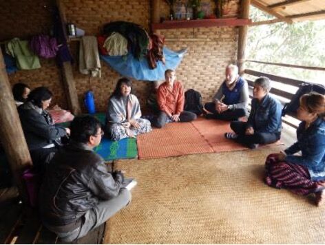
Loboda (fourth from the right) at a meeting with local malaria officers and volunteers, trained in administering malaria testing and treatment. Credits: Tatiana Loboda
All three researchers contributed to this March 2021 publication, highlighting that detailed Earth observations from NASA satellites can provide decision-makers with precise, localized mapping of mosquito habitats to support global efforts toward malaria control, elimination, and eradication. High-resolution land use and land cover maps can even shed light on human activities, like agriculture and deforestation, that affect mosquito habitats and exposure to mosquito bites.


