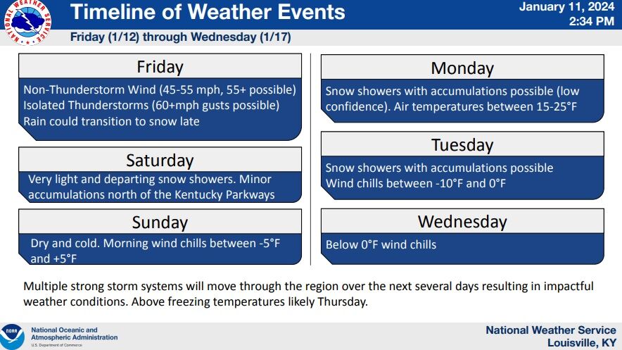
We just wrapped up a call with the National Weather Service Louisville and other partners about the active weather pattern shaping up for the next five days. Below is the presentation they put together and what we talked about:
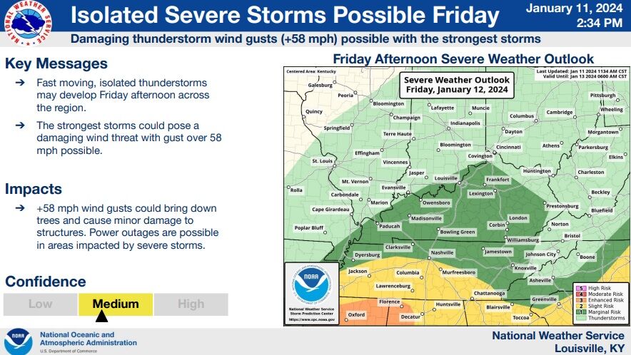
"It's gonna be windy tomorrow (Friday). If it's not windy tomorrow, call me. I'll buy you lunch." This was a light-hearted comment from John Gordon, the NWS employee leading the briefing that accurately depicts much of what we talked about. The wind is the main concern in the short term.
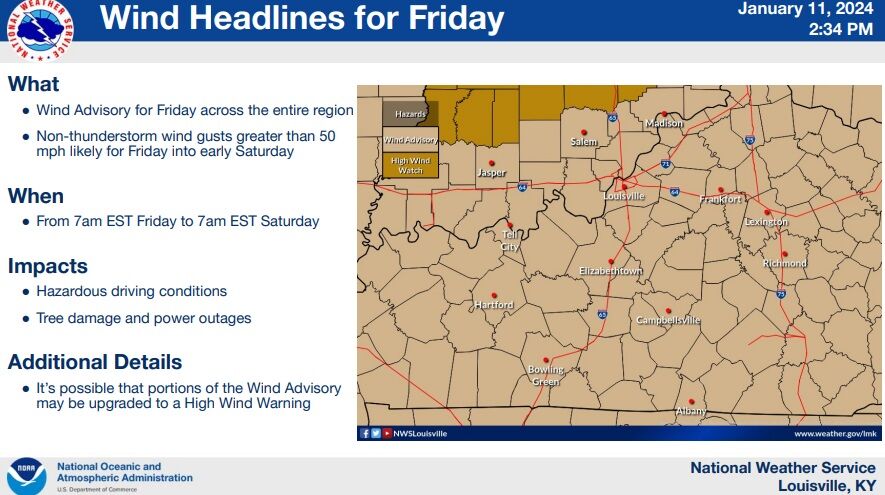
All of our area is under a Wind Advisory and there's been a lot of discussion about if a High Wind Watch/Warning is needed, especially after Indianapolis issued a High Wind Watch just north of here.
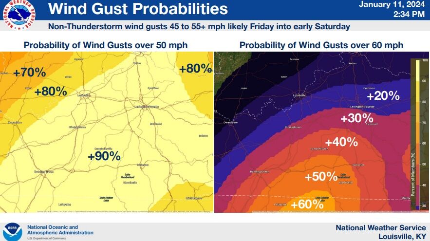
IF NWS Louisville issued a High Wind Warning Friday, they expect it would be most likely for our far southern communities. The Storm Prediction Center has also shifted a Slight Risk farther north to account for stronger wind gusts in storms that are most likely in our southern communities.
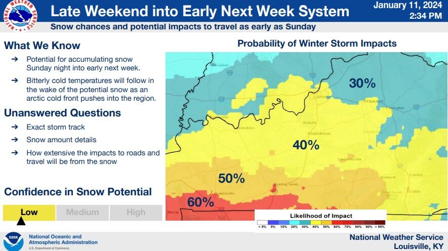
There are many more questions about snow potential early next week. We didn't spend a lot of time on this because the snow is less certain than the strong wind followed by the dangerous cold.
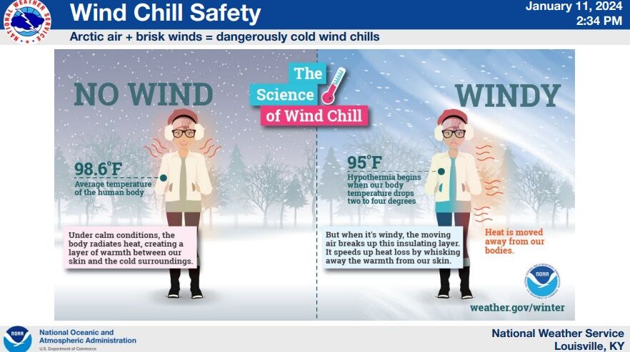
"The cold is coming" - there is zero chance it misses us. You can see below how cold the National Weather Service expects the air to feel next week.
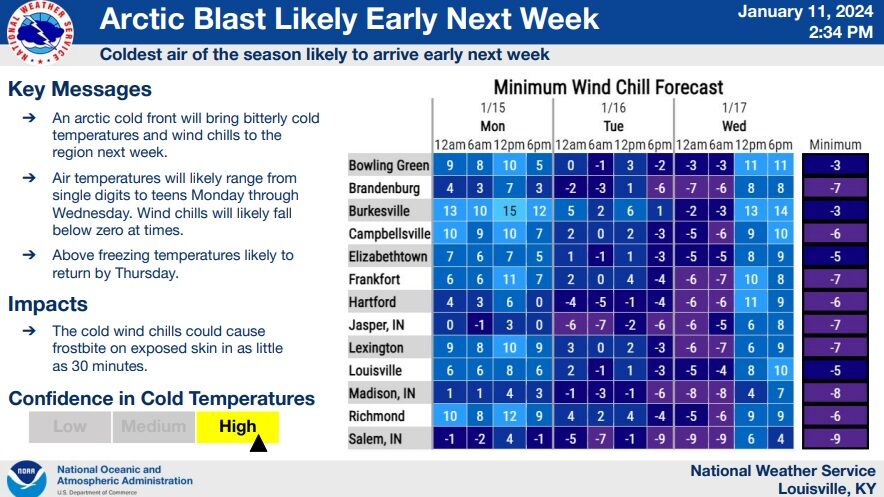
Power outages may be possible with the strong wind gusts Friday then the cold moving in. Any lingering outages during this stretch of cold would quickly become an issue. Once we drop below freezing Saturday night, we won't see temperatures above freezing until Thursday afternoon.
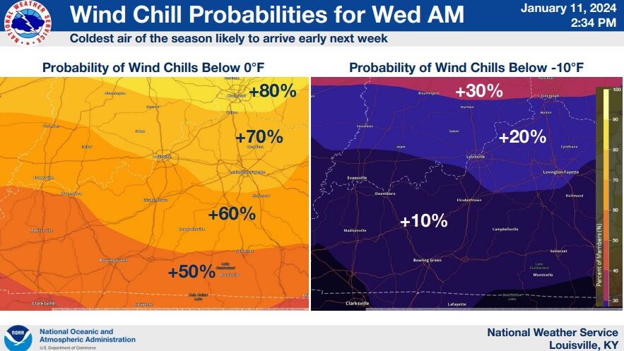
The briefing wrapped up with a quick discussion about how dangerous this cold will be. Frostbite will set in on exposed skin in as little as 30 minutes with this level of cold and wind.
Tune into WDRB News tonight to hear from Chief Meteorologist Marc Weinberg and Meteorologist Rick DeLuca. They will share their thoughts on each of these factors plus discuss snow potential for early next week.


