
In September 2024, Hurricane Helene made landfall in the United States, unleashing extreme winds, deadly storm surge and numerous tornadoes. The cyclone, alongside a predecessor rainfall event (PRE), devastated portions of the southeastern United States and southern Appalachia with catastrophic flooding that caused significant loss of life and widespread destruction. With more than 200 fatalities, Helene became the deadliest tropical cyclone to hit the contiguous United States since Katrina in 2005. An estimate of $78.7 billion in damages places Helene as the seventh-costliest U.S. tropical cyclone, with records dating back to 1980.

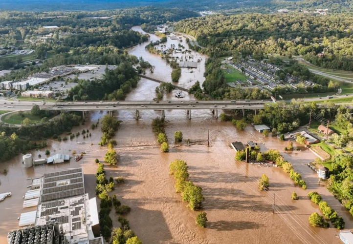
Source: NOAA French Broad River in Asheville, North Carolina.
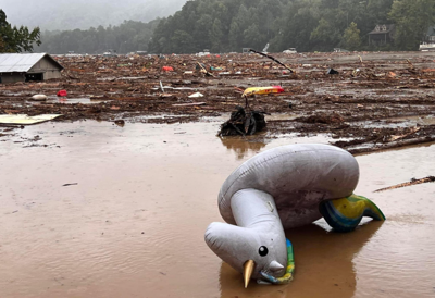
Many cities in southern Appalachia, including Asheville, N.C., were affected by both the PRE and Helene’s main circulation for weeks and months after the rain and winds ceased; many communities are still recovering a year later. Impacts included power and cellular outages, historic flooding and landslides, and a lack of water infrastructure for nearly two months. The Asheville-based headquarters of NOAA’s National Centers for Environmental Information (NCEI) was also severely impacted, but recovered services quickly thanks to efficient teamwork across its partner locations . This type of event is not uncommon to the area. In 2021, remnants from another tropical cyclone (Fred) brought localized flooding to Cruso, N.C., killing six people. Tropical cyclone remnants during the 2004 hurricane season (Ivan, Frances, Jeanne) and the 1916 hurricane season (two unnamed systems) also brought significant rainfall and flooding to the area.
The effects of Helene remind us of the power and danger of these systems and emphasize the importance of preparedness and resilience in facing such extreme weather events.
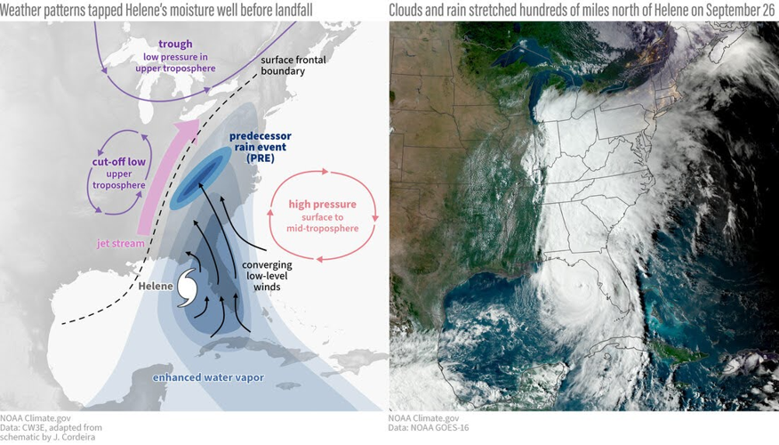
Predecessor Rainfall Event

Source: NOAA Climate.gov and the Center for Western Weather and Water Extremes (CW3E).
A heavy rainfall event occurred over the Southern Appalachians well in advance of Helene on September 25th–26th, 2024. This event was characterized as a " predecessor rainfall event " (PRE), where conditions in the upper atmosphere funnel enhanced water vapor from the Gulf waters towards the Southeast U.S. The forecast from the Weather Prediction Center (WPC) first indicated that heavy rainfall could occur over portions of the Southeast U.S. and southern Appalachians about three days in advance, when a Slight Risk was issued in their Excessive Rainfall Outlook (ERO). It was eventually upgraded to a rare High Risk during the event to highlight the extreme nature of the expected rainfall. The interaction of this moisture coinciding with the terrain of the Blue Ridge Mountains resulted in nearly six to eight inches of rainfall before Helene arrived in the area. This amount alone is well above normal for the month of September, and led to the ground becoming saturated before Helene’s arrival.


