

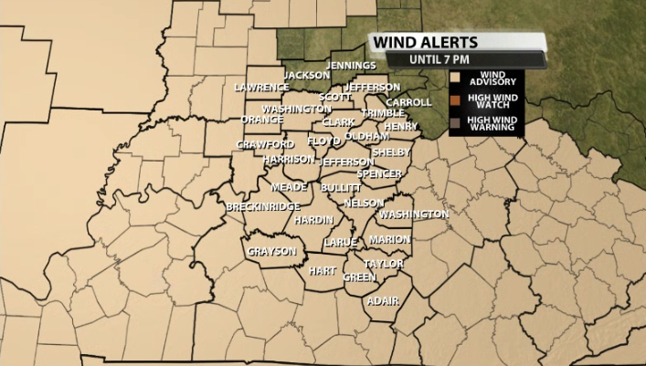
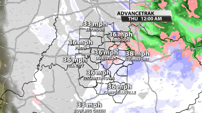
Temperatures are now crashing through the rest of the day in our area now that the cold front has rolled its way on through. In fact, temperatures will drop fast enough to where the rain that we see out there right now will likely transition over to snow showers by this evening. We are still under a Wind Advisory until 7PM this evening.
We should remain in a mostly all rain scenario through most of the afternoon. Temperatures continue to crash, but they have a long way to go to get to the freezing mark to see the transition to snowflakes.
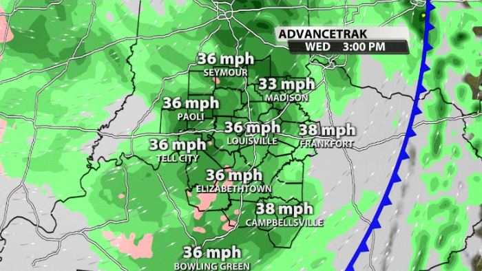
We should start to see that transition take place around the 4pm-6pm timeframe across our area.
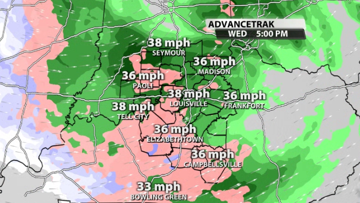
The later we go into the evening and after sunset, the more snow showers will be in our area. It's important to keep in mind that there will probably be a few heavier snow bursts will be scattered around our area as well with reduced visibilities at times. If snow comes down a little heavier, wind gusts will still be ranging around 30-40mph.
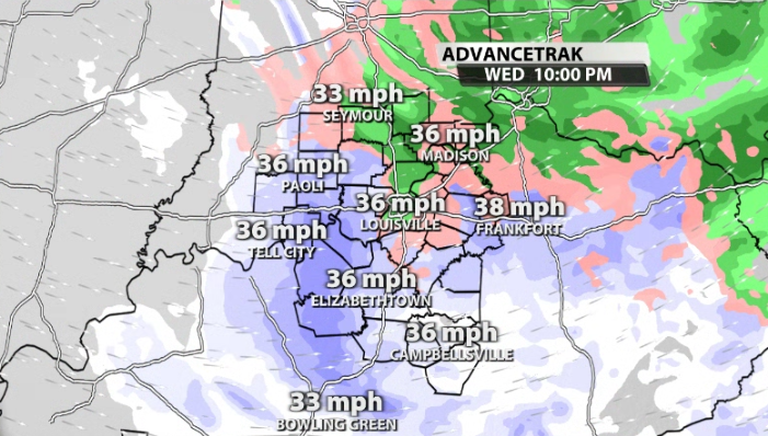
What is going to help us is the fact that we have been pretty warm recently, so most of what falls will melt on contact with the ground. However, if we get some intensity in the heavier snow bursts that could be out there, we could see upwards of a trace to a few tenths of an inch on elevated surfaces and grassy areas.


