

Morning showers and storms may have woken some of you up this morning, but rest assured if you didn't get enough rain for your liking over the last day and a half we've got plenty more on the way.
This afternoon and evening will bring in more chances for storms around our area, a few of which could end up being on the stronger side.
Hi-resolution data has been pretty abysmal handling these situations recently, so exact placement of storms should be taken with some grain of salt, but here is what we know.
With a lot of our Kentucky counties remaining mostly dry, although cloudy, for a good chunk of the mid-morning through early afternoon, that allows temperatures to warm and for more storm energy to develop in those areas. As storms reenter our area today, they will try and use that to be stronger than storms in Indiana.

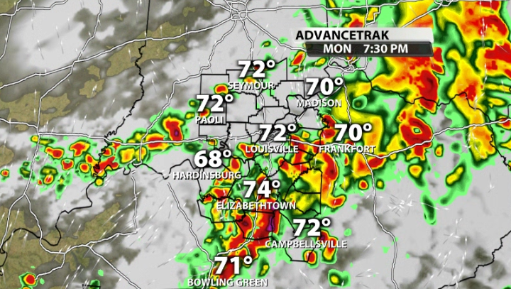
You'll see heading into the late afternoon/evening timeframe, data is showing waves of scattered storms rolling into our area, some of them packing a punch.


Notice how many of them are along and west of I-65, and once again, in our Kentucky counties. This would be the most likely area to see strong storms if we were to see some later today.
The Storm Prediction Center currently has a Slight (2/5) risk for severe storms in that exact area. The main impact with any strong storm would be damaging wind gusts.

Again, data has not been great with this set-up, so we will be watching as storms pop up and try to thrive for some of us later this afternoon and evening, but this is not anywhere close to a high end severe event.


