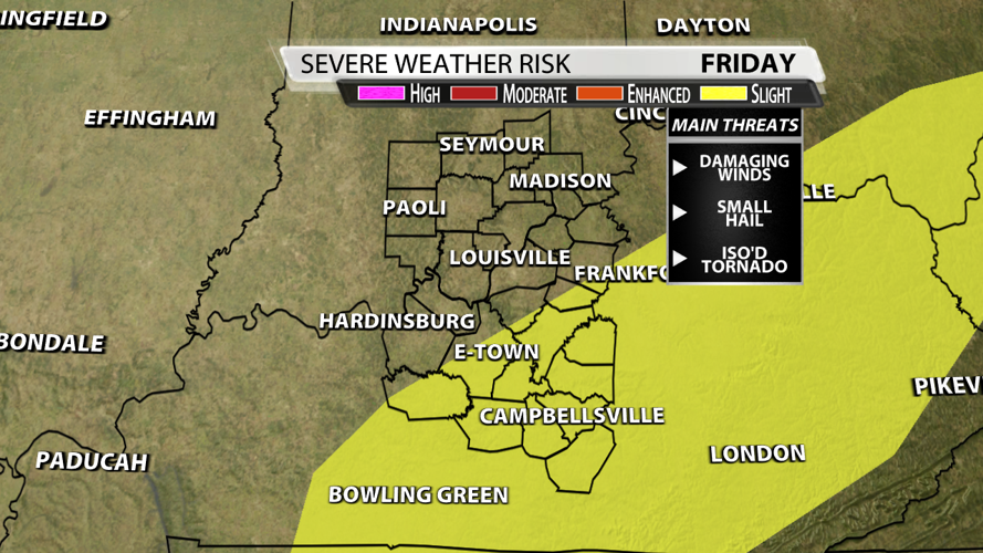


It's been a while since we've had to talk about severe weather. Clerarly, the pattern has changed and the Storm Prediction Center placed locations southeast of Louisville under their "slight risk" for severe weather on Friday. That includes Elizabethtown, Leitchfield, Munfordville, Bardstown, Lebanon, Springfield, Campbellsville and Greensburg in Kentucky. Remember, "slight risk" means scattered severe storms are likely, but they would be short-lived and/or not widespread.

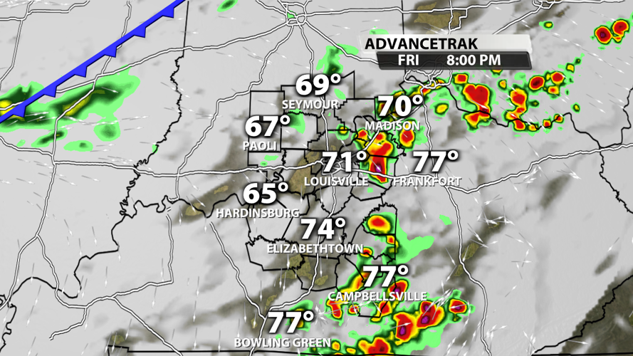
Let me be clear, the window for strong to severe storms is narrow. From 6 - 9 pm you should be aware of the potential in Louisville. Those of you along and south of the Western Kentucky and Bluegrass Parkway it may take until 11 or so until the threat dimishes. Check out the future radar images below to get an idea of what time storms strike during the late afternoon, evening, overnight and into Saturday...


Damaging winds are the main threat by far. Winds do get stronger as you go up in the atmosphere, but not in the lower levels which means it will be more of a challenge to transport that energy down to the surface. If you get a warning it could be for gusts around 60 mph. Small hail can't be ruled out either, but nothing big enough to do damage. The probability of damaging thunderstorm winds or wind gusts of 58 mph or higher within 25 miles of a point is 5% in Louisville and 15% to the southeast.

There isn't much directional shear, so the tornado threat isn't zero but very low. That explains why the probability of a tornado within 25 miles of a point is only 2%. The bottom line, this is a low-end threat, yet one that still needs to be watched carefully southeast of Louisville. Please stay with the WDRB Weather Team for updates!


