
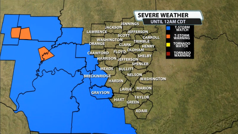
A new Severe Thunderstorm Watch has been issued for part of our area for tonight. Only a couple counties are included for now ahead of storms developing to our West. Here's who's included:
Meteorologist Bryce Jones will be doing a LIVE stream on Facebook and Youtube discussing tonight's threat at 7:15pm and will be live on air starting at 10PM on WDRB News.
Here's more specifics on the watch from the NWS and the SPC:
* Primary threats include...
Scattered damaging wind gusts to 70 mph likely
Isolated very large hail events to 2 inches in diameter possible
A tornado or two possible
SUMMARY...Widely scattered thunderstorms are forecast to continue to
develop and intensify through the early and mid evening. A couple
of the stronger storms will probably acquire supercell structure and
pose a risk for large hail, damaging gusts, and perhaps a tornado
through the early evening. As additional storms develop and outflow
becomes more prevalent, strong to severe gusts (55 to 70 mph)
capable of wind damage will become the primary severe hazard towards
the mid to late evening.