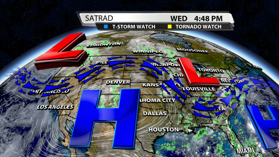

The summer heat is back with a few 90s across the area today. Shower activity will be on the low side through the weekend and as we head into next week, but temperatures will be on the rise.

A ridge of high pressure currently sitting over the Desert Southwest and Southern Plains will slowly spread eastward and work in tandem with the ridge currently situated over the Atlantic Basin. As long as these ridges are in play, you can expect rain chances to stay low and temperatures to hover around our average of 90°.

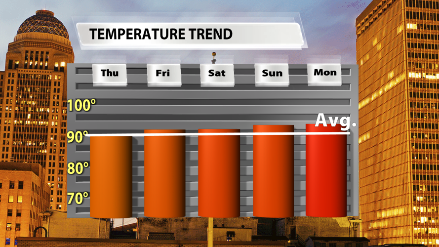
Fortunately, it doesn't appear that our temperatures will go sky high. Yes, it will be toasty. But we've had hotter days before, and we've definitely had higher "feels-like" temperatures. Each day will either be the basically the same as (or just a degree or two warmer than) the previous one.

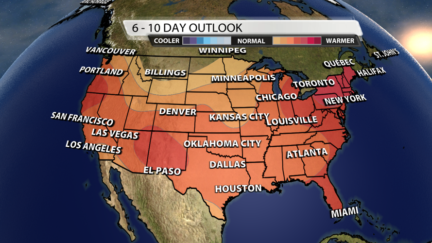
And how long do we expect these ridges to be in play? At this point, it looks like it will be for the long-haul. The Climate Prediction Center is forecasting much of the lower 48 area to have higher than average temperatures in the 6-10 day outlook. Our region is in the 50-70% chance for above average temperatures in that 6-10 day outlook.


