

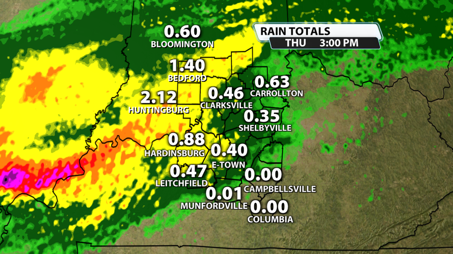


The rain started off fairly heavy across the region this morning, particularly in southern Indiana. Since midnight alone, there was a large swatch of 1" - 2.5" of rain in Lawrence, Jackson, Jennings, Orange, and Washington counties in Indiana. But some places, like south central Kentucky, didn't record hardly any rain at all. In total, some places in southern Indiana have seen roughly 4" of rain during the first 5 days of March.

While the flood watches have been allowed to expire this afternoon, the flood warnings along the East Fork of the White River and the Muscatatuck River will continue for now. The White River crested above 19' near Seymour today. This puts it in Major Flood Stage. It will stay in Major Flood Stage until Friday afternoon. The Muscatatuck River peaked at almost 19' today, but it will be dropping out of Minor Flood Stage tonight.

The heavy rain has also led to roads being washed out in southern Indiana. A portion of County Road 1100 in Jennings County has been completely washed away.

Also in Jennings County, the Bertram family sent a picture of a road covered with water preventing them from leaving North Vernon.

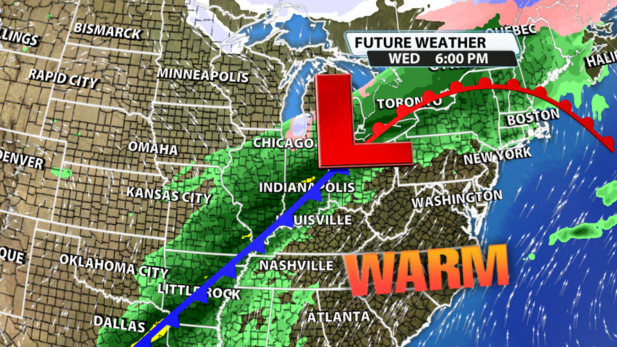
Friday will be much drier with some showers in the morning. Besides a pop up shower or storm in the afternoon, temperatures will be the big story! Highs could top out in the low 80s. Louisville record high for the date of March 6th of 78 degrees was set back in 2023, and it could be broken tomorrow. Saturday brings back a chance for widespread showers and storms as a cold front slides through the region. Our rain chances are highest between 9 AM and 3 PM. Some of these storms could be strong to severe with 60 mph gusts being the main threat. Hail won't be ruled out.

After a break behind Saturday's cold front, more showers and storms are likely next week, particularly in the middle of the week.

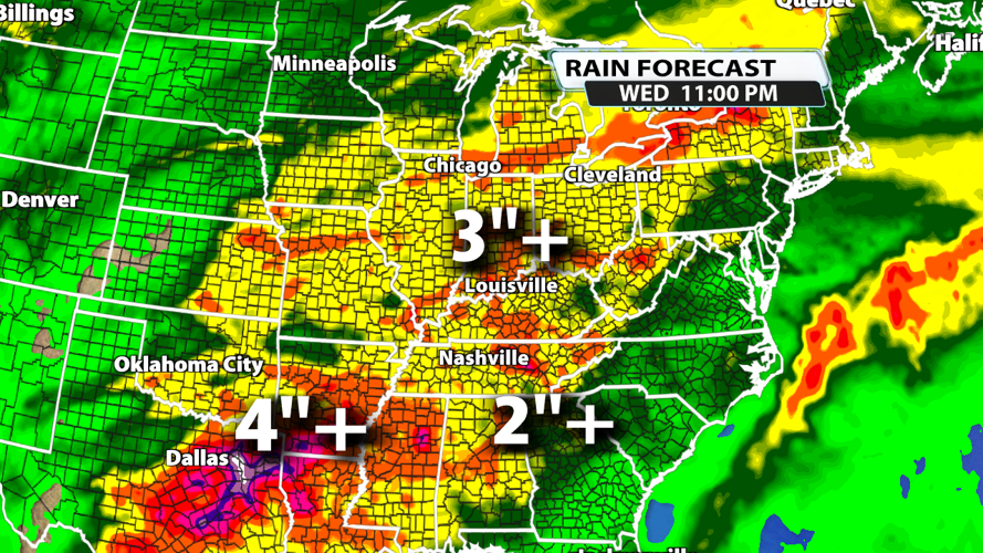
Once all is said and done through Wednesday night, rainfall totals could exceed 3 inches in the Ohio River Valley. This could lead to more flooding issues and washed out roads, so be vigilant in the days to come.


