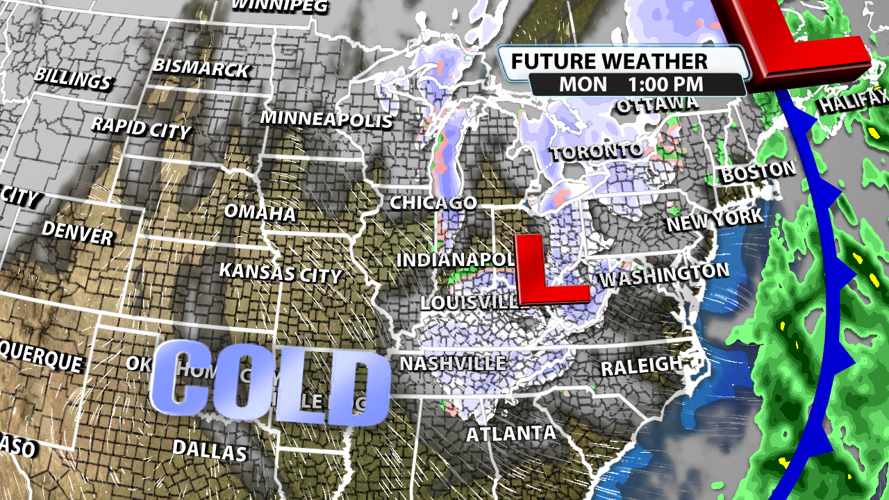
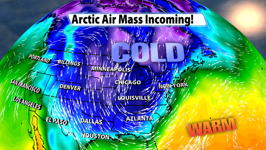

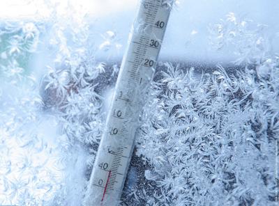
Two areas of low pressure will be working in tandem this weekend and early next week to bring us some very unseasonably cold air. The low pressure system coming off the Rockies will bring us the moisture responsible for rain our rain and snow while the low pressure system directly to our north in Canada will bring us the frigid air.

Saturday will be dry, but showers move in Saturday late in the evening and overnight. Hit-or-miss sprinkles and light showers will hang around on Sunday, but this will transition to snow Sunday night. Flurries will continue to fly on Monday, but nothing more than a dusting or coating is expected at this time.

And it's not just us getting this round of cold air! Basically the entire eastern half of the country will be unseasonably cold for part of this weekend and the start of next week.

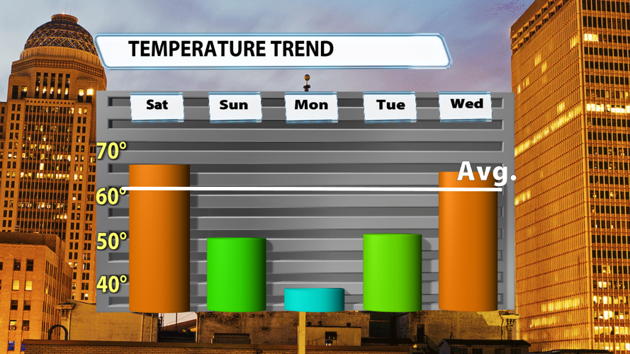
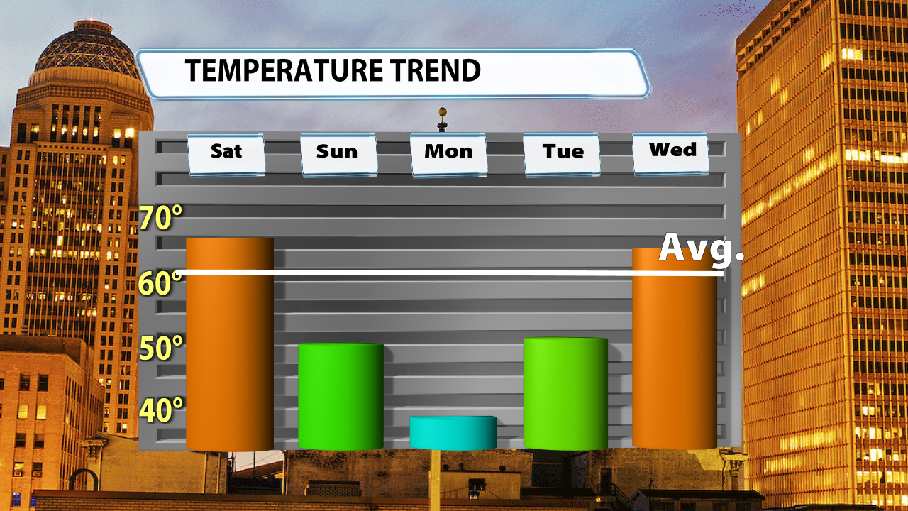
But you won't have to wait long for a change. While Monday's high temperatures will be roughly 20-25 degrees colder than normal, Tuesday gets us back to roughly 50 degrees and Wednesday already has us back at or above average. What a change a couple of days can make around here!


