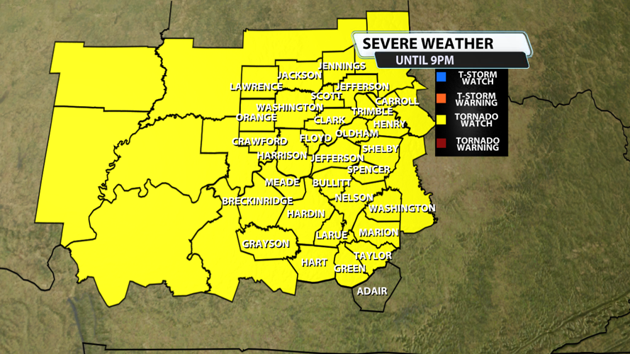


The NWS Storm Prediction Center has issued a
* Tornado Watch for portions of
Southeast Illinois
Southern Indiana
Western and Central Kentucky
* Effective this Thursday afternoon and evening from 115 PM until
900 PM EST.
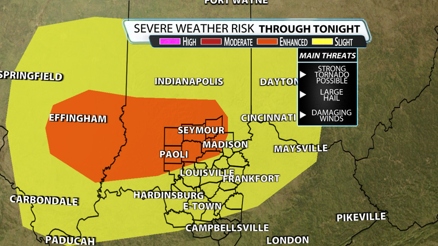
* Primary threats include...
A few tornadoes and a couple intense tornadoes possible
Scattered large hail and isolated very large hail events to 2
inches in diameter possible
Scattered damaging wind gusts to 70 mph possible
SUMMARY...Thunderstorm development is anticipated this afternoon
from southeast Illinois into southern Indiana and western/central
Kentucky. In these areas, increasing low-level moisture will lead to
airmass destabilization. Strong vertical shear is in place,
supporting the potential for some of these storms to organize into
supercells. All severe hazards are possible with any supercells that
develop, including very large hail greater than 2" in diameter and
tornadoes. Low-level shear is strong enough to support the potential
for a strong (EF2+) tornado.
The tornado watch area is approximately along and 75 statute miles
north and south of a line from 50 miles west of Evansville IN to 50
miles east northeast of Louisville KY. For a complete depiction of
the watch see the associated watch outline update (WOUS64 KWNS
WOU0).
PRECAUTIONARY/PREPAREDNESS ACTIONS...
REMEMBER...A Tornado Watch means conditions are favorable for
tornadoes and severe thunderstorms in and close to the watch
area. Persons in these areas should be on the lookout for
threatening weather conditions and listen for later statements
and possible warnings.
&&
AVIATION...Tornadoes and a few severe thunderstorms with hail
surface and aloft to 2 inches. Extreme turbulence and surface wind
gusts to 60 knots. A few cumulonimbi with maximum tops to 500. Mean
storm motion vector 24035.


