
It is hurricane season and even though the season and even though it has been off to a slow start, it is just starting to ramp up. This is typically the time of year we really start to see cyclones become more numerous. You can read more about that in this blog here.
Well, now we have Tropical Storm Erin out in the eastern Atlantic Ocean. Erin is the 5th named storm so far this year, but this one could end up being the first major storm of the year.
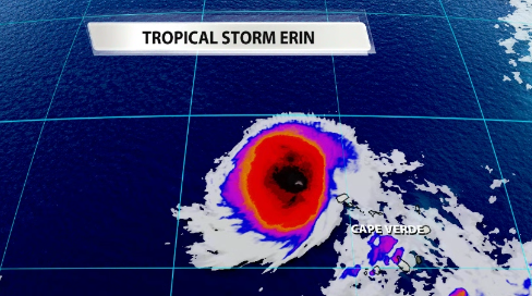
Erin formed into a tropical storm this morning off the coast of Africa. It unfortunately caused a number of casualties just as an invest on Cape Verde as it passed over off the coast of Africa. Now that it is over open water, it will continue to strengthen slowly until it moves over warmer water as it gets closer to the Lesser Antilles.
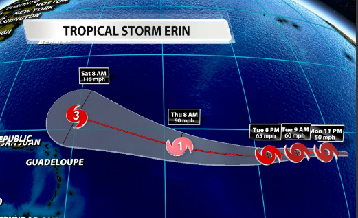
The National Hurricane Center released its first advisory on Erin late this morning. They are already projecting Erin to become a major category 3 hurricane by Saturday morning.
"Erin" name history
Erin is projected to become a hurricane by Wednesday evening. If it were to become a hurricane, this would be the first time since 2001 that the name "Erin" would be associated with a hurricane. In fact, the last time we had a "hurricane Erin" was on the same day as an important and tragic historical event, September 11th, 2001.
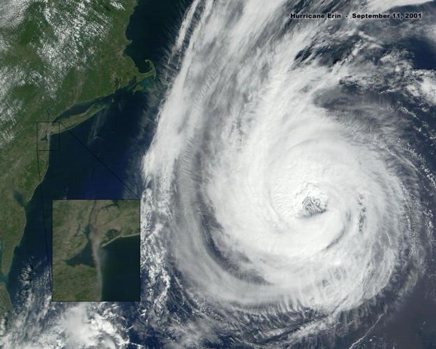
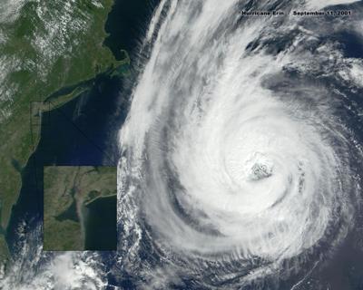
At the time of the World Trade Center attacks, "hurricane Erin" was off the east coast. In fact, you can see from satellite imagery, smoke from the World Trade Center with Erin off the coast of the US.

Image: NASA
Hurricane Erin was a Cat 2 hurricane on September 11th, 2001. We have had 3 other tropical cyclones with the name Erin, but all of which never got above tropical storm strength post 2001. Those would be Tropical Storm Erin in 2007, 2013, & 2019.


