The weather the last two days has been very similar - cloudy, flurries for some, and cold for all. What happened to cause two such similar weather days in a row is fascinating.
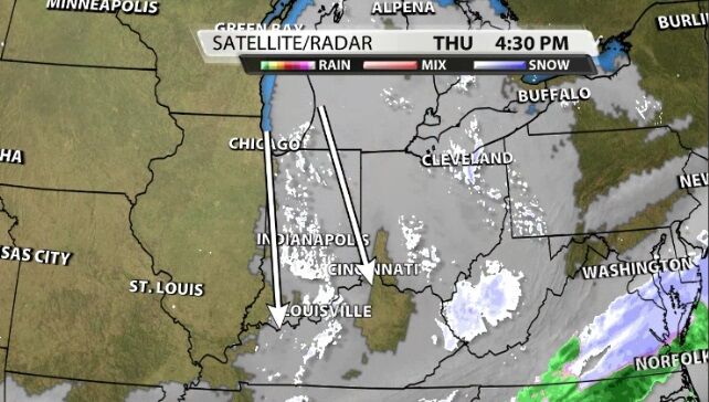
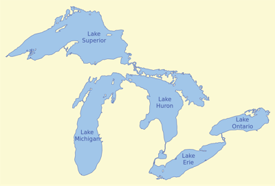
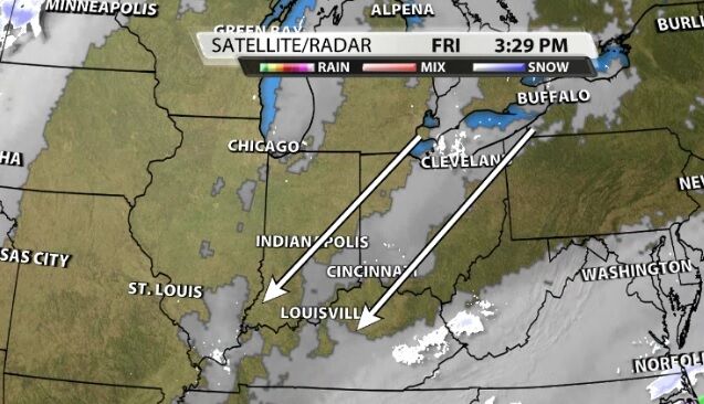
We experienced lake enhanced snow and clouds Thursday from Lake Michigan and Friday from Lake Erie. In the image above you can see the route the moisture takes off Lake Michigan to get to us down here in Kentuckiana, and the image below shows the same thing happening from Lake Erie Friday. The wind direction has to support this, and it does! Our wind was moving in from the northwest on Thursday and shifted to the northeast by Friday. So it's safe to call this lake enhanced snow and clouds. While we have seen lake enhanced snow and clouds in our area before, it's pretty unusual to get it from one lake one day and a different lake the next day. That's not something we remember having seen here before in the WDRB Weather Center.
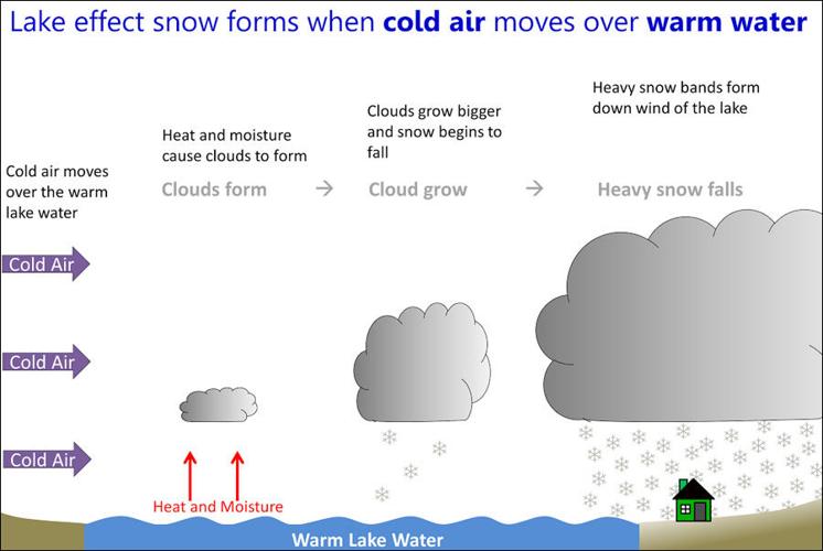
Why are we calling it lake "enhanced" instead of lake "effect"? First, let's look at how lake effect snow happens. The lake water needs to be warmer than the air blowing over it. The warmer, moist air rises into the cooler air above it causing the warm air to condense into clouds. Since the lake provides so much moisture to that system, this type of setup can produce heavy snow closer to the lake.

Image via NWS
So why is ours called "enhanced" and how does that get all the way down here? We call what we saw in our area Thursday and Friday "lake enhanced" because the lake didn't create our weather, but it added to it. A "lake effect" snow event would not have happened without the lake. We still would have seen clouds in our area without the lake, but the lake did enhance the moisture in those clouds so they could hold on longer and drop some flurries across our area Thursday and early Friday.


