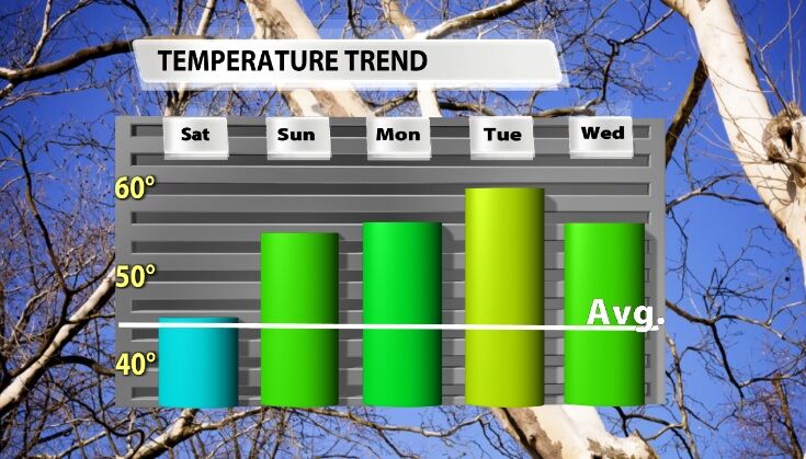
The news you are looking for on this biting cold day - a warm-up is coming! You'll have to wait through one more frigid morning, but as the wind shifts Saturday afternoon, so will the temperatures. In the next 6 days, both high and low temperatures will climb above what is considered normal for this time of year. The graph below shows forecast high temperatures compared to the seasonal average.
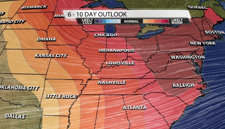
It's not just the next six days, though. The Climate Prediction Center's 6-10 day temperature outlook also shows a high likelihood of above average temperatures through the next week and a half.
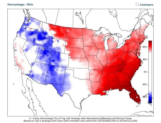
To be even more specific, Louisville has a 78% chance of seeing above average temperatures through the next six days which is a pretty high probability when prediction the weather.

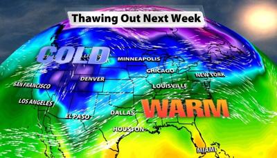
In the big picture the wind pattern will be changing, bringing in this warmer air. Right now the wind is flowing in from the northwest bringing cold, Canadian air. In the next few days the wind shifts to coming out of the south and southwest from locations where temperatures are higher than they are here. That will allow warmer air to flow into our region and help temperatures climb as we get into more zonal flow next week.


