

Some of us got more rain yesterday and even some severe storms across parts of our area, mainly along and north of the river. If you didn't get any rain, don't fret just yet, there will be more chances in the coming week.
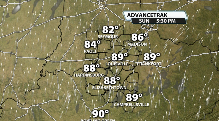
Before we get to more storm chances, the heat builds back into our area and we get a little taste of early summer. Temperatures climb to around 90 for Sunday afternoon, approaching the record high of 91 set back in 1911.
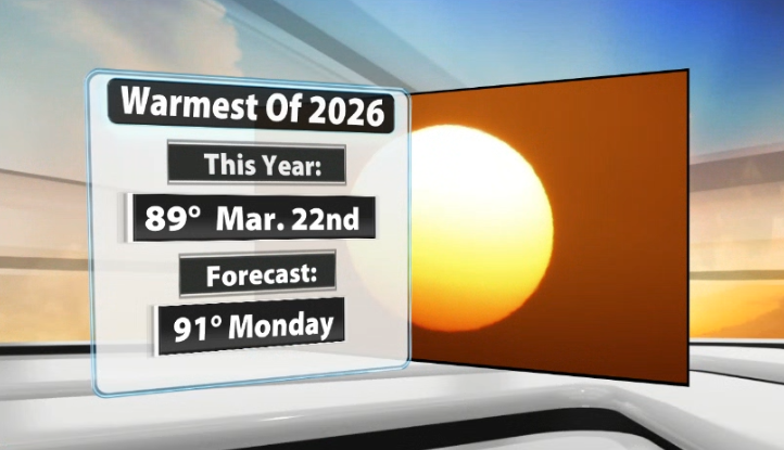
If we don't quite reach 90 on Sunday, then we likely will on Monday. It'll be a second day in a row with a chance to climb back to the 90 degree mark or perhaps even warmer. The warmest that we've been all year so far was, oddly enough, back on March 22nd when we reached 89 degrees.
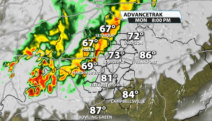
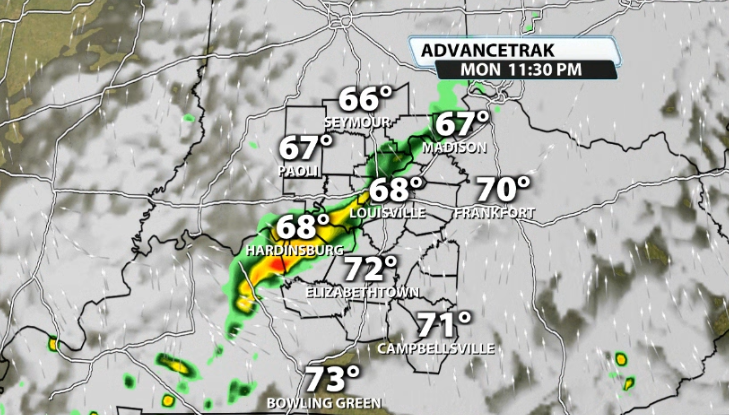
The work week carries more rain & storm chances. Monday's rain/storm chance doesn't arrive until late, and likely won't affect everyone. A dying line of showers will try to get into our area around sunset, but will be running out of gas by the time they get here.
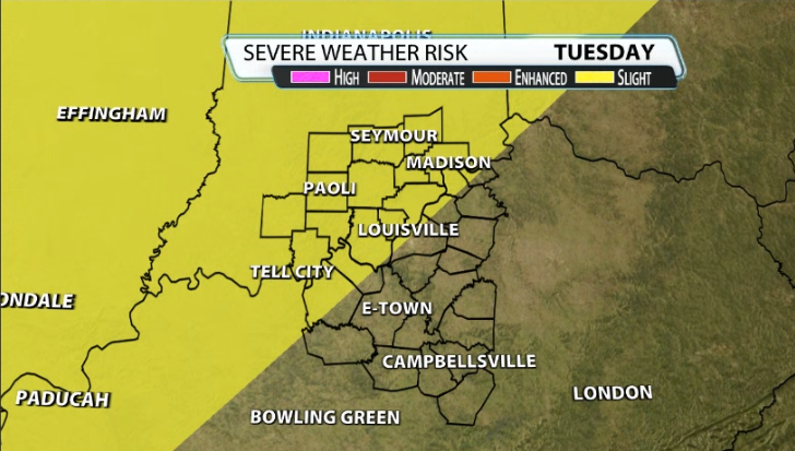
Tuesday will likely have scattered storm chances during the daytime, but at night severe weather to our west will be slowly decaying as it gets closer to our area come Tuesday night. If they still have enough steam, they could produce stronger storms in our area as well. The SPC already has a "slight" (2/5) risk for severe weather for part of our area for Tuesday night, mainly in southern Indiana and clipping parts of Louisville.
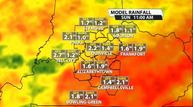
We still won't stop there. Most data is suggesting more of a "rinse & repeat" cycle of storm chances for the upcoming work week. Data shows around 1-2" of rain, especially in our Kentucky counties by the end of the week. Those southern Kentucky locations are in the worse of the drought across our area and could really use it, so let's hope that it ends up playing out that way!


