

Sunday comes with a few light showers and a lot of cloud cover in our area. This should keep temperatures in the low to mid 60s again today. Other than a few light showers, rain chances are fairly low today. That is about to change.
Rain chances start to go up on Monday. While any rain that rolls in should be light, the coverage should grow slightly compared to what we're seeing this weekend, especially for our Kentucky counties.
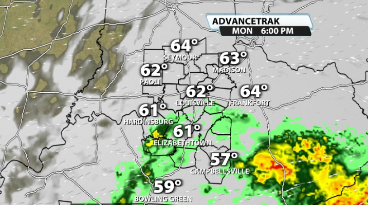
Still, most of that is fairly light and scattered tomorrow afternoon and tomorrow evening.
By Tuesday we have already seen data shift. Most data now has a lot of Tuesday ending up being dry, but throwing the farm at a very high rain chance for Wednesday of this week. A strong low will swing very close to our area and likely bring us widespread light to moderate rain with breezy, if not windy, conditions all day on Wednesday.
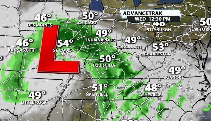
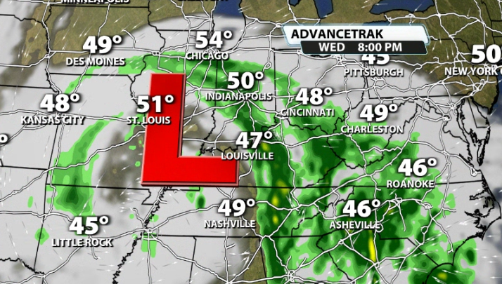
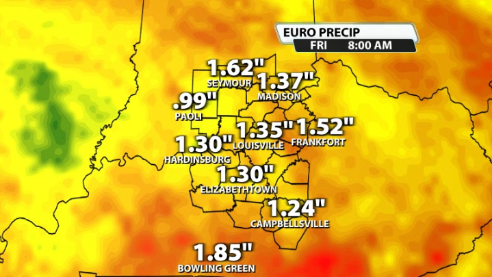
This will likely be the "washout" day of the week. The showers will likely linger some into Thursday as well, bringing in what will probably end up being 6 straight days of cloudy and gloomy weather in our area. This will likely add up to around 1-1.5" of rain by the time the upcoming work week is said and done.


