Last month we shared this ENSO update with you that NOAA had issued an El Niño Watch. You can click the post below to jog your memory about what that means.
The following article is courtesy of NOAA and written by Emily Becker
That led to a lot of questions from you all about what a developing El Niño means for us which we will discuss here. Please understand this is not a forecast; this is a discussion of typical U.S. weather patterns that set up as a result of a developing El Niño in the Pacific Ocean.
First, let's be clear about what El Niño is and isn't. El Niño is not a storm system that we track as it moves; it is a connection between wind and water flow patterns in the equatorial Pacific Ocean.
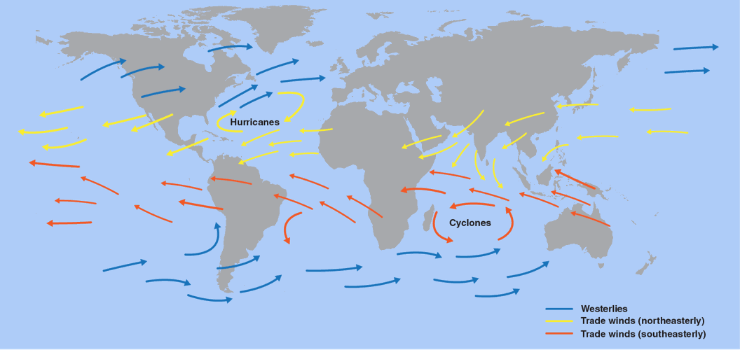
During a neutral phase (a.k.a. "normal), the trade winds blow toward the west around the equator. That wind pattern pushes the warmer water from the southern Pacific Ocean around South America toward Asia. Colder water then rises up from deeper in the ocean to replace the warmer water that's been pushed away, a process called upwelling.

The trade winds blow from east to west near the equator. Credit: NASA/JPL-Caltech
El Niño and La Niña (its opposite) happen when that normal pattern is disturbed. In the case of El Niño, the trade winds are weaker, so the warmer water flows back toward the east instead of being pushed west. This means warmer ocean water along the west coast of North and South America.
South American fisherman were the ones to first notice and name this pattern because it was affecting their livelihood, and it continues to affect fishing conditions. According to NOAA, "El Niño also has a strong effect on marine life off the Pacific coast. During normal conditions, upwelling brings water from the depths to the surface; this water is cold and nutrient rich. During El Niño, upwelling weakens or stops altogether. Without the nutrients from the deep, there are fewer phytoplankton off the coast. This affects fish that eat phytoplankton and, in turn, affects everything that eats fish. The warmer waters can also bring tropical species, like yellowtail and albacore tuna, into areas that are normally too cold."
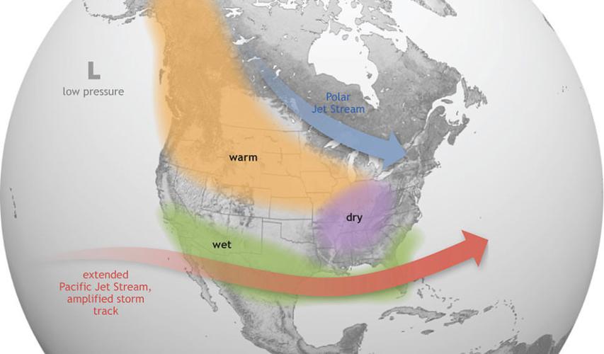
Now let's talk about what it means for us. NOAA shared the graphic below and this statement: "The warmer waters cause the Pacific jet stream to move south of its neutral position. With this shift, areas in the northern U.S. and Canada are dryer and warmer than usual. But in the U.S. Gulf Coast and Southeast, these periods are wetter than usual and have increased flooding." The Ohio Valley is sort of in no man's land according to that description. We're not quite the Gulf Coast/Southeast nor are we in the northern U.S., so what does this mean for us? In this part of the country, El Niño typically means warmer, drier conditions, but we have to watch that southern jet stream closely. When it moves farther north, we can get wetter conditions here.

El Niño causes the Pacific jet stream to move south and spread further east. During winter, this leads to wetter conditions than usual in the Southern U.S. and warmer and drier conditions in the North. (Credit: NOAA)
If you've heard of a La Niña pattern, it is the opposite of El Niño. We are transitioning out of the La Niña pattern we've been in since 2020 into an El Niño.