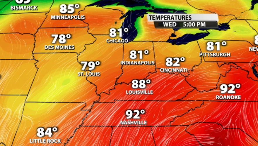
The forecast this week is turning hot! A ridge is building in our region which will allow all of this heat to stack up. Let's talk about what a ridge is and why it means heat for us.
Officially a ridge is defined by the American Meteorological Society as, "an elongated area of relatively high atmospheric pressure, almost always associated with and most clearly identified as an area of maximum anticyclonic curvature of wind flow (...) The most common use of this term is to distinguish it from the closed circulation of a high (or anticyclone); but a ridge may include a high (and an upper-air ridge may be associated with a surface high)..."
But what does that mean?
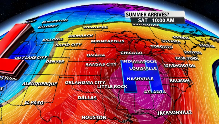
When we show you a big blue H on TV, that's a center of high pressure. The air is putting a higher amount of pressure on the Earth which means the air in the atmosphere is sinking. A ridge happens when you have a larger area of high pressure. It's the same idea about sinking air and wind flowing clockwise around that pressure center, but on a larger scale. The biggest difference is that a ridge doesn't have to form a circle, like a closed High. It can look more like an Omega or a bell curve like the area of yellow shading in the image below.

So how hot will that make us?
When a ridge sets up over our region it brings in air from the south. Look again at the image above. You can see how this flow pattern blocks wind from coming to us from any other direction that than the south. The air to our south is generally warmer, and that's part of what will help build heat this week. It's not just surface wind bringing warm air; it's wind up through the levels in the atmosphere, too.

The other piece of this puzzle is the sunshine. Sinking air in a high pressure center means clouds are harder to form; clouds form (generally) when air is moving up in the atmosphere. Without clouds we will see lots of sunshine which will also help warm our air.


