The week ahead brings a few notable changes to the weather pattern with a few big story lines to keep an eye on:
- Meteorological summer starts
- first 90° day(s) of the year
- long dry stretch
Meteorological summer starts June 1, as does hurricane season. Both of these are used to keep clean records; they don't control the weather. However in our area, June 1 will also bring coincidentally bring our highest temperatures of the year so far.

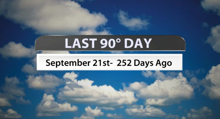
The last time our temperature in Louisville topped 90° was September 21, 2022 - 252 days ago. At this point it looks like we will see the 90s again by Friday at the latest; some spots may get close on Thursday.

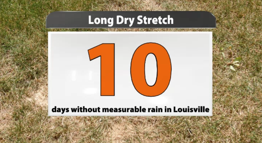
The last time Louisville saw measurable rain was Saturday, May 20. There have been pop-up showers and storms in our area since then, but none that dropped rain at the Louisville airport where official records are kept. That makes 10 days without measurable rain, not counting Wednesday. If we make it through Wednesday without rain at the airport, that's 11 days. Thursday would make 12 days in a row without measurable rain.

April 6-15 was the last time we had a dry stretch that long; in October 2022 we went 11 days without measurable rain between the 7th and 17th. According to information compiled by the National Weather Service in Louisville, there was not a dry stretch longer than 11 days in the last year.

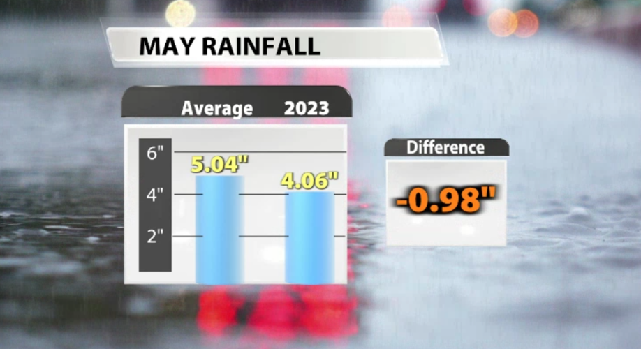
If we get past Thursday without measuring rain in Louisville, the next several days beyond that look dry again, without even the chance of pop-up showers which would extend this dry spell even longer. We will end the month of May about an inch below normal rainfall. The first half of the month brought a couple good, soaking days that helped balance out this dry stretch we are dealing with here at the end.

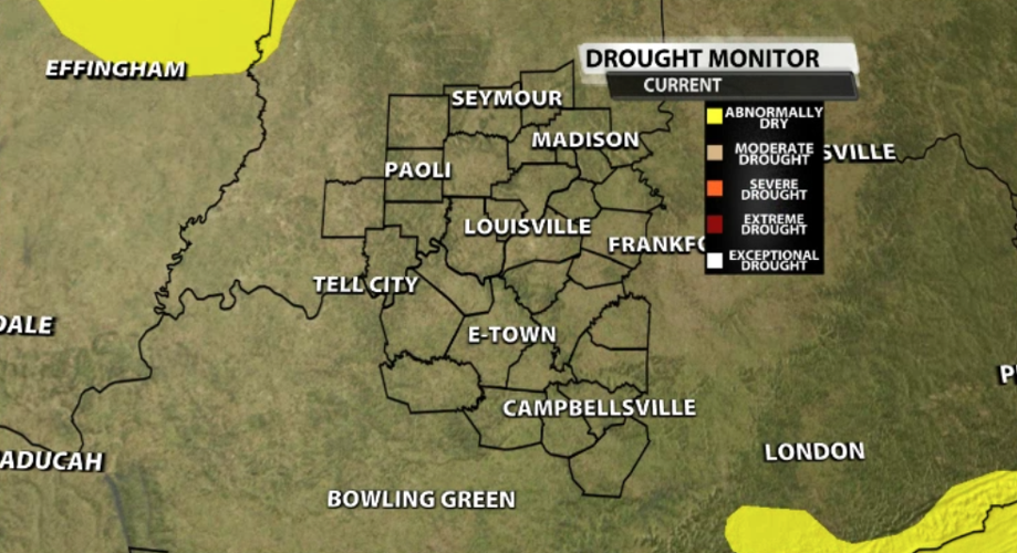
The updated U.S. Drought Monitor comes out Thursday morning and includes data through Tuesday morning. Currently none of our area is in drought or even considered abnormally dry, and this week's update may not change that. But drought potential is something we will need to keep an eye on for the next couple weeks as we continue in a dry pattern.


